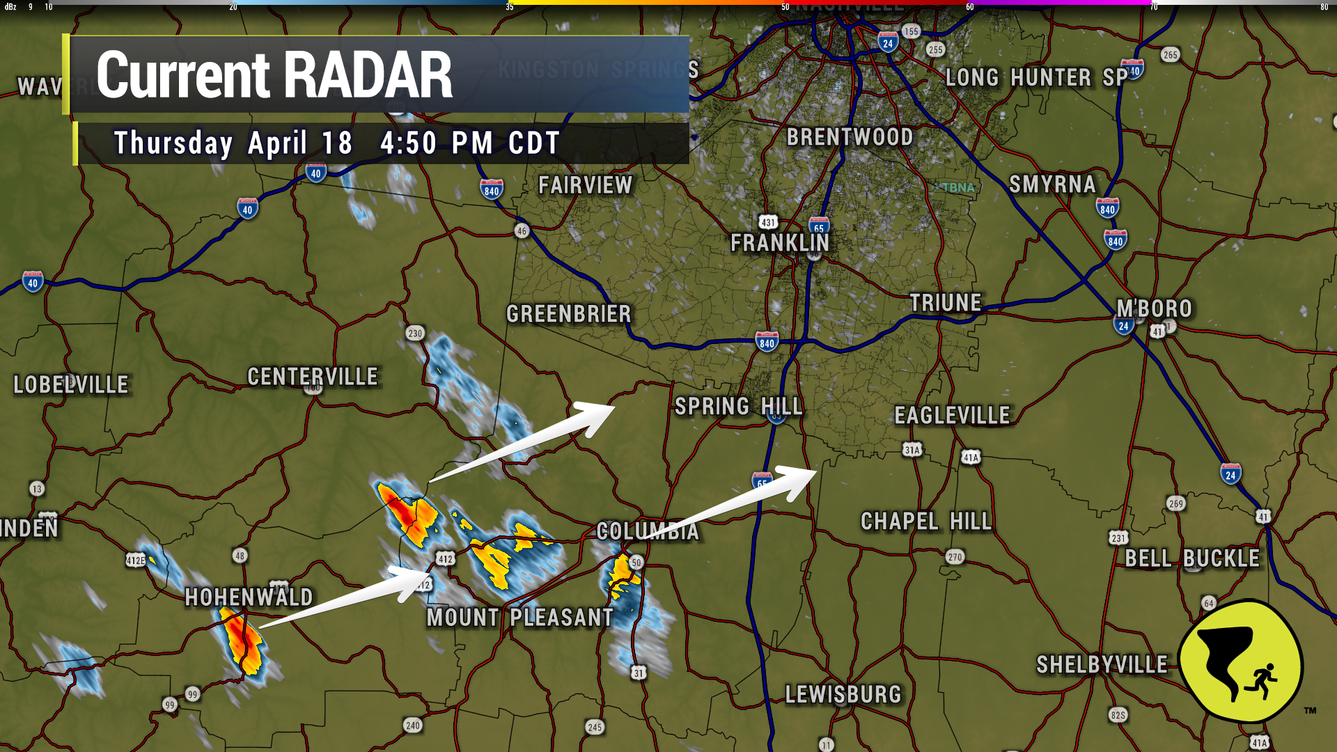
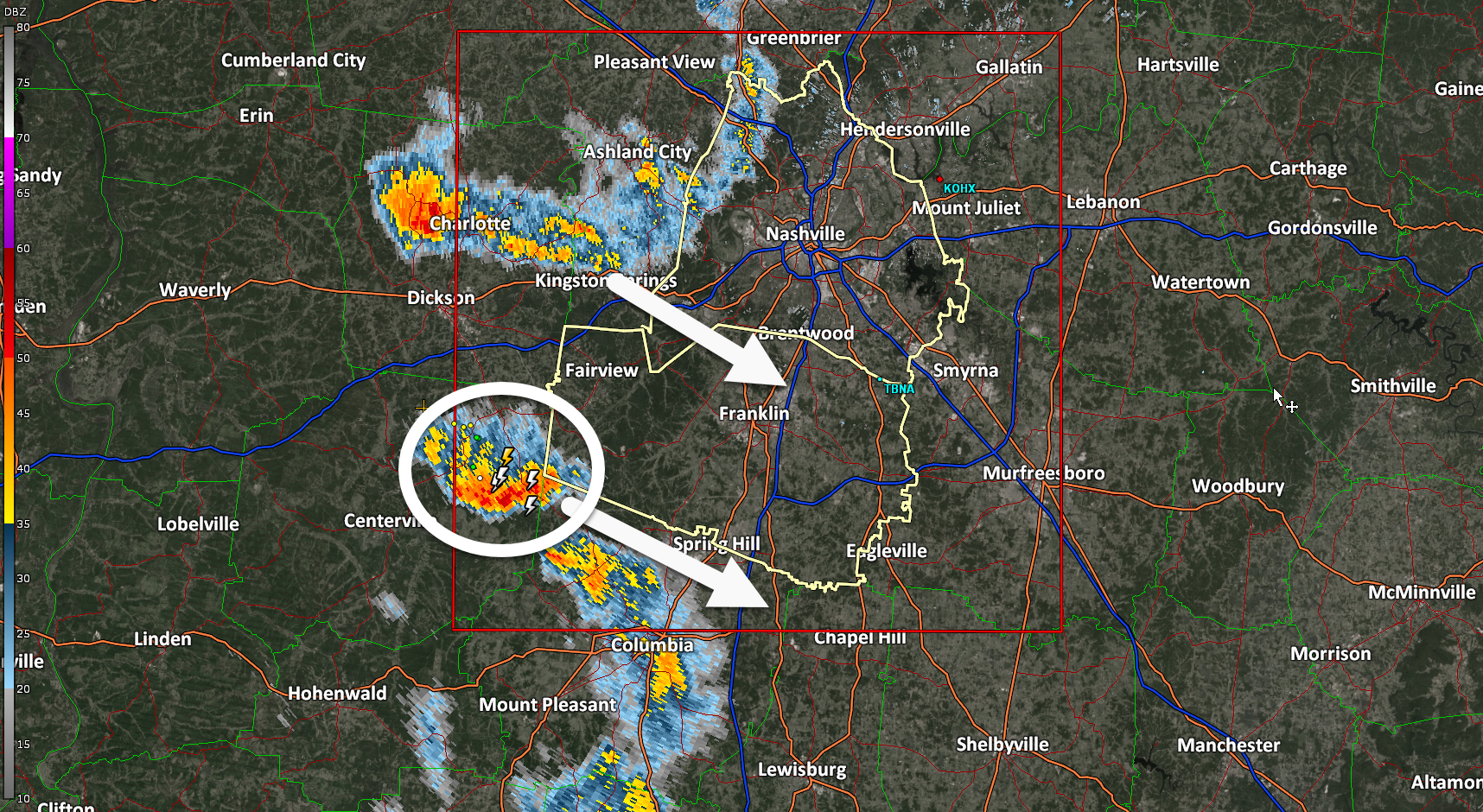
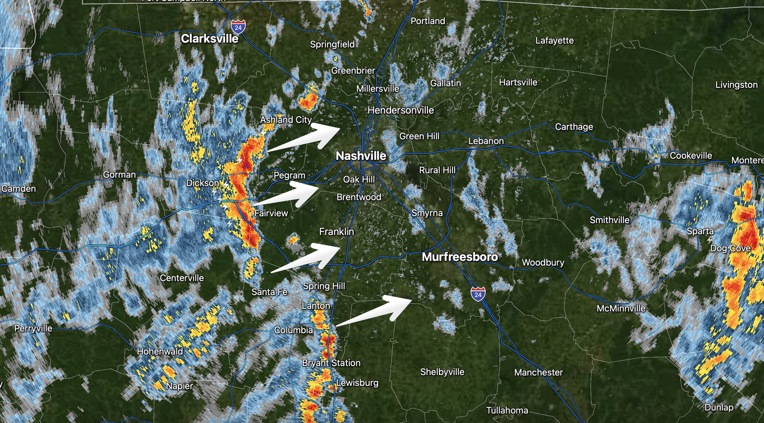
Coupla no big deal downpours moving NE through Maury Co. Could be in Spring Hill and Bethesda in the next 30 min or so. Might be lightning makers if they gain strength. 4:52 pm

Coupla no big deal downpours moving NE through Maury Co. Could be in Spring Hill and Bethesda in the next 30 min or so. Might be lightning makers if they gain strength. 4:52 pm
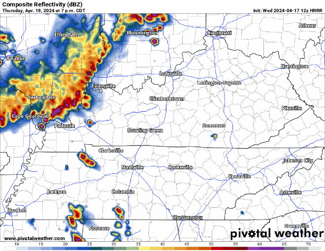
NWS: “We continue to expect a few instances of localized gusty winds and marginal severe hail with the early evening scattered storms. Later storms coming in from the west northwest after 10 PM will have better shear, so gusty winds and maybe a QLCS spinup tornado cannot be ruled out as the storms approach. But the late storms will weaken considerably as they push into our area and especially toward I-65.”
NWS: “We continue to expect a few instances of localized gusty winds and marginal severe hail with the early evening scattered storms. Later storms coming in from the west northwest after 10 PM will have better shear, so gusty winds and maybe a QLCS spinup tornado cannot be ruled out as the storms approach. But the late storms will weaken considerably as they push into our area and especially toward I-65.”
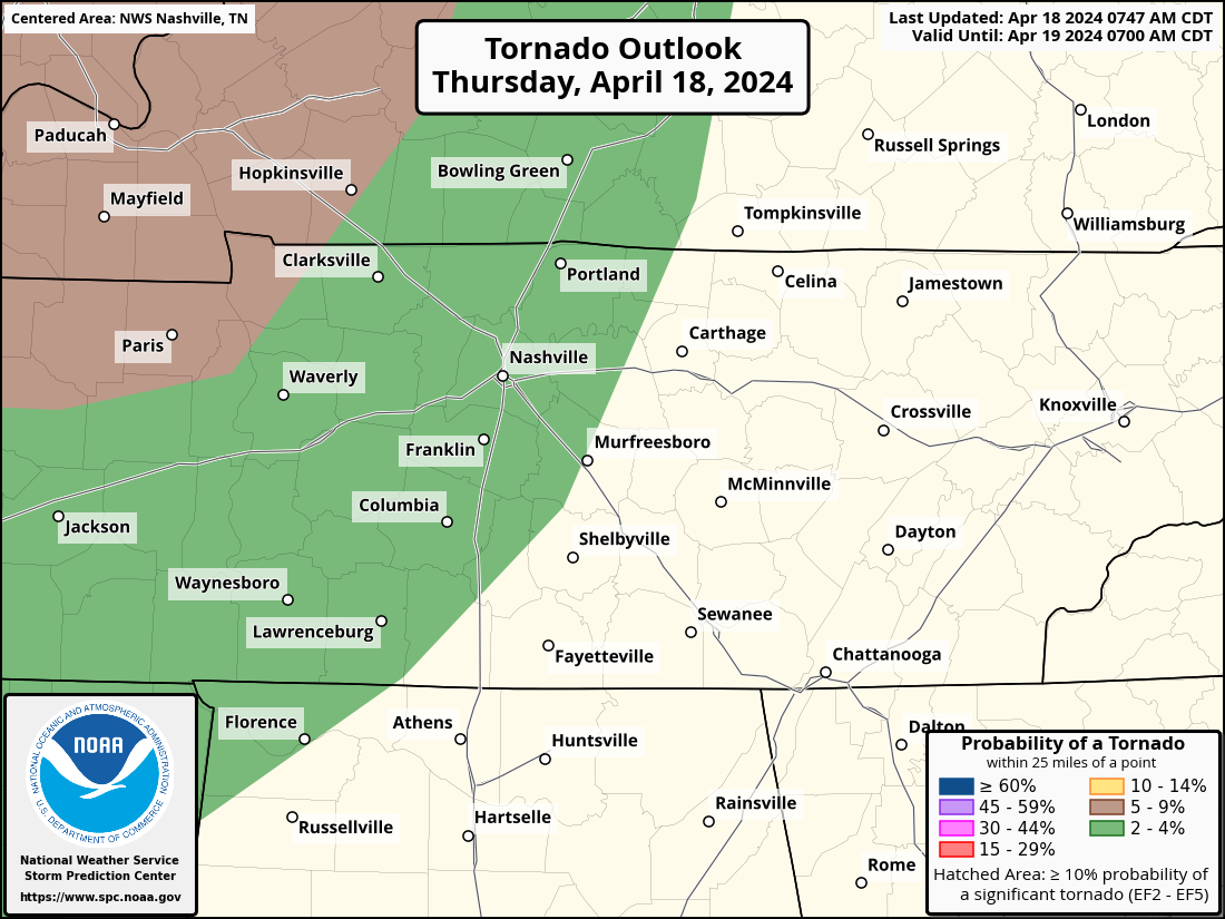
Storms expected this evening and tonight. Low tornado thread added.
Within 25 miles of you tonight, there is a 2% chance of a tornado occurring, a 15% chance of damaging wind occurring and a 5% chance of large hail.
Storms likely Thursday night — Models think no storms today. The atmosphere would support severe weather today if storms could get going, but the last several runs show nothing happening.
But tomorrow/Thursday night a storm complex should drop down I-24 from Kentucky, aka an “I-24 Special.” These are usually dog stressors and noisemakers, with a lightning lottery.
Storms incoming predawn/sunrise tomorrow (Weds) morning. Lightning and briefly heavy rain. Severe weather not expected. Storms lacking key ingredient: CAPE, which is near zero.
Weds afternoon/evening remains questionable. Previous models showed storms in place, with plenty of storm-making ingredients. While the tornado threat appears to be well north of us, the atmosphere could support heavy downpours, lightning, and low probability of damaging winds and hail. However, the last several model runs do not show any storm formation after the storms that will come through early in the morning.
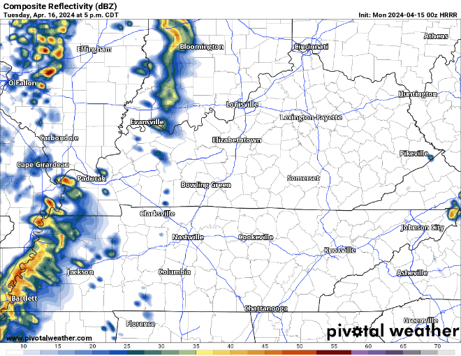
Rain arrives early Tuesday evening if you want to believe the HRRR model. Never believe one run of one model. Remain curious for future runs. Understand rainouts/interruptions will be possible Tuesday night.
731 PM one thunderstorm is tossing CG lightning heading along and south of I-840. Other scattered rain showers ready to make some of that chilly rain no one likes. Ok maybe some of y’all like it. No severe, no worries.
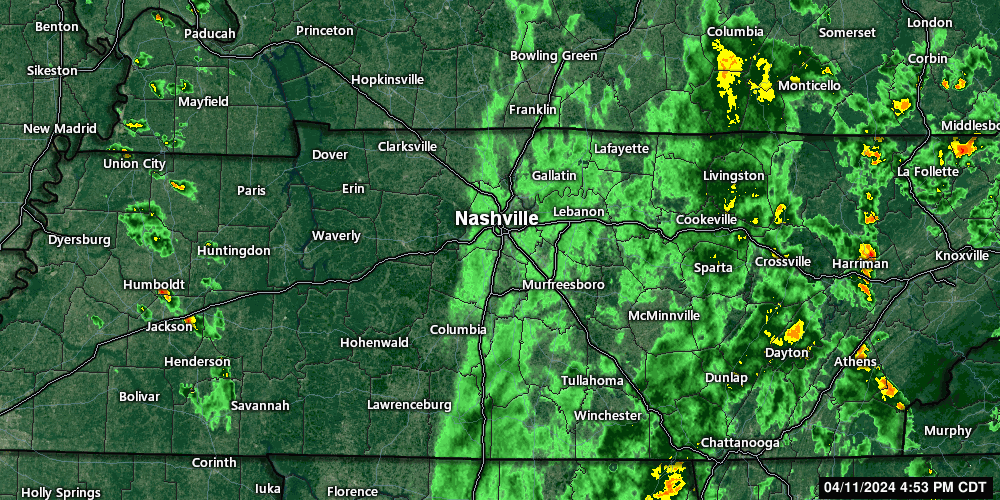
5:54 pm, maybe not quiiite done with the thundershowers. A few more cells have developed west of us and may come through later. Moving NW to SE. Non-severe.
Incoming storms are non-severe, but will produce brief heavy rain and lightning. Get wherever you’re going if you have lunch plans. 12:06 pm
You must be logged in to post a comment.