It was another scorcher today, and we’ll have a few more of those days.
We still are dealing with a daily Heat Advisory until Friday, one for Saturday may be needed too. Vandy’s home opener looks like a sweaty one.

It was another scorcher today, and we’ll have a few more of those days.
We still are dealing with a daily Heat Advisory until Friday, one for Saturday may be needed too. Vandy’s home opener looks like a sweaty one.
Today was miserable, tomorrow will be miserable, Thursday will be miserable, Friday will be miserable, Saturday will also be miserable.

However, don’t fret my friend, relief is on the way.
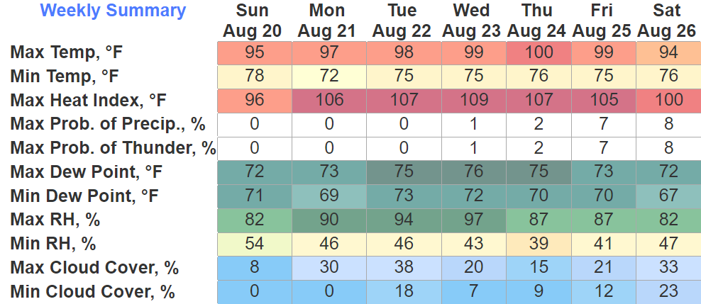
Sunday those high temperature color turn from a dark, mean, scary red, to a nice light orange, signifying return of cooler temps.
Just a really gross forecast over the next five days.

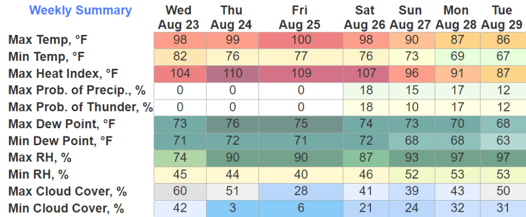
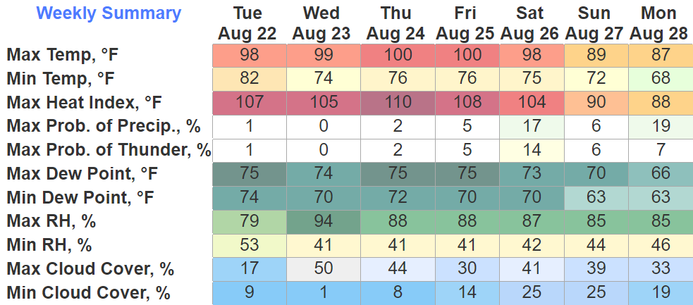
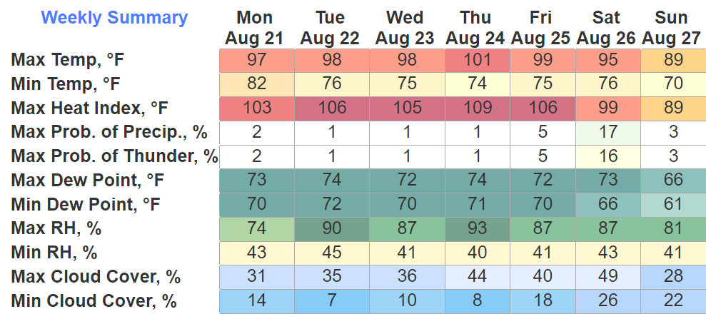
Today thru Friday we will be under a Heat Advisory, heat index values will reach 105°+ daily.
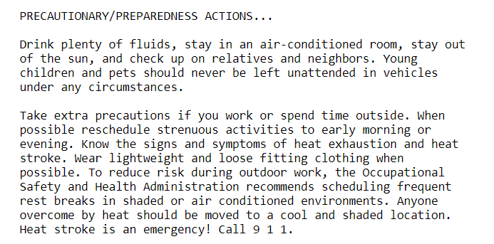
Please, heed above advice. Heat is a dangerous thing and can be deadly if not taken seriously. Always look before you lock.
If you missed summer, here you go. It will be in full action this week.
Mid to upper 90’s, maybe even seeing triple digits.
Our heat index will surpass the century mark, Monday thru Friday looks to be the worst. Heat index values look to be 105°+ daily, a Heat Advisory will probably be needed for most of these days.
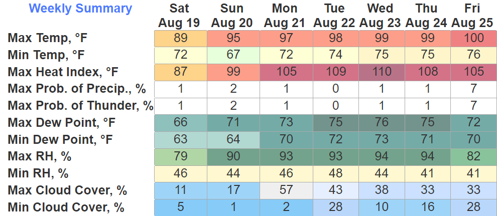
Today will be the last day we deal with high temps not in the 90’s. It’s gonna get gross.
Monday thru at least Friday, heat index values will be 105°+. These types of conditions can be dangerous, listen to your bod when it starts to scream at you for water and shade.
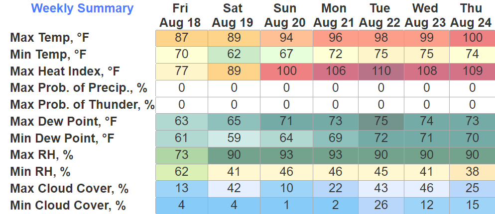
Another day or two of slightly below average temperatures before we heat up.
Those that hate PSL season may get more than what they bargained for…

Temps reach the mid 90’s by Sunday, and will make their way to the upper 90’s, even surpassing the century mark by the end of next week.
Whether I was rightfully reprimanded or not, I stand by my actions. PSL is a good great flavor, and the morning air just had that fall feeling to it, so I went for it. Tomorrow I might go for an iced pumpkin spiced latte. Who’s gonna stop me? I’ll face the consequences.
Fantastic weather we had today, and we’ll continue to experience these great conditions the next few days.

Still no rainfall expected over the next 7 days.
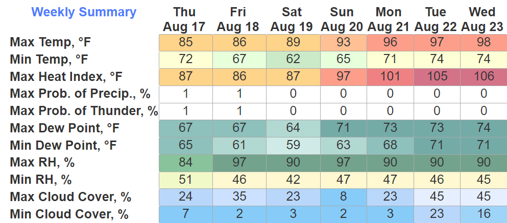
Only news to really talk about is the slow increase in temps throughout the week. The mid 80’s will slowly turn to low to mid 90’s by the weekend, more average for this time of the year.
Not a whole lot to talk about except good news…

High temps in the 80’s for the next five days, which is pretty sweet. Slowly getting warmer each day.
And a look at the expected rainfall over the next 7 days…
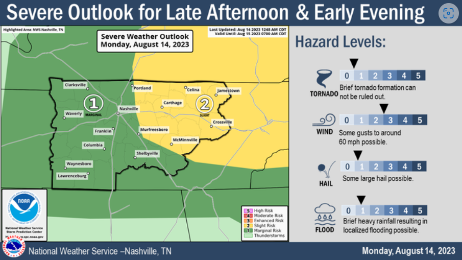
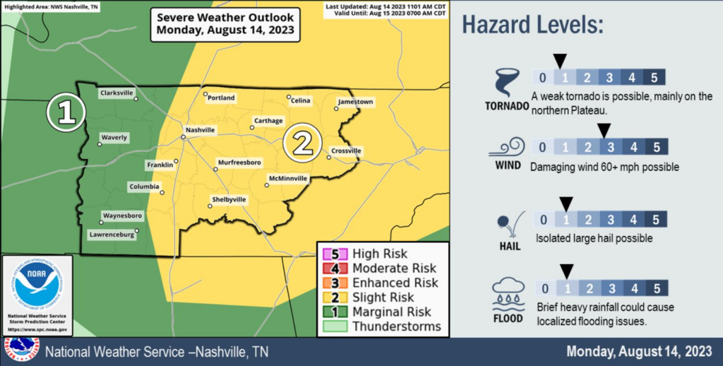
The Storm Prediction Center has outlooked us with a:
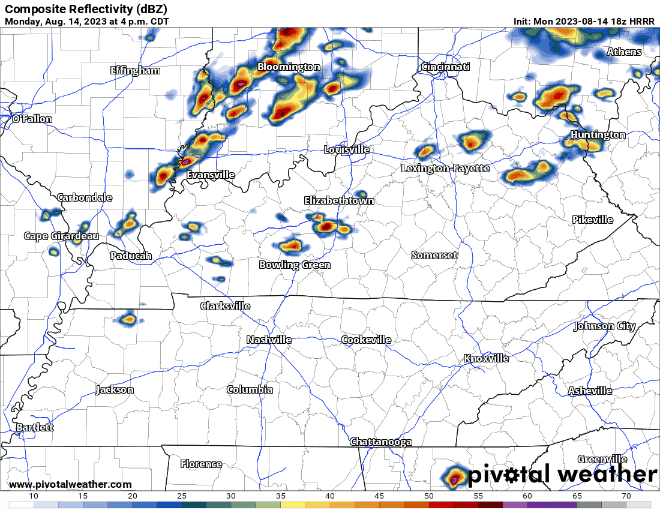
The HRRR model (above) shows storms forming just to our west, almost on top of us. Not everyone will see a storm. If you have outdoor plans, stay connected. If you see a storm, it could be feisty.
You must be logged in to post a comment.