
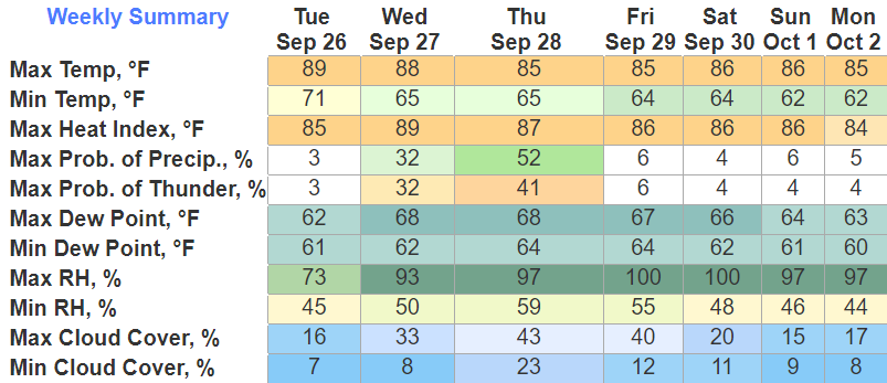
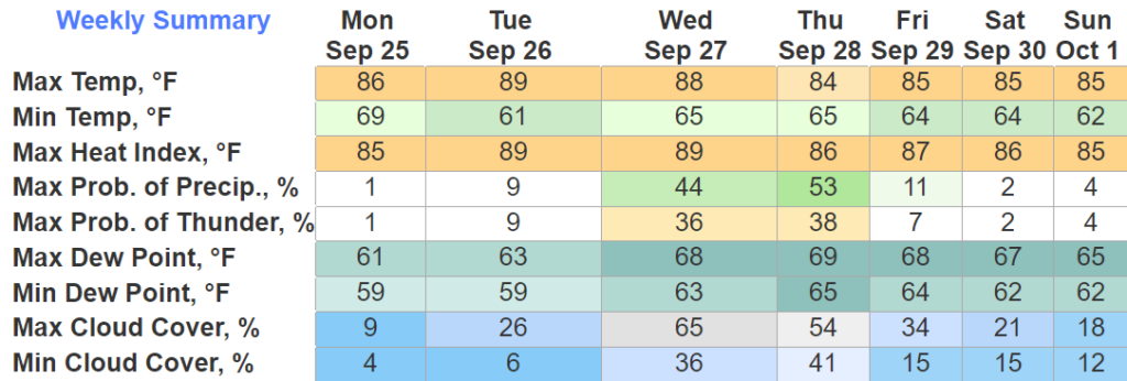
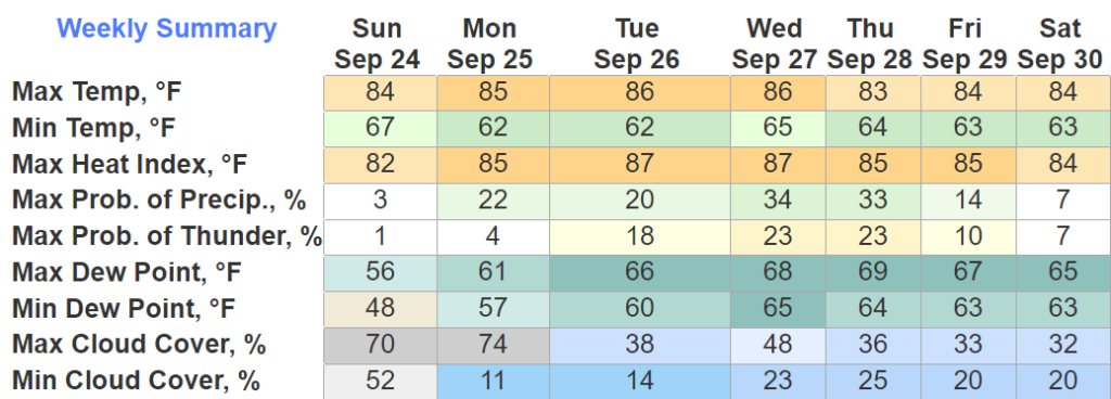
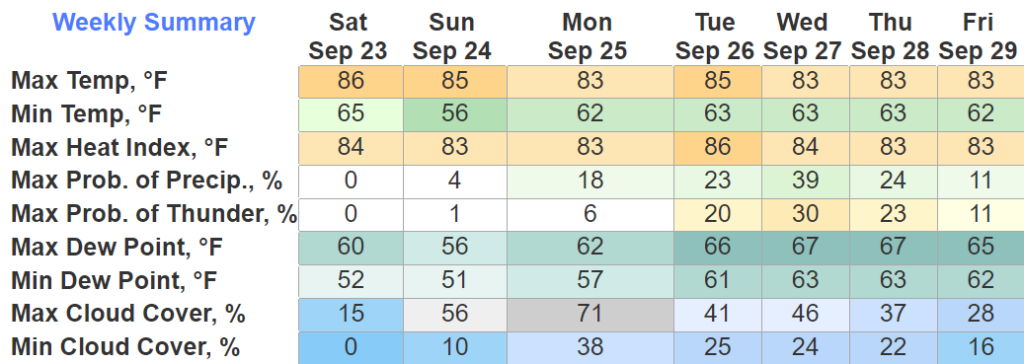
Some of us, especially Davidson Co. saw some decent thunderstorms today, everything stayed under severe limits thankfully.
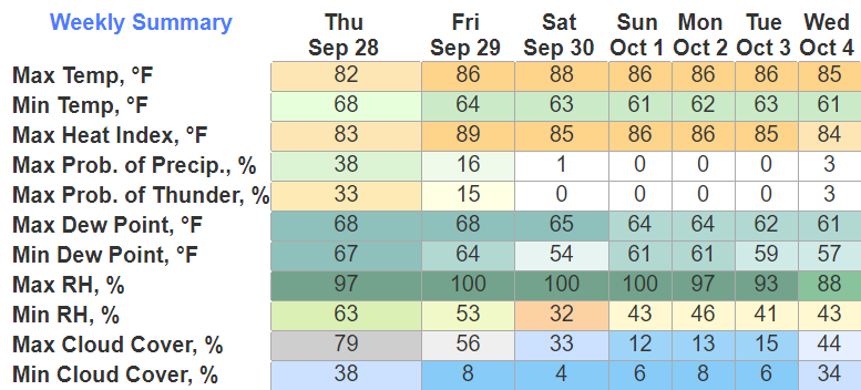
We get one more shot of rain overnight into Friday morning.
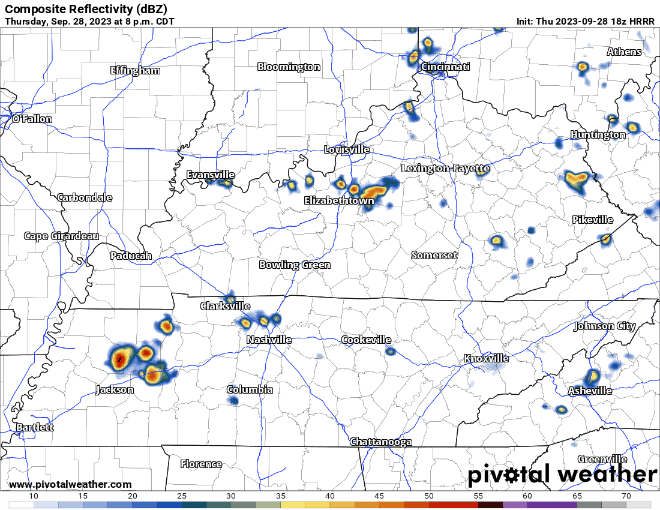
As shown above by the HRRR model, these would just be some quick showers, nothin’ crazy. Should be out of our neck of the woods by mid-morning Friday.


You must be logged in to post a comment.