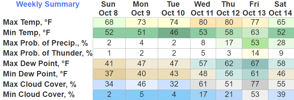
Today thru Tuesday we’ll experience some more good fall weather before a little warm up.
Wednesday and Thursday we return to the 80° mark, but dewpoints will cooperate so won’t feel miserable. Although, the mornings will still be cool in the 50s.

Today thru Tuesday we’ll experience some more good fall weather before a little warm up.
Wednesday and Thursday we return to the 80° mark, but dewpoints will cooperate so won’t feel miserable. Although, the mornings will still be cool in the 50s.
A beautiful fall morning for us. Temps haven’t been this low in a while. Temps only getting up into the mid 60s.
Sunday morning will be more of the same, maybe even cooler. Think the frost will stay confined to the Plateau, but if you want to be extra cautious, you may consider covering up loved plants.
Tonight will consist of some great football weather. Might want to grab a hoodie on your way out, kickoff temp looks to be in the upper 60s, dipping down to around 60° by the 4th.
Tomorrow morning you’ll step outside and fall will say…
I’m writing because the fearless intern bugged out claiming it’s a “test day/travel day for me” but I hacked his Life 360 and apparently he’s been at some lampshade and garden gnome emporium since 11 AM so yeah, we’ll have to take that up with him offline.
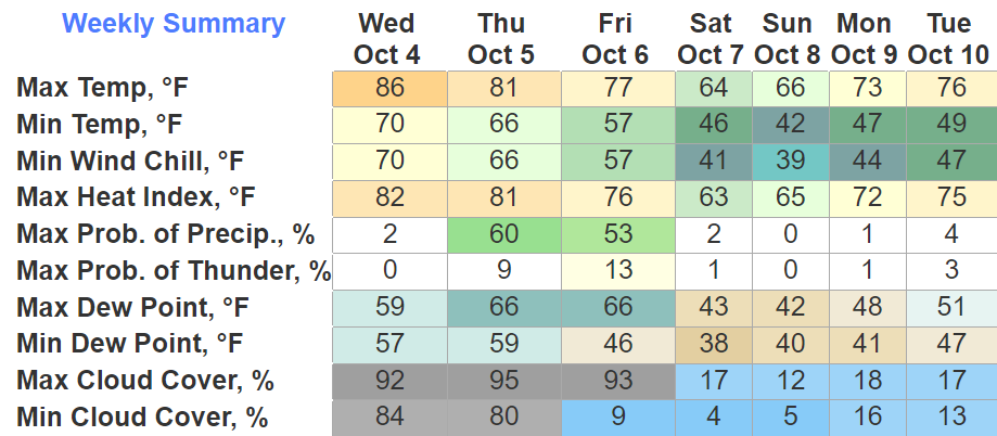
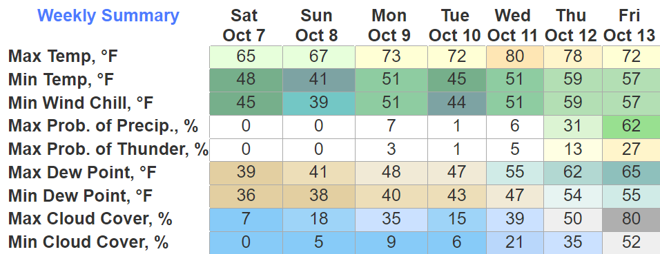
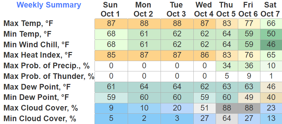
Today was our last day of mid 80s for a while.
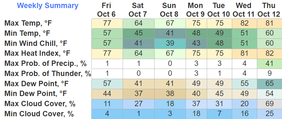
Thursday we finally get to talk about rain again, I’ve been looking forward to it.
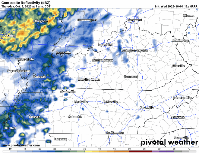
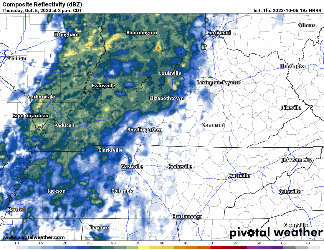
Timing wise, scattered showers look to start in the AM hours, with rain filling in more as we get into the afternoon and evening. HRRR model gives its best guess above. Rain tapers off a bit after sunset.
It was a big day today.

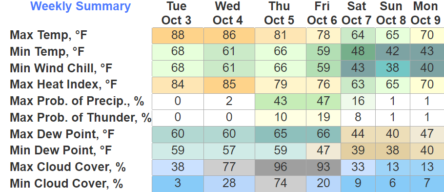
What she failed to mention is that it’s October 3rd and we experienced 88° for a high temp. Thankfully dewpoints were calm, so it did not feel horrendous.
Wednesday will be in the mid 80’s, with no rain chances.
If you like warm weather, the first half of the week is just for you. Highs in the upper 80s, dewpoints aren’t miserable, no rain. Not exactly beginning of October weather tho.
If you like cooler weather, the back of the week has your name written all over it. A cold front will push thru Thursday/Friday bringing some rain chances and fall-like temps.
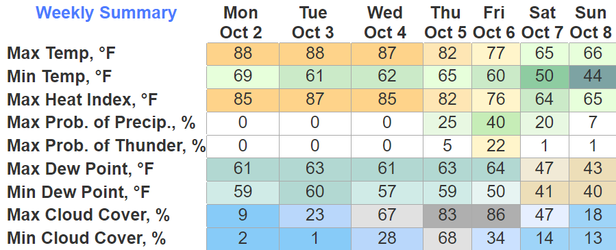
Not the most ideal start to the tenth month of year. High temps in the upper 80s, at least there is no rain chances?
This dry, yet warm trend will continue thru Wednesday. Thursday is when change comes.
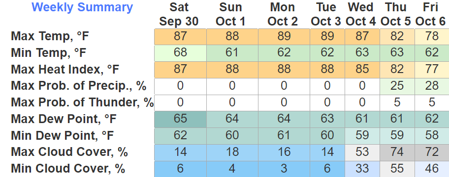
We have several more days to deal with the upper 80s before we get the real deal fall weather.
The next 5 days will basically be a repeat of each other, no rain, above norm temps with dewpoints in the low to mid 60s. Meh.
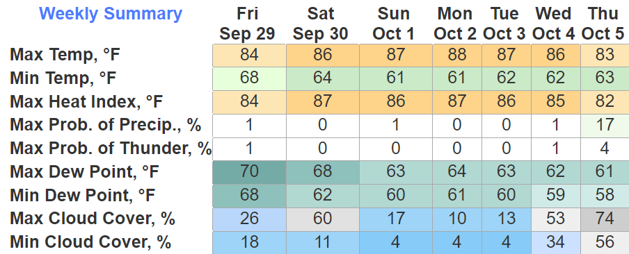
The rain we saw this morning will be the last we’ll see for a while. Rainfall totals range from 2″+ in Northern Davidson Co. to 0.06″ in far SE WillCo.
Next 6 days will be dry and not a lot like fall. High temps in the mid to upper 80s, with dewpoints in the mid 60s. Not the most ideal end to September.
You must be logged in to post a comment.