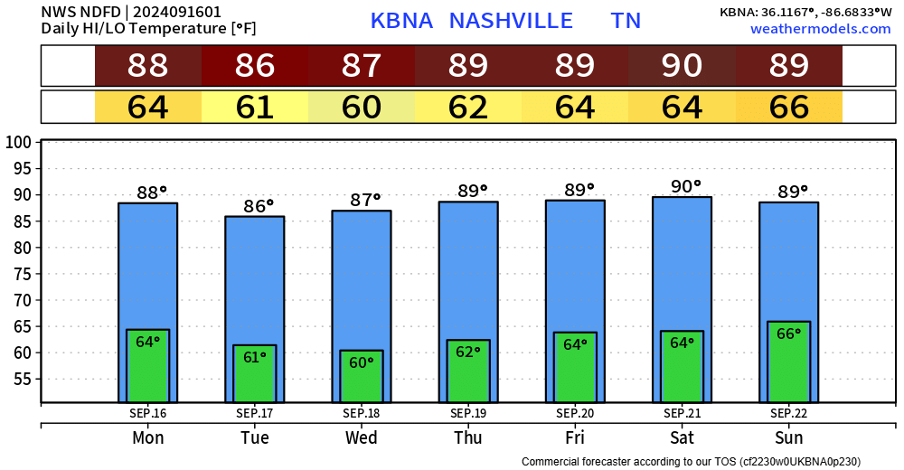
No real rain chances in over the next 7 or so days.
Maybe a light shower on Tuesday or Wednesday from PTC #8, which could become Helene tomorrow. Mostly a rain-maker for the Carolinas.

Temps just slightly above average thru the week.

No real rain chances in over the next 7 or so days.
Maybe a light shower on Tuesday or Wednesday from PTC #8, which could become Helene tomorrow. Mostly a rain-maker for the Carolinas.
Temps just slightly above average thru the week.

Bright side – we have avoided any severe weather or flooding issues.
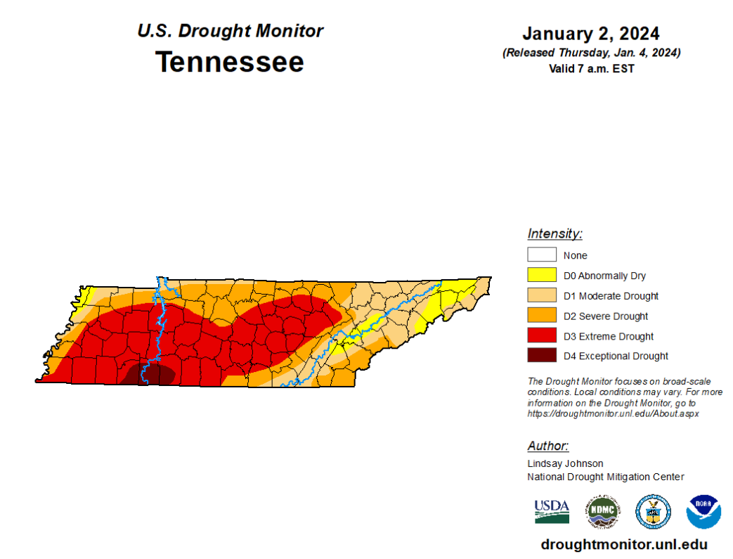
Not-so-bright side – we haven’t received much rain to help with our drought situation.

Latest HRRR model (above) shows the main axis of rain staying to our SW most of the day, with a few showers coming up to our neck of the woods – especially around dinnertime. Models have not been the best the past few days, so be sure to keep an eye on the radar if you have any outdoor plans – you can always check the radar on our website here.
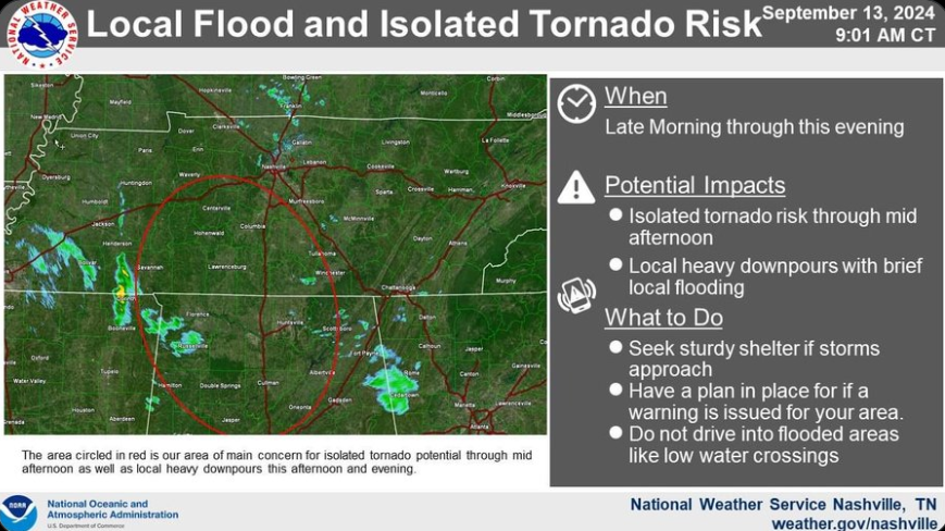
Thus far rainfall totals have been extremely disappointing, but the threat is not quite over.

NWS Nashville has highlighted an area of concern for a local flood and isolated tornado risk which includes most of WillCo. This does not mean Nashville and Davidson Co. are in the clear, but the main area of focus will be inside the red circle.

Rain from now Tropical Depression Francine is moving in and will increase in coverage throughout the day.
The latest HRRR model shows heavier rain later this afternoon, continuing into tonight.

Friday is where some uncertainty comes in.
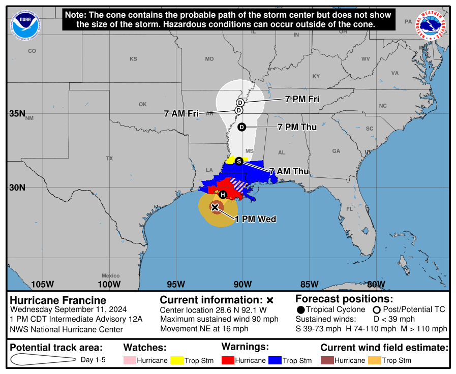

Francine has made landfall in Louisiana, and is beginning to make its’ way up north and will bring impacts to us starting Thursday morning.
Expected rainfall totals thru Monday night look to be 3 to 5 inches.

There have been some minor changes to our expected local impacts from Francine. Changes to this forecast are very possible, be sure to check in for updates!
Francine is still expected to make landfall as a hurricane sometime Wednesday afternoon/evening along the coast of Louisiana and make its way up to our neck of the woods as a Tropical Depression.
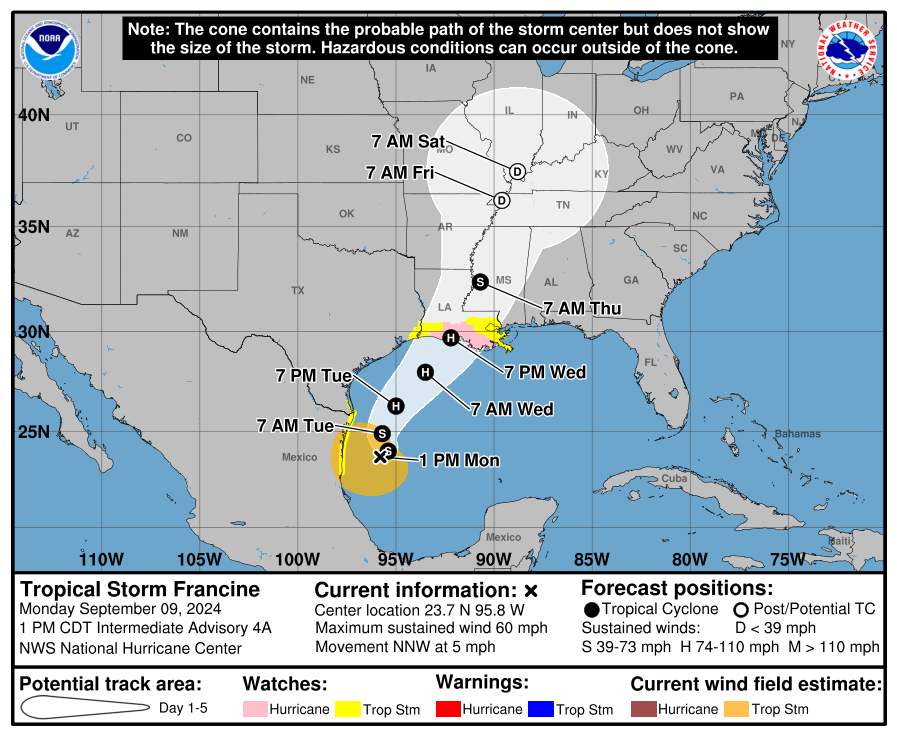

Tropical Storm Francine was officially named earlier today and is expected to make landfall as a hurricane somewhere along the Louisiana coast on Wednesday evening.
Francine is expected to travel up along the Mississippi River, bringing impacts to our neck of the woods by Thursday lasting into the weekend as a Tropical Depression.
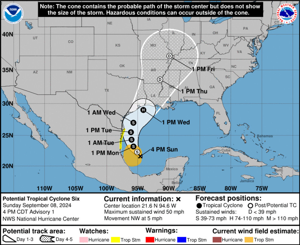
No rain chances until Thursday but could be a legit soaking for us – thanks to Potential Tropical Cyclone Six which should become Francine later tonight or tomorrow.
Deets are still fuzzy, but rainfall totals in the 1 – 3 inch range look possible from Thursday – Saturday. More details later on when things become clearer.
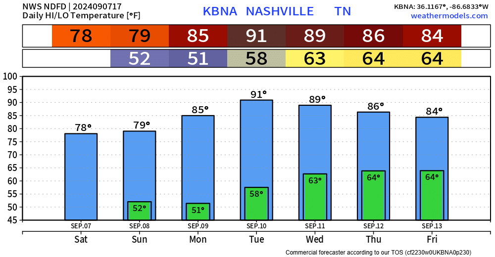
Relatively strong north winds (gusts up to 20 – 25 mph possible) have ushered in some cooler and drier air for us. Dewpoints are down in the mid 40s and high temps will comfortably be in the upper 70s.

A quick shower or lil’ storm is possible tonight, something to keep in mind as you head to FNL or your outdoor Friday evening plans.
HRRR model gives its’ best guess below. We’ll be covering anything noteworthy on X/IG. No severe storms expected but can’t rule out some lightning and heavy rain. Some of us will stay dry!
You must be logged in to post a comment.