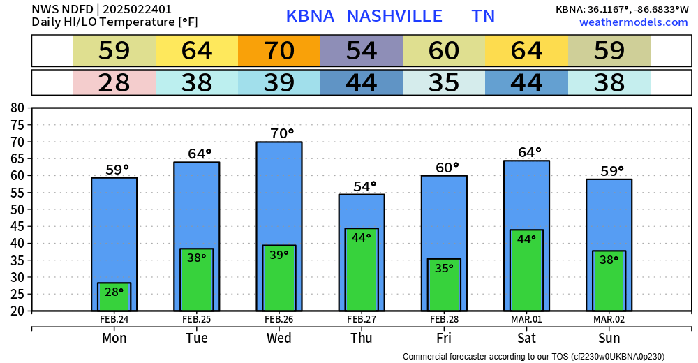
70° by Wednesday. Late Weds / early Thurs a cold front sweeps out the warm temps, only for us to warm up again.
A little rain Thursday morning with the front passage, not much, no big deal.
Weekend looks weather boring.

70° by Wednesday. Late Weds / early Thurs a cold front sweeps out the warm temps, only for us to warm up again.
A little rain Thursday morning with the front passage, not much, no big deal.
Weekend looks weather boring.
Last week was quite busy weather-wise – and we’ll get a much-needed break with some calm days ahead.
Temps in the low 40s this afternoon will allow for some legit melting. We’ll dip below freezing again tonight, so any wet pavement will turn into icy pavement.
Most of us got above freezing for a couple of hours today, getting some effective melting done.
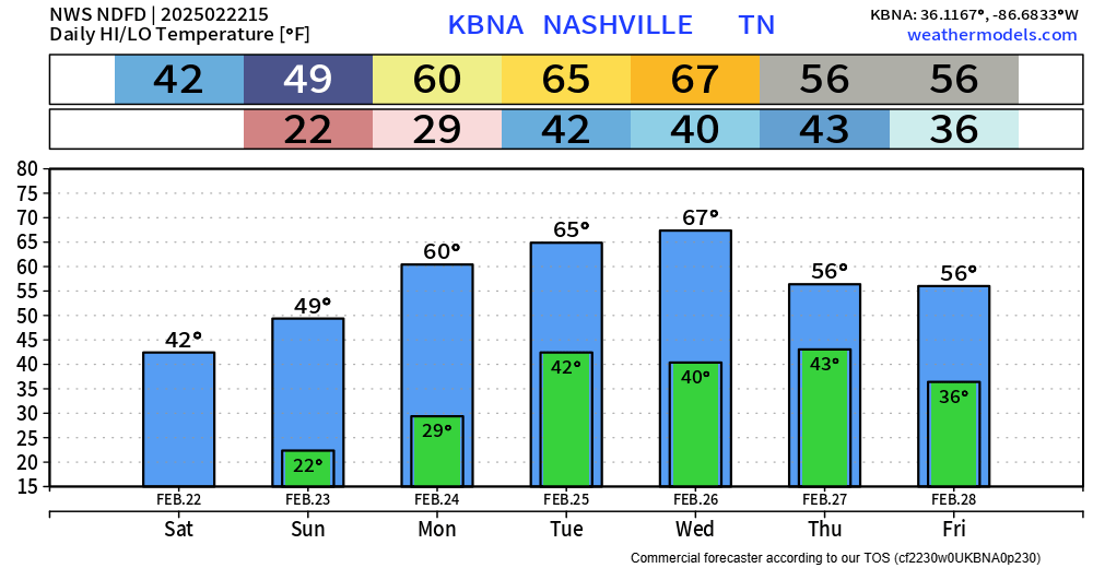
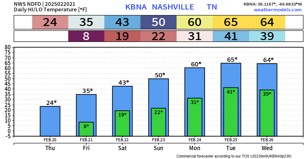
Temperatures will continue to be on the climb over the next several days – topping out in the low 60s early next week.
While we still have several cold nights in the foreseeable future, tonight will be our last super crazy cold one – at least for a while.
Temps will dip all the way to near 8°, with wind chills as low as 1° possible.
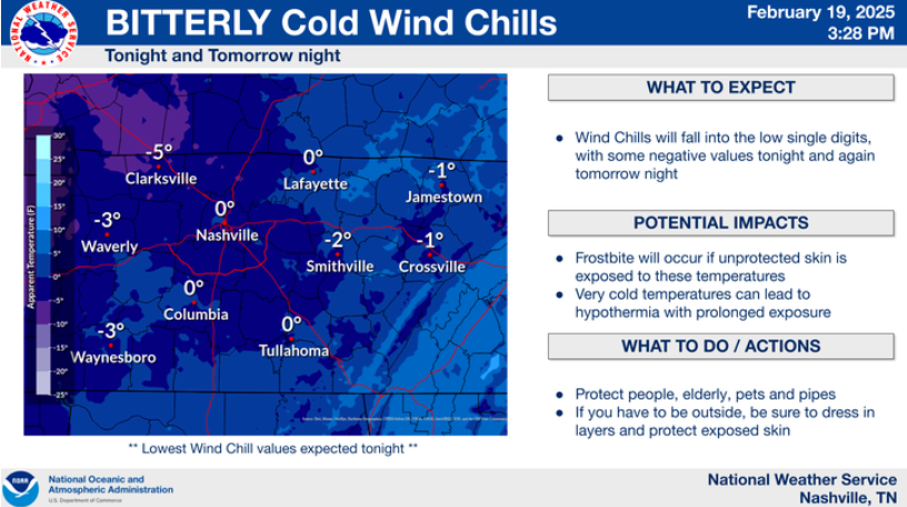
Temps will dive into the low teens tonight, combined with wind gusts from 15-20 mph, wind chill values will get near 0° tonight. This is the reason for our Cold Weather Advisory from midnight tonight to 10a Thursday.

The overall forecast remains on track.
Davidson Co. will be under a Winter Storm Warning from 9p tonight thru noon Wednesday.
Williamson Co. will be under a Winter Weather Advisory, also from 9p tonight thru noon Wednesday.


Headlines:
❄️ 1 – 4″ of snow expected
⚠️ Travel issues likely starting Tuesday night
🥶 Single digit lows possible later this week
Sun is out today, but it’s cold. Most of us have not made it to 40° – and it will only get colder this week.

In true Middle Tennessee weather fashion, we go straight from talking about our severe/flood threat to winter weather.
Much colder week ahead.
Temperatures will be below average the entire week – well below average Wednesday thru Saturday. Sub-freezing temps may be with us Tuesday evening thru Friday, maybe longer.
We’ve already dealt with some flash flooding – along with creek/river rises so far today. This threat will continue thru Sunday as creek and rivers continue to rise with heavy rainfall expected tonight. If you come across a flooded roadway – turn around, don’t drown. If you see flooding that is threatening structures or vehicles, please send us a report using #tSpotter, with a pic and location if you can do so safely.
Headlines:
Heavy rain is still expected on Saturday, potentially lingering into early Sunday. Our rainfall totals have come down a tad due to the axis of heaviest rain inching to the NW. Regardless, we still could deal with some flooding issues.
You must be logged in to post a comment.