
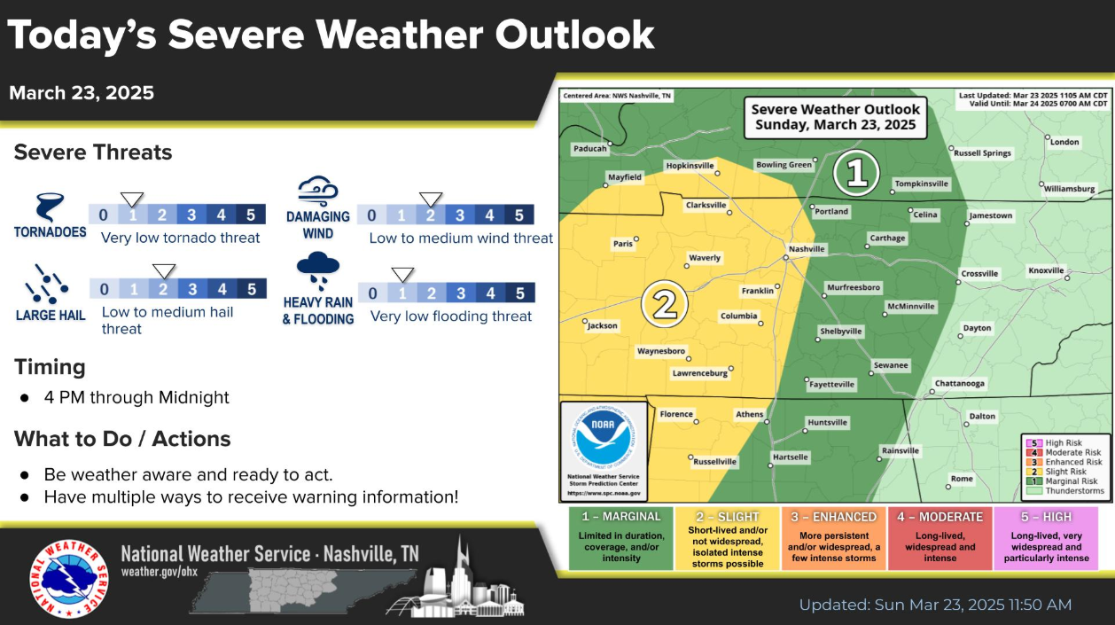

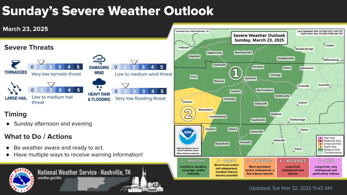
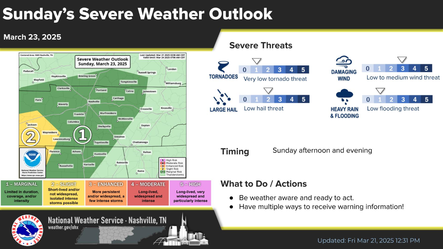
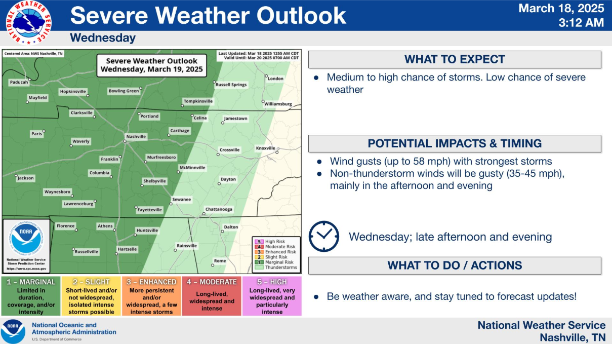
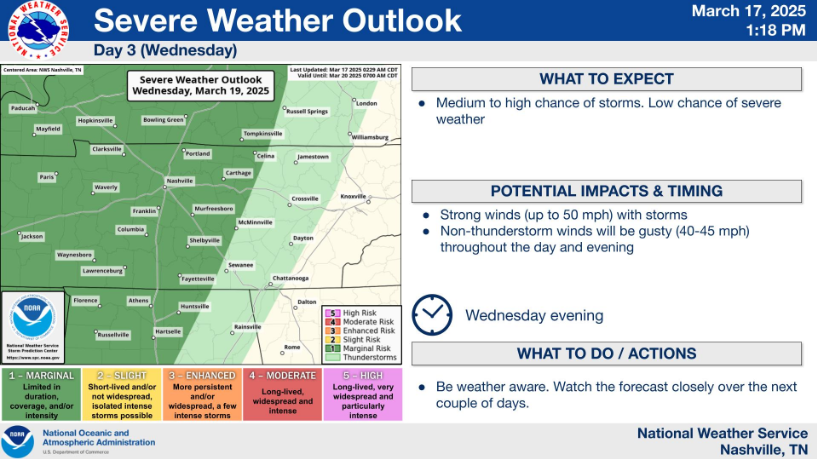
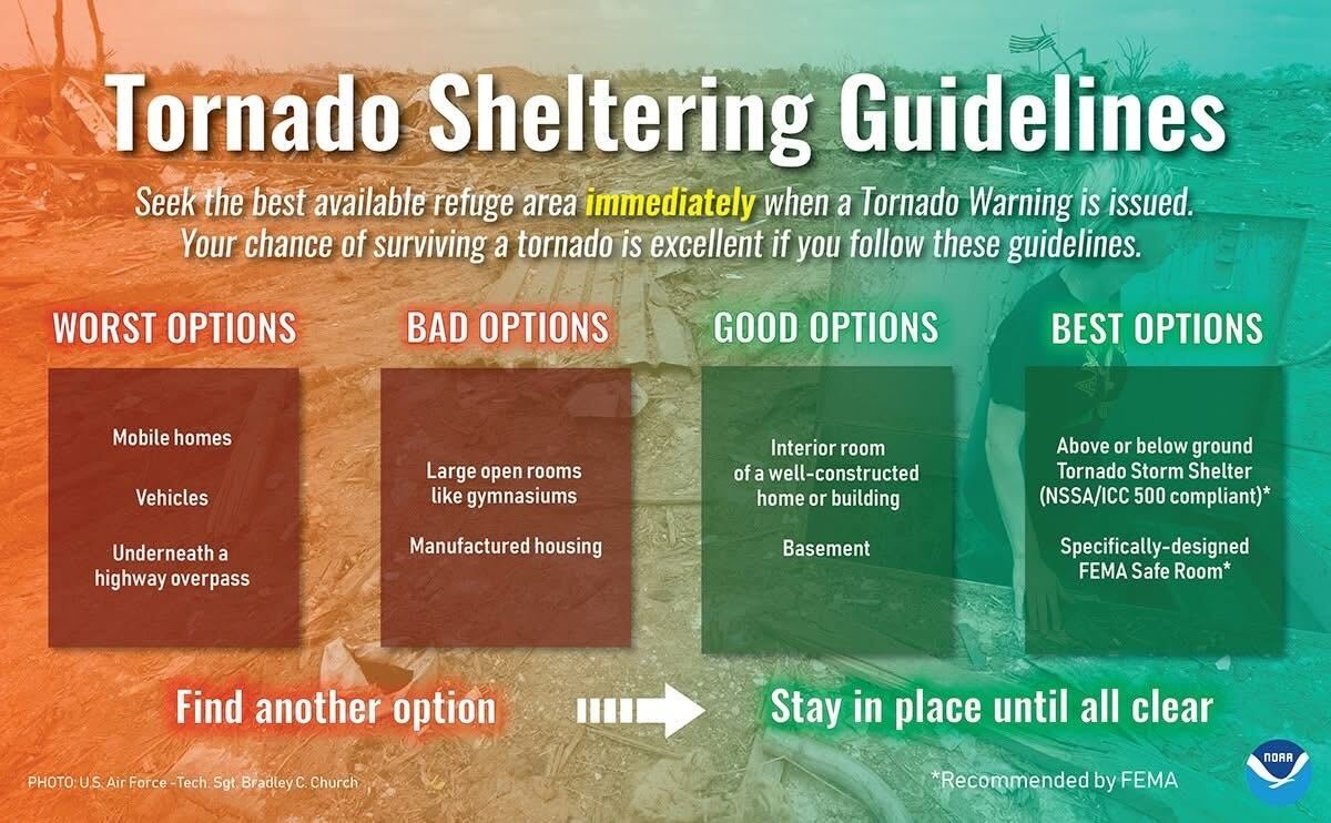
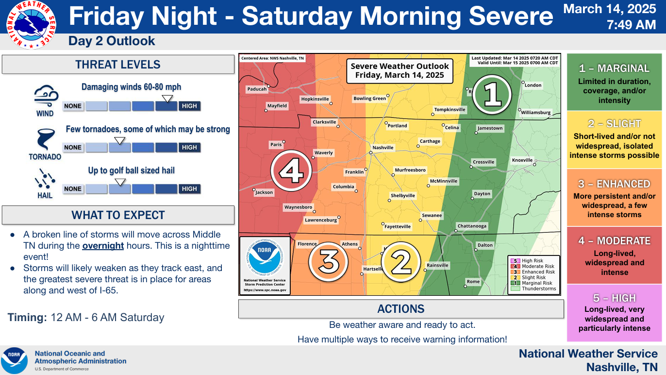
We are still outlooked by the Storm Prediction Center with the following probabilities within 25 miles:
- 15% chance of damaging straight-line winds (58 mph+)
- 15% chance of hail (1″+ in diameter)
- 2% chance of a tornado
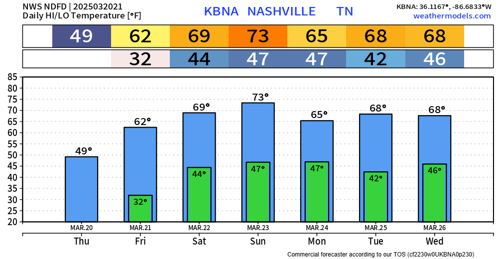
Rainfall totals only around 1″, so no flooding issues expected.
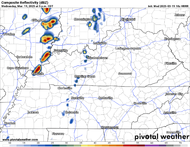
Timing:
Latest HRRR model thinks majority of the activity will be during the 6-8p timeframe. This could be off by an hour or so.


You must be logged in to post a comment.