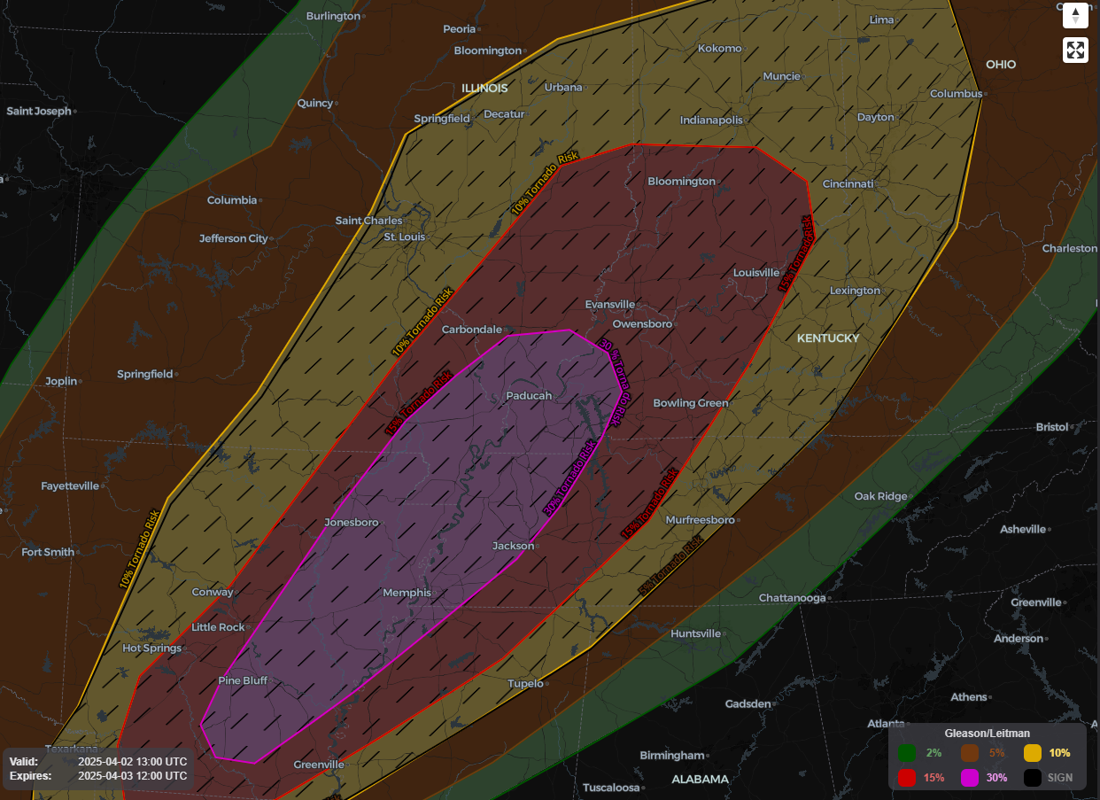
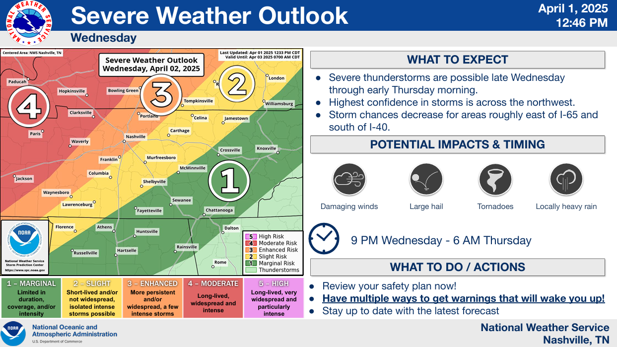
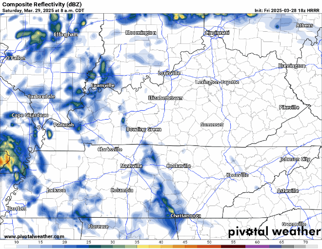
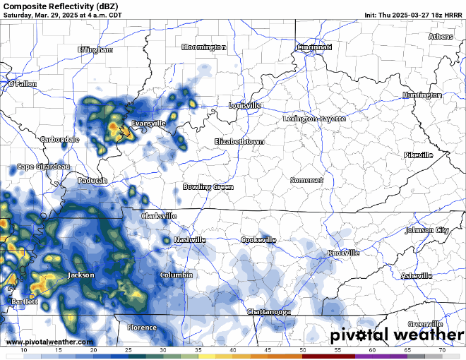
Today will be the day to get any yardwork done before the weekend.
Friday will be hot, but Saturday will take the cake.

With heat index values reaching into the 105° – 110°+ range, it will be downright brutal.
Another hot one, but today some lucky folks will see a shower or storm to help cool things off.
HRRR model (above) demonstrates the potential for scattered showers and storms throughout the evening, with things quieting down after sunset. A few strong to severe storms cannot be ruled out, with lightning, damaging straight-line, and heavy rain being the main concerns. No tornado concerns.
Another very hot day is underway, thankfully the dewpoints have been relatively tame in the low to mid 60s, so heat index values are “only” hovering around 100°.
There will be no shortage of hot temperatures thru Tuesday. High temperatures in the upper 90s daily, possibly surpassing the century mark on Tuesday.
While this isn’t a forecast blog, this is a look ahead to something coming soon!
David, Will and I remember the days, not so long ago, when we were financially supporting NashSevereWx out of our own pockets. Granted, we didn’t have as many ongoing costs as we do now. But, being weather twitterers was a sandbox we wanted to play in, and our families were gracious enough to humor us (and still do).