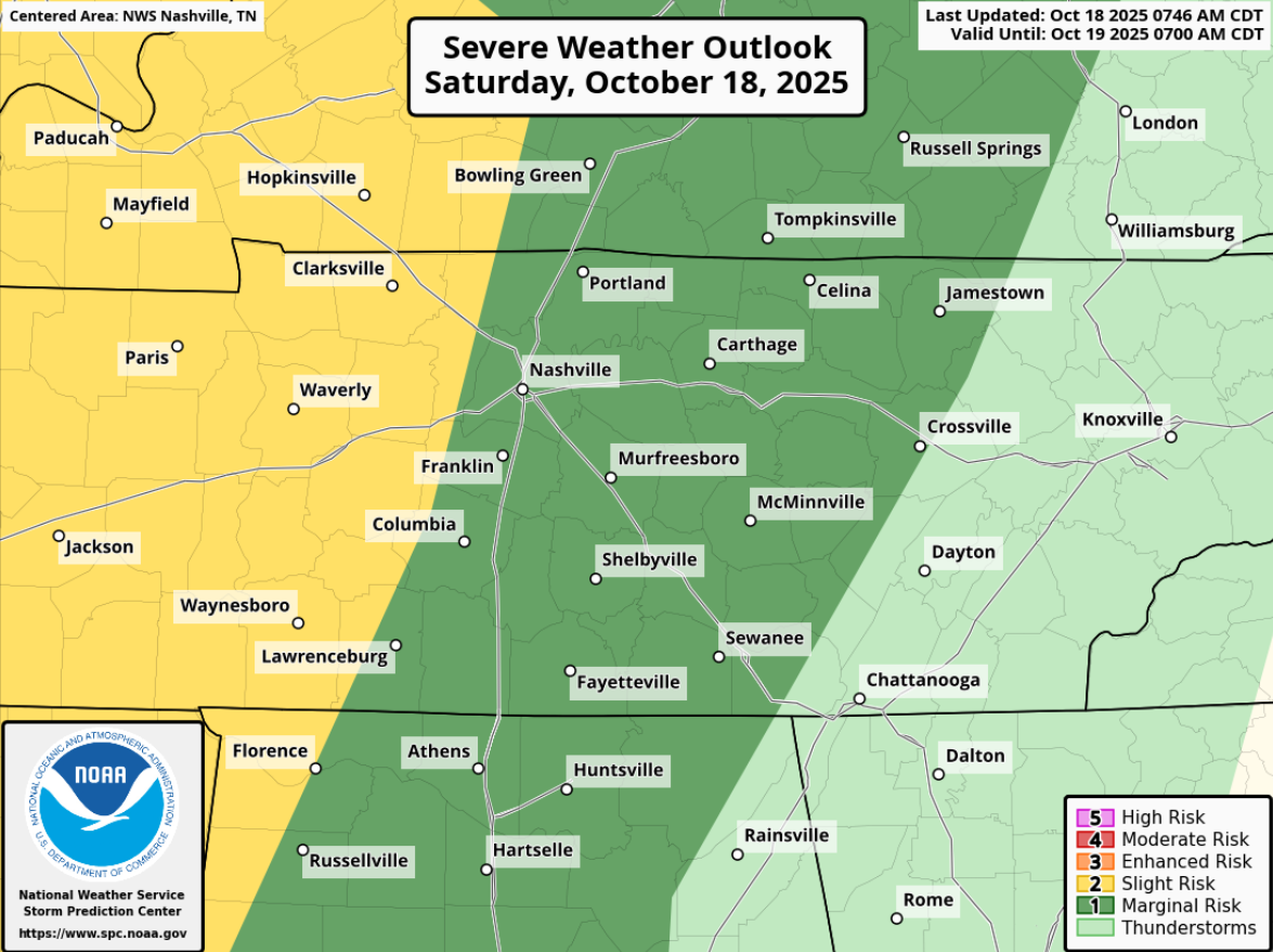
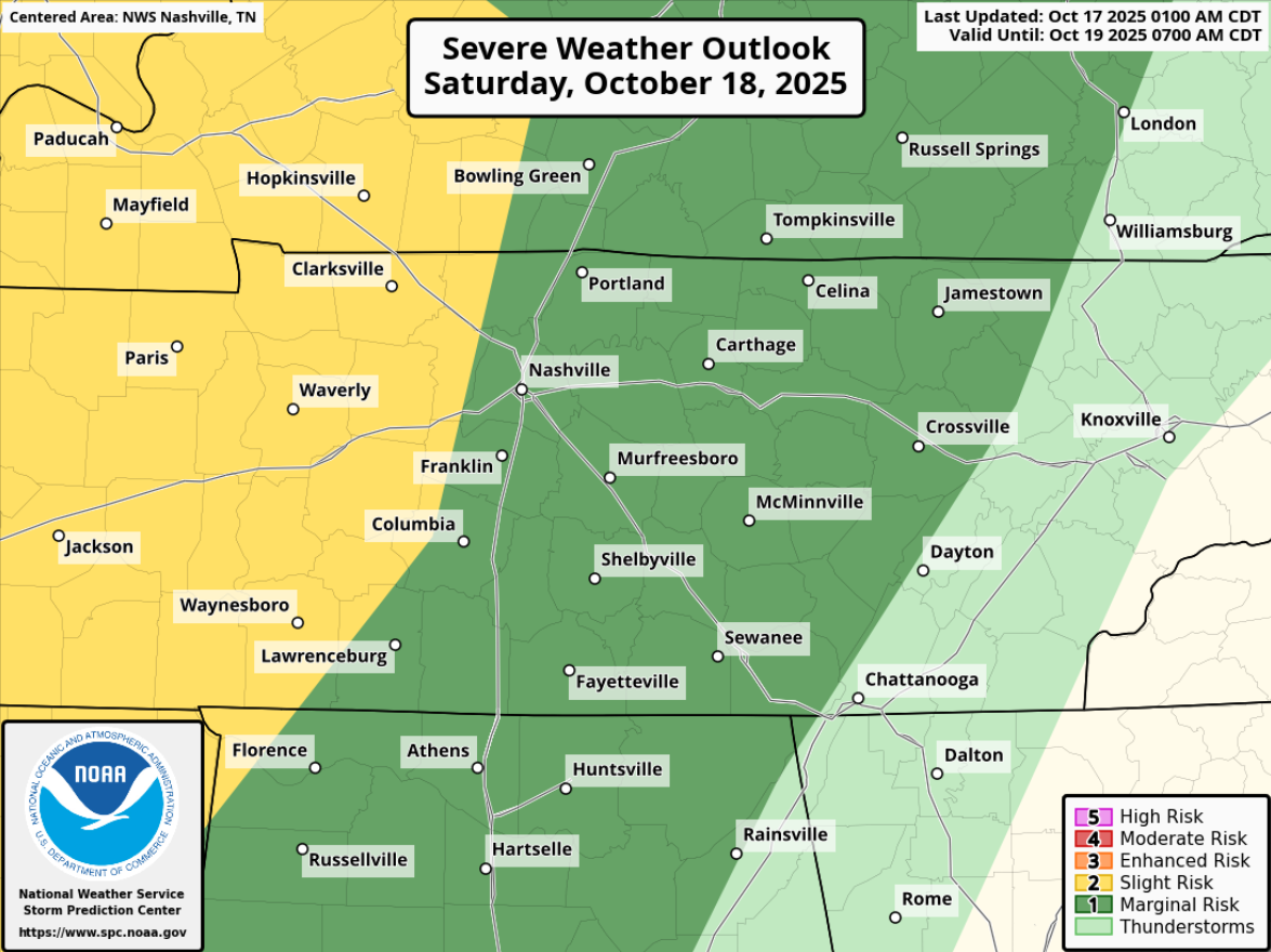
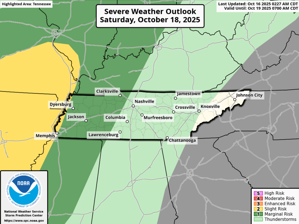
Summary: A weakening line of storms will arrive roughly between midnight – 2a, carrying a low chance of damaging straight-line winds, and a very, very, very low chance of a brief tornado. We’ll be following this the whole way thru.

Summary: A weakening line of storms will arrive roughly between midnight – 2a, carrying a low chance of damaging straight-line winds, and a very, very, very low chance of a brief tornado. We’ll be following this the whole way thru.
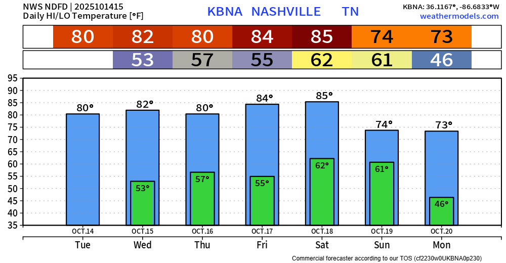
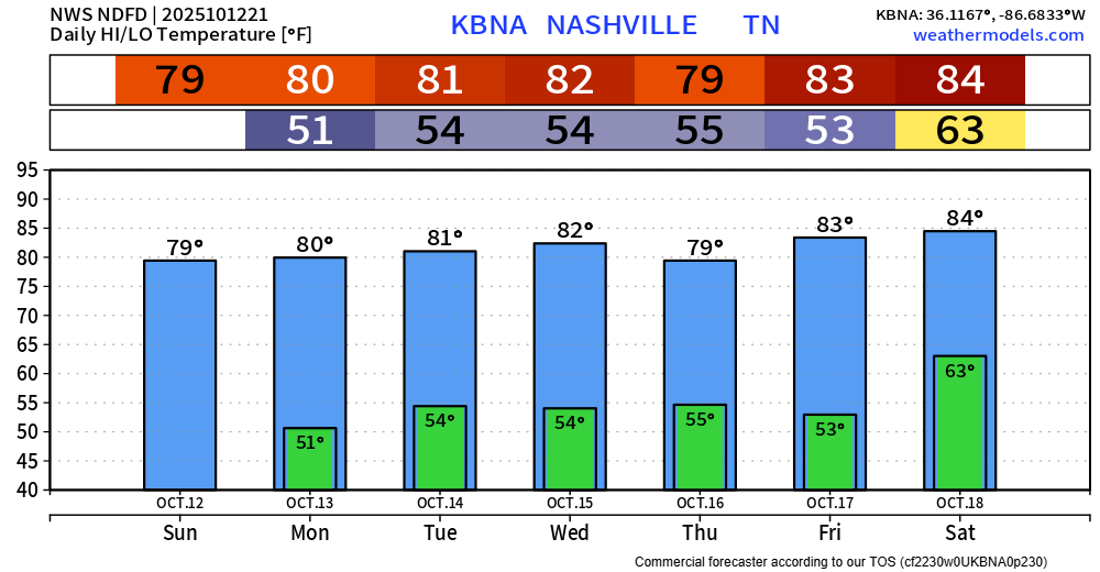
Today will have good weather. Saturday during the day will be dry but hot, we’ll be close to a daily record high.
Saturday evening our attention will turn towards an incoming cold front that will bring some showers and storms to the area.
Today, Friday, and Saturday during the day will be warm and dry. Saturday’s current forecasted high is 88°, which would be a new daily record.
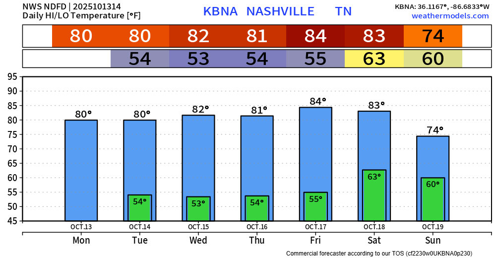
Overall thinking for our Saturday night/Sunday morning “event” remains generally the same.
This work week continues to be nearly a copy and paste. Cool mornings, warm afternoons and dry. I’ll skip to the “interesting” part – but things aren’t really that interesting.
We continue our streak of cool mornings, warmer-than-average afternoons and dry weather throughout the work week.
We get a pattern shift on Saturday/Sunday as a cold front will work thru the area, bringing showers/storms along with cooler temps following it.
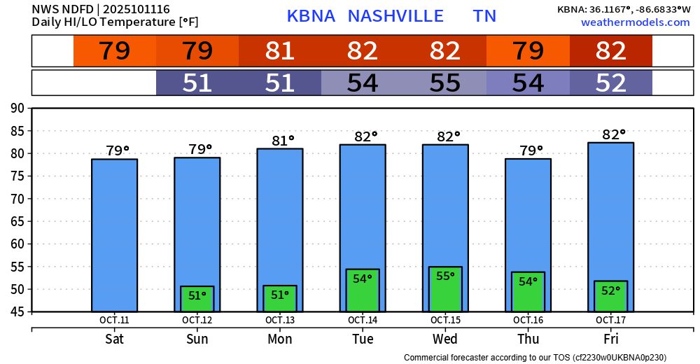
We continue our streak of cool mornings, warm afternoons, and staying dry throughout the work week.
Average high for this time of the year is ~75°, so we’ll be several degrees above average throughout the week.
In the near-term, our days and nights will be near carbon copies of each other, highs around 80….morning lows in the low-mid 50s.
Looking toward next weekend, a trough of low pressure “of decent strength” (NWS) could move through from west to east. While it’s too soon to tell whether we could get severe weather out of it, these are the types of Fall systems that can deliver such.
The pattern continues. Mornings will be cool in the low 50s with localized fog.
Afternoon highs will range from the upper 70s to lower 80s…plenty of sun.
No rain until at least next weekend. The GFS hints at a *possible* weak system on Saturday/Sunday a week from now, but that’s gonna need to come into better view before we get to excited about it.

Strap yourself in. Ready? For the next week:
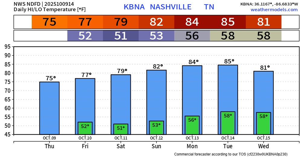
We’ll wake up with cool mornings, not a bad idea to have a light jacket for the walk out the door. Lows near 50° thru this weekend.
We’ll warm up nicely each day thanks to plenty of sun. Highs in the mid to upper 70s this week, low to mid 80s for at least the first half of next week.
You must be logged in to post a comment.