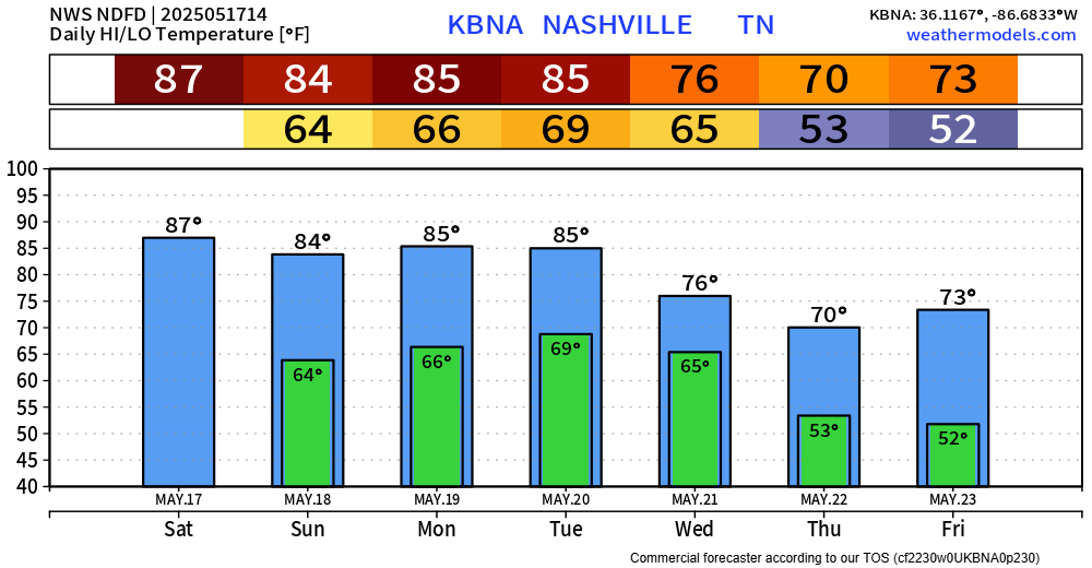
While Saturday doesn’t look like a complete washout, our stretch of nice and dry days will come to an end.
The HRRR and Euro are in fairly good agreement on how tomorrow plays out – I’ll show the HRRR for high-res sake.
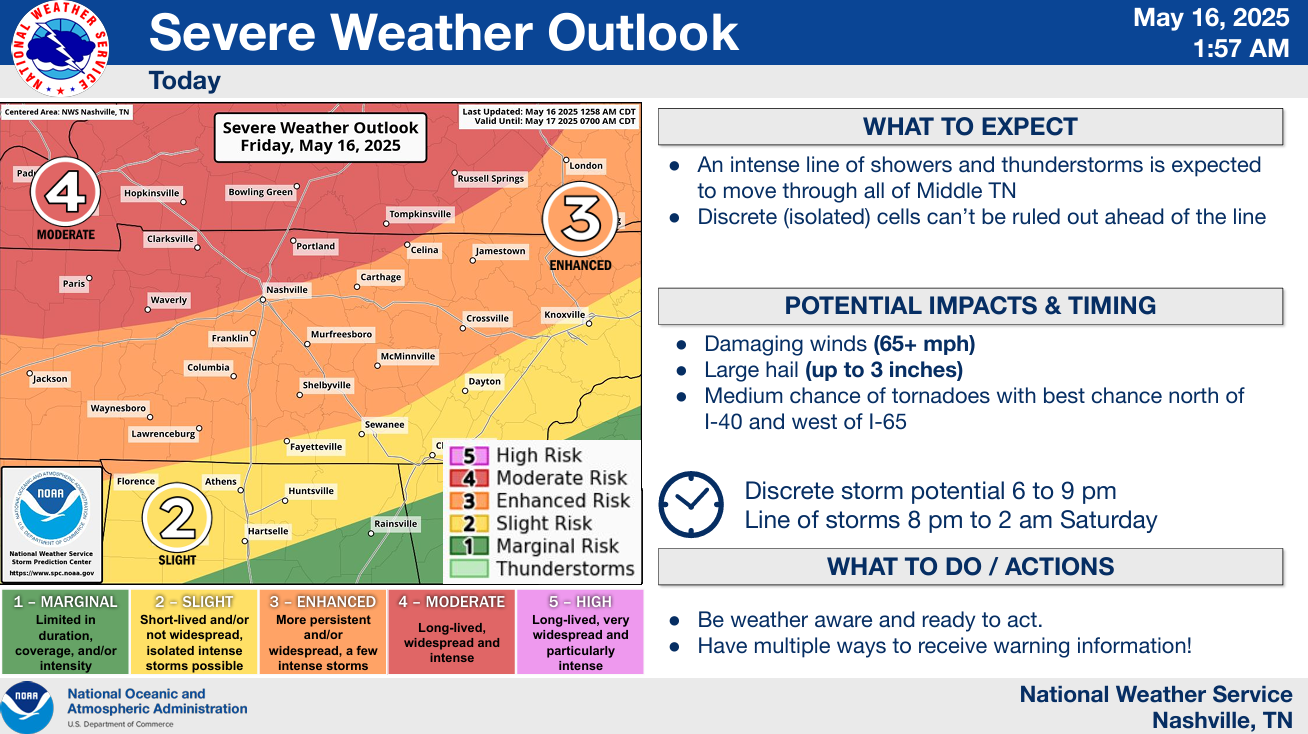
Note: NOAA Weather Radios will be down for today due to maintenance. This means it will not go off if a warning is issued for you. Have other ways to receive warnings if they are issued such as the Wireless Emergency Alerts on your phone, mobile apps. Do not rely on sirens as a way to get warnings, as they are only meant to be heard outdoors.
Note: NOAA Weather Radios will be down for today and Tuesday due to maintenance. This means it will not go off if a warning is issued for you. Have other ways to receive warnings if they are issued such as the Wireless Emergency Alerts on your phone, mobile apps. Do not rely on sirens as a way to get warnings.
Today will be hot and (probably) dry. Very, very, very low chance of storms thanks to a “cap” in place – which is just a layer of warm, stable air aloft. Highs near 90°.
Friday morning we could see some showers/storms move thru, most likely between 3a – 9a. Gusty winds, small hail and lightning not out of the question with these. Allowing some extra time for the AM commute not a bad idea.
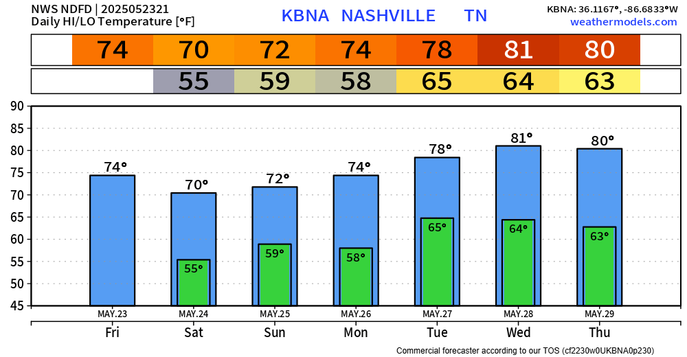
Tuesday will be our only certain dry day of this week – although I feel fairly confident most of us will get at least one more dry day out of this week, just hard to say which one!
GFS and Euro models are not in good agreement about how this week plays out – except for both agreeing that we’ll have no severe worries.