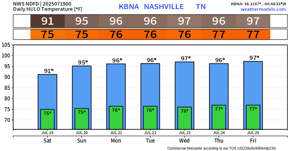
It’s still hot today, but just not hot enough to get us into Heat Advisory criteria.
Sunday thru Wednesday – we’ll have no problem getting there.
Heat index values in the 105-110° range will be likely.

It’s still hot today, but just not hot enough to get us into Heat Advisory criteria.
Sunday thru Wednesday – we’ll have no problem getting there.
Heat index values in the 105-110° range will be likely.
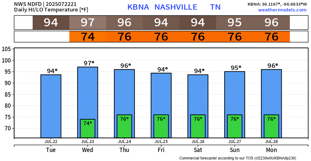
Although it’ll still be hot on Saturday, we won’t have a Heat Advisory for the first time since Sunday. Heat index values will still be near 100°, but most of us should stay below the Heat Advisory criteria of 105°+.
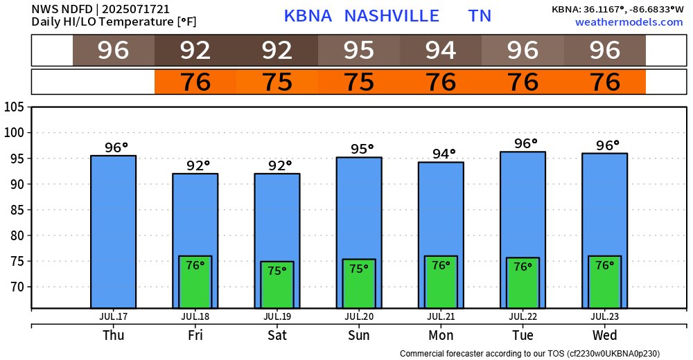
Another day, another Heat Advisory in effect until Friday 8p.
Heat index values will yet again be up around 105°.
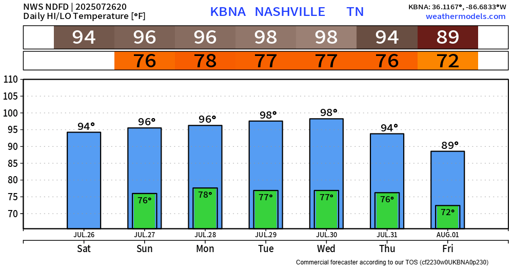
High temps will drop only a couple of degrees this weekend, but this may be just enough to break our streak of Heat Advisories.
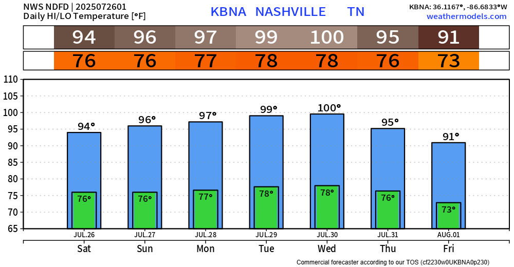
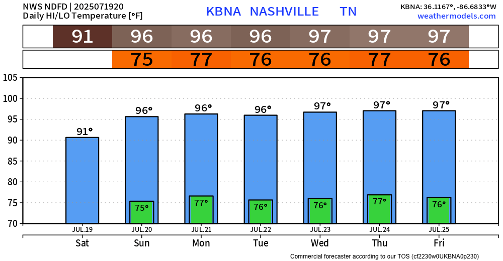
Our Heat Advisory has continued to get extended and is now valid until 8p Thursday.
Heat index values will continue to peak near 108° each afternoon and evening.
And it looks like this brutal temp + dewpoint combo will be a common theme for us thru the end of July.
High-res models continue to show signs for a dry Coldplay concert tonight. It’ll still be hot out but think we make it without any “Sparks” – fingers crossed.
If there are any updates – we’ll post them to all of our socials.
Some dense fog is possible tonight and early Tuesday morning. If you encounter any on your AM commute, take it slow.
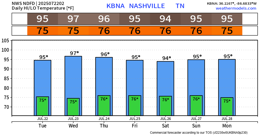
Main story for this week is still the heat.
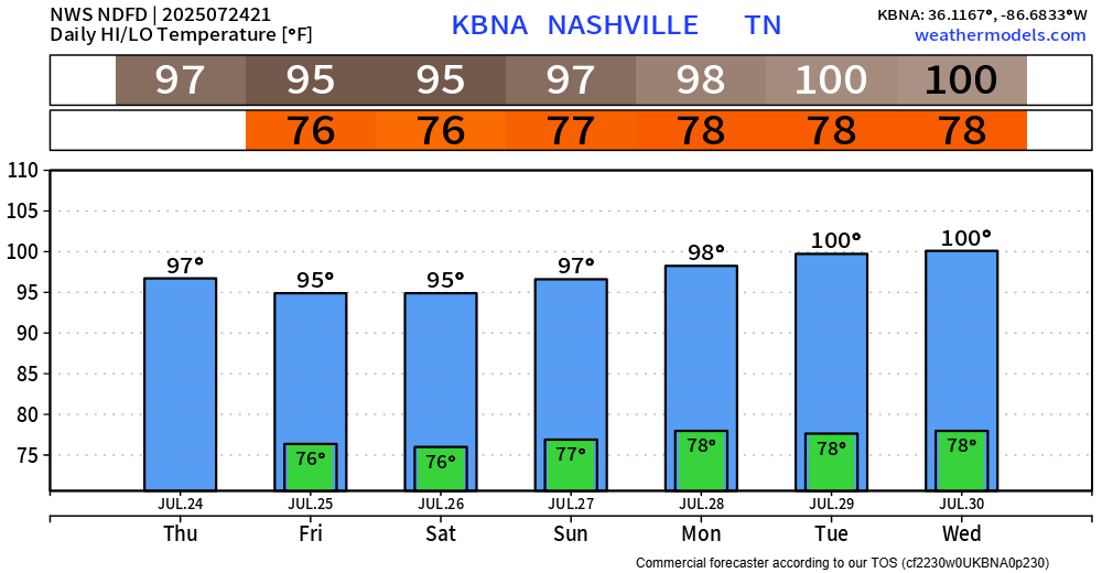
We still have a Heat Advisory in effect until 8p Wednesday.
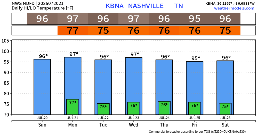
Main story this week weather-wise will be the consistent heat.
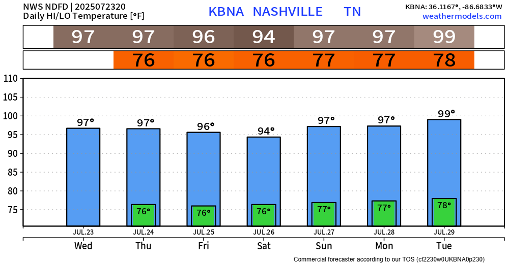
We have another Heat Advisory from 11a to 8p Monday, along with the one that expires at 8p tonight.
Heat index values up to 109° will be possible.
At the time of writing (4:30p), we are currently watching a line of storms that’s in KY and slowly moving south. It’s unknown if this will make it all the way here – but it’s something worth watching. Any severe threat is very low, and the main concern will be the potential for isolated flooding (especially those that saw heavy rain yesterday), frequent lightning and gusty winds.
Several showers and storms are out there tonight, being sparked off by outflow boundaries. If you have outdoor plans, keep an eye on the radar – when thunder roars, go indoors. No severe worries, but heavy rain (w/ isolated flooding), frequent lightning and gusty winds all possible. Some will stay totally dry.
Although we have missed out on any showers or storms so far today, the HRRR model has been consistent with the thinking that somewhere in Middle TN will see some storms closer to sunset. Something to keep an eye on if you have any outdoor plans this evening. You can check the radar on our website anytime right here: Radar | Nashville Severe Weather