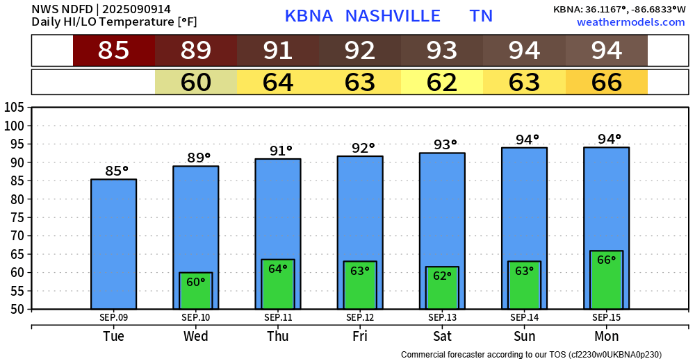
I’m going to sound like a broken record for probably for the next week or so.
High temperatures slowly creeping up throughout the week, getting into the low 90s.
Dewpoints will be in the upper 50s, so eees ok.

I’m going to sound like a broken record for probably for the next week or so.
High temperatures slowly creeping up throughout the week, getting into the low 90s.
Dewpoints will be in the upper 50s, so eees ok.
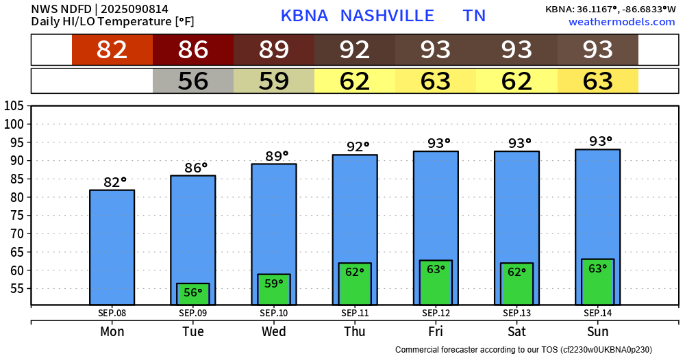
BNA got all the way down to 51° this morning. Some could say that was signaling that football season is in full swing.
Probably won’t get that cool again for a while. Temps will slowly warm up throughout the week. High temps making it to the low 90s by late this week – nearly 10° above average.
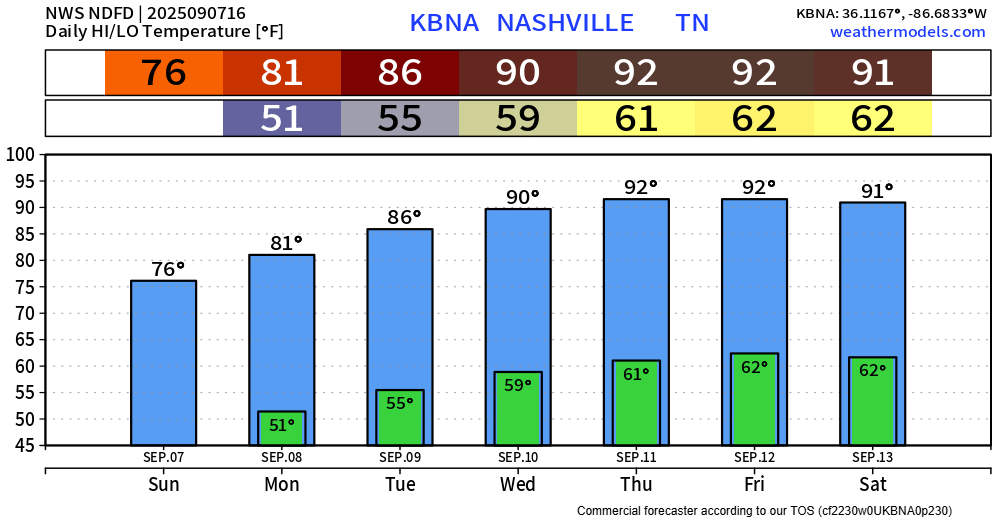
Absolutely beautiful weather today. Highs in the mid 70s, dewpoints in the upper 40s/low 50s. Great day to be outside. Too bad the Titans game is away today.
Temperatures slowly warm throughout the week, getting into the low 90s by the end of the week. Our average for this time of year is ~85°, so we’ll be getting several degrees above average.
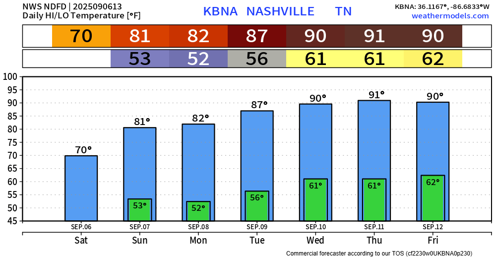
This morning Saturday rain may be putting a damper on your plans but try to enjoy it while it lasts. You can check the radar anytime on our website: Radar | Nashville Severe Weather
Mostly light rain, it all should be gone by early afternoon. Temps will stay cool today; we may not get out of the 60s. Guess that’s a fair trade for the rain.
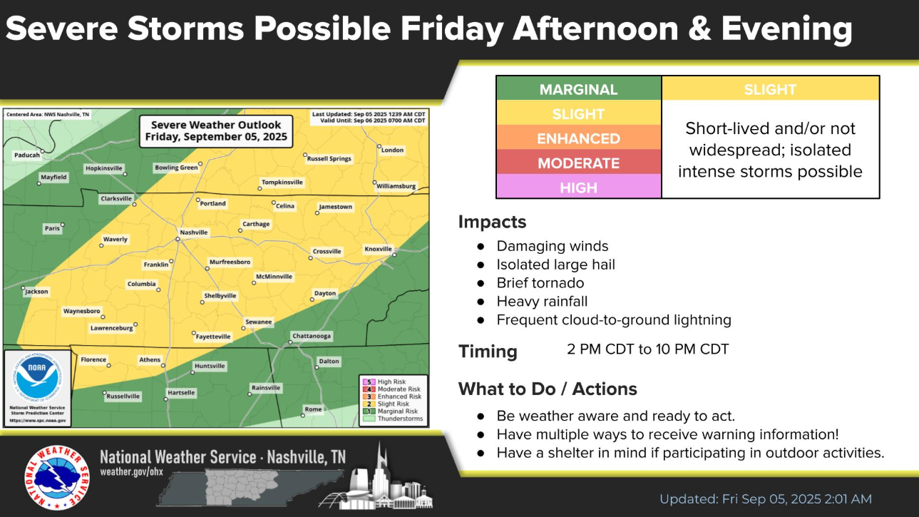
What:
The Storm Prediction Center has outlooked our two counties with the following probability of ‘x’ within 25 miles:
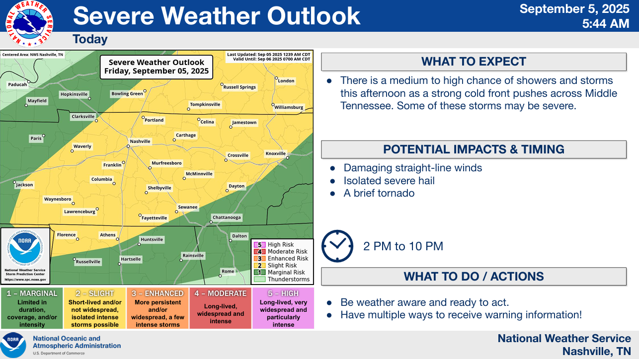
When:
A broad timeframe will be 2p-10p, but a narrower one for us would probably be 6p-10p.
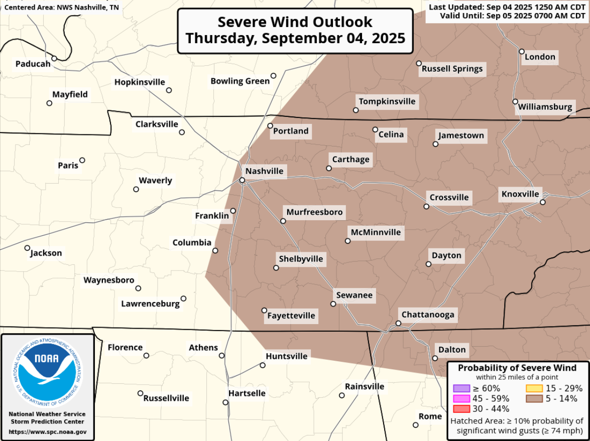
We have a very low-end chance for damaging straight-line winds today and Friday. It’s really not much, but let’s go day-by-day.
The Storm Prediction Center has outlooked most of our two counties with a 5% chance of damaging straight-line winds within 25 miles today. Tornadoes are not expected.
Lower rain chances today, but they aren’t zero either.
Scattered shower, maybe a storm, can’t be completely ruled out this afternoon or evening. Most of us will probably stay dry though, sorry to the crunchy grass.
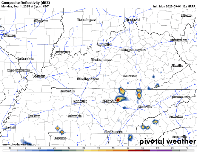
Scattered showers and storms will remain in the forecast over the next several days – nothing too noteworthy though.
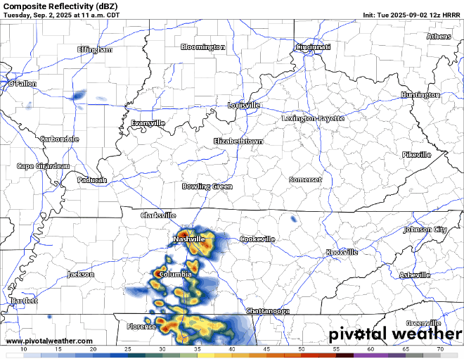
Looking at today [Tuesday], some showers have already affected southern WillCo., and more showers and storms will be possible throughout this evening.
Not too bad of a Labor Day forecast.
A bit warm and muggy, with high temps in the upper 80s, dewpoints in the low 60s – it could always be worse.
We could see a few showers and storms around the area this afternoon and evening. Wattery (rain lottery) style, so impossible to know exactly when and where these might pop up.
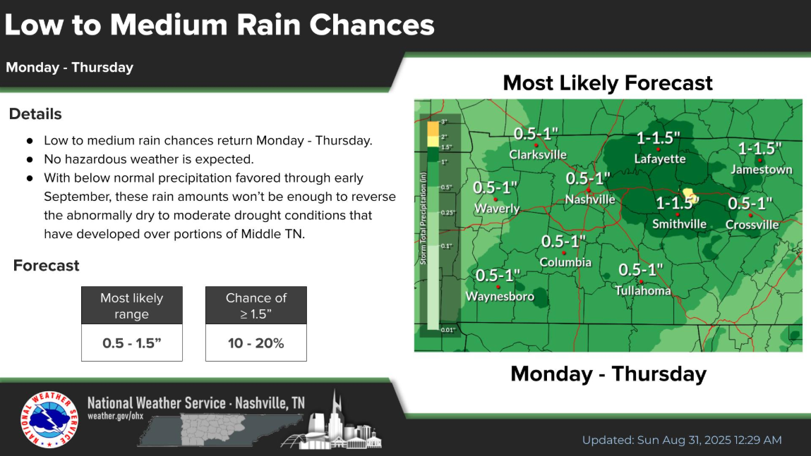
Low to medium daily rain chances get introduced starting Monday, and stick with us thru Thursday.
Chances will peak each day during the afternoon but won’t be surprised if we see one or two rainy mornings. Not a bad idea to keep the umbrella handy this week.
You must be logged in to post a comment.