Note: Blogs will now be published in the morning hours, instead of the evening hours. Fueled by coffee or energy drinks, depending on what kind of day it is. Today was an energy drink kinda day, in case you were wondering,

Note: Blogs will now be published in the morning hours, instead of the evening hours. Fueled by coffee or energy drinks, depending on what kind of day it is. Today was an energy drink kinda day, in case you were wondering,
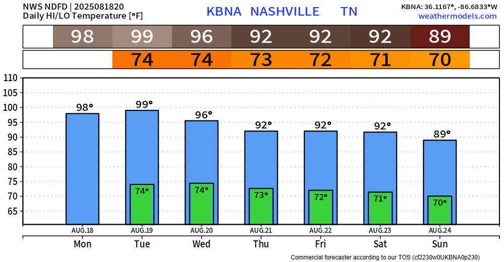
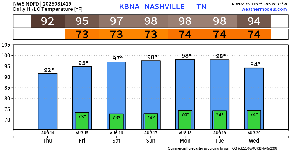
Today was hot. BNA reached 101° today, the first time we’ve hit triple digits since last August.

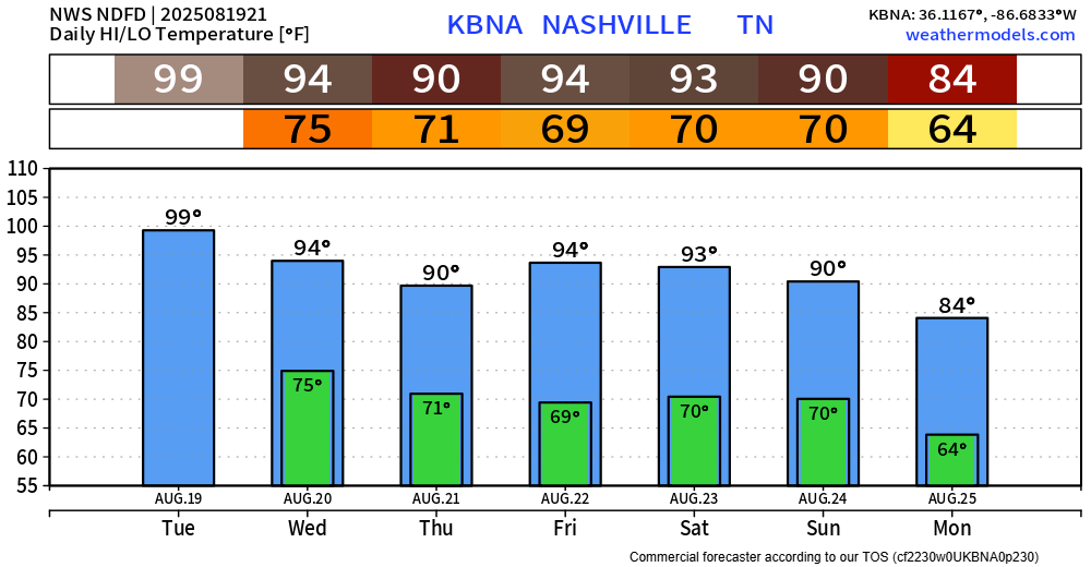
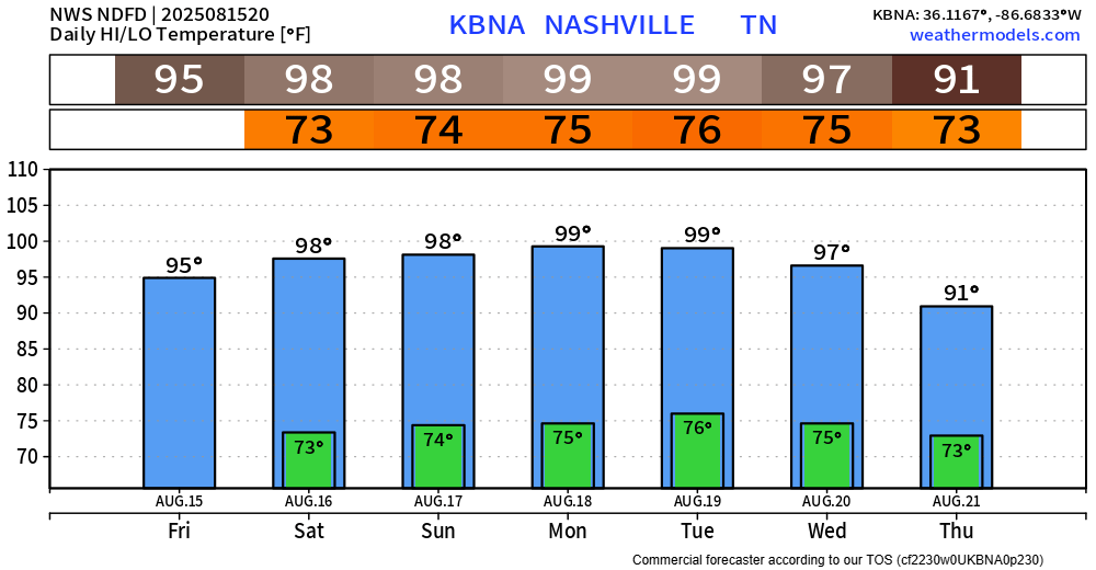
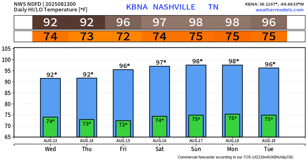
It’ll still be hot over the next several days, but thankfully not that hot.
High temps will “only” be in the low 90s thru this weekend. More manageable.
You’ve probably noticed, but it’s hot outside.
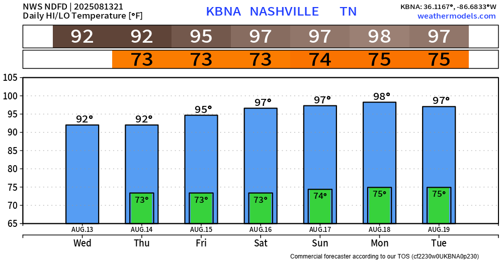
Temperatures are in the upper 90s right now, and dewpoints near 70° are pushing our heat index values towards the 105-108° range.
That is the reason we have a Heat Advisory until 7p Tuesday.
NWS Nashville went ahead and issued a Heat Advisory valid until 7p Tuesday. Heat index values up to 108° will be possible daily.
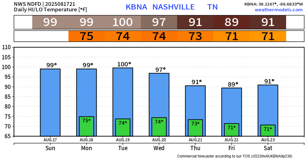
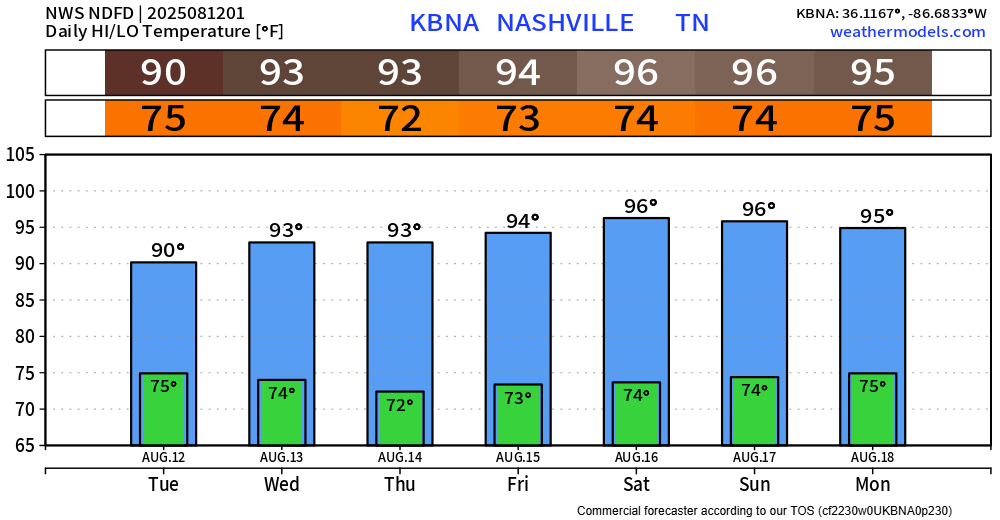
High temperatures will get very close to 100° each day, halfway decent shot of actually making it there on Monday and Tuesday. Dewpoints near 70° will make it feel that much worse.
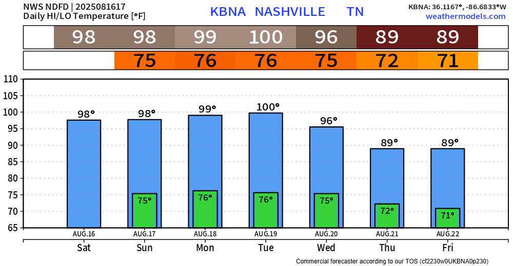
The heat will be the main story over the next several days.

High temperatures will be in the upper 90s, maybe hitting 100° each day thru Tuesday.
Dewpoints will be a muggy ~70° during this time, causing heat index values to get up near 105° each day.
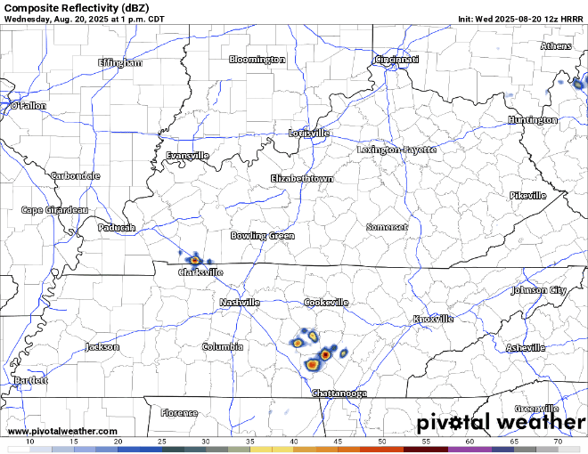
Isolated showers and storms will continue thru the evening, but isolated is the key word here. Most of us will stay dry, while a few folks might see a thunderstorm – your grass would love it, I’m sure.
A passing shower or storm can’t totally be ruled out today and Friday during the afternoon and evening. However, chances will be fairly low, only around 20-30%. Most of us should (knock on wood) stay dry.
BNA has seen 2.25″ of rain so far today – as of 5p. Not everyone has seen that much, but some is better than none.

Additional showers and storms can’t be ruled out thru the rest of the evening. We’ll be watching and posting any updates to all of our socials.
Coverage was relatively more widespread today compared to the past few days – as expected. This will be a continued trend on Wednesday.
~60% rain chances will be around during the afternoon and evening hours of Wednesday. Similar to today, no guarantees, best of lucky trying to get some free water for the yard and a nice cool down.
All was quiet today on the radar, but this will likely change over the next couple of days.
Rain/storm chances will be ~60% during the afternoon and evening hours of Tuesday and Wednesday.
Still far away from any guarantees, but chances will be much greater than what we’ve seen the past several days. Thankfully, we still don’t have any severe worries – but a few storms could be on the stronger side with heavy rain, frequent lightning and gusty winds.