
Good morning. Multiple rounds of severe weather are possible today and tonight with all modes possible. Flash flooding, tornadoes, damaging straight line wind and large hail.
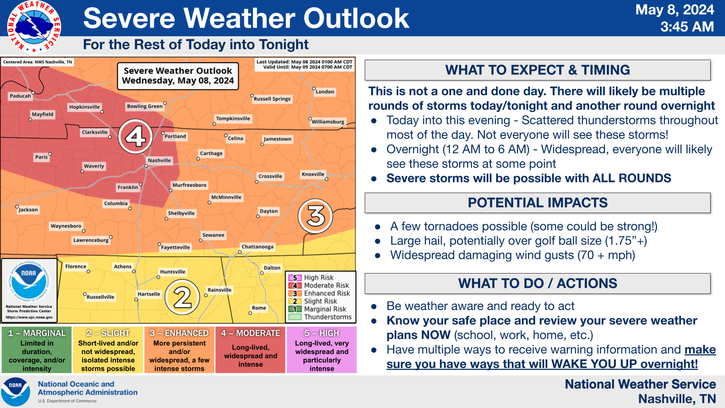
Timing: This is especially difficult to communicate. Some may see multiple severe storms today. Some may see only one or just one nearby. It depends on many factors, many of which aren’t being handled well in the models today. This is not a one and done event and will likely last about 24 hours.
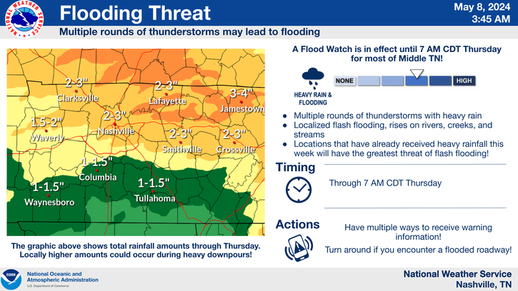
Flooding: It’s becoming evident that a boundary will probably stall out either over us or just to our north. This will set the stage for training storms and flooding where that boundary sets up. Don’t discount this threat today. A Flood Watch is in effect until 7:00 am Thursday morning.
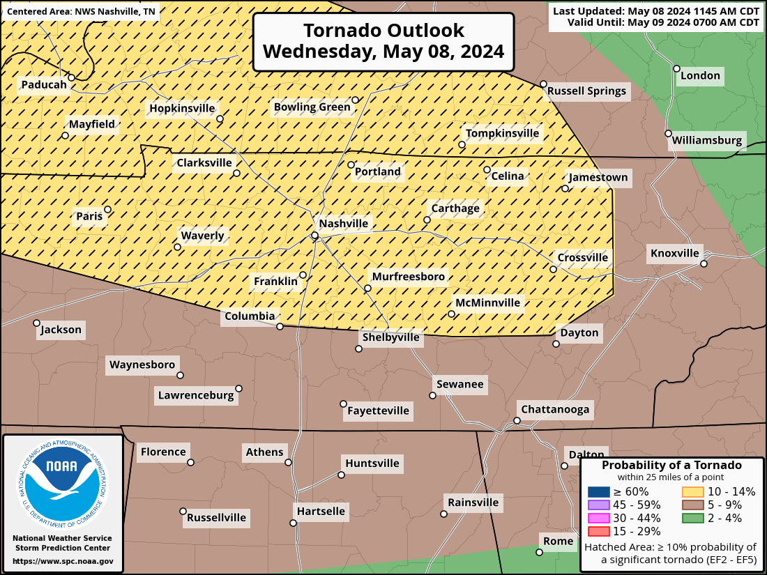
Tornadoes: There is a 10% chance of a tornado within 25 miles of you today. If a tornado occurs, it could be a strong one. Some of this depends on whether any supercells can develop. If so, this increases the threat substantially. We’ll watch it.
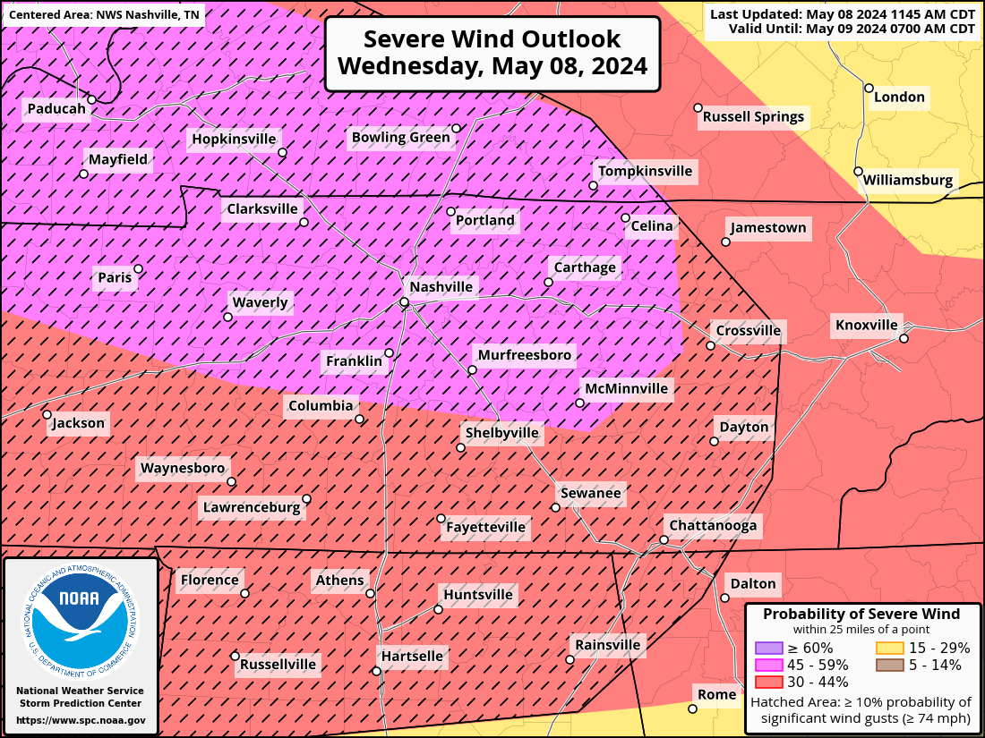
Damaging Wind: This is the threat that earned us the “moderate risk” from SPC this morning. There is a 45% chance of seeing damaging straight-line wind within 25 miles of you. And, if it occurs, it could be particularly damaging. Yuck.
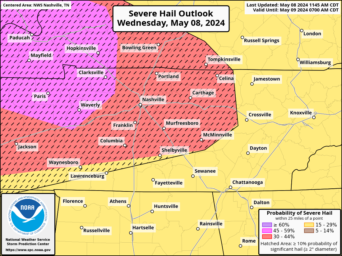
SPC has backed off ever so slightly the hail probabilities. But, that’s hardly worth mentioning because there still exists a 30% chance of seeing quarter size hail or larger, and it could be even larger than that…think golf ball or larger. There have already been large hail reports this morning in counties around us.
It’s important that you don’t find yourself in a vulnerable place today when a storm approaches. Think vehicle, mobile home, outdoors, etc. Stay connected to weather information today and be ready to take action if you need to. We’ll be posting updates on X today and will go live on YouTube Live if warnings are issued for Davidson and/or Williamson Counties. https://nashvillesevereweather.com/what-to-do/
Reports from you have already been useful this morning. If you see hail, compare the size to an object and let us know. #tSpotter is the best way to send reports to us and NWS. Same applies to tornadoes, funnel clouds, wind damage or flooding. Please include your location and only send reports safely. Don’t get hurt sending a report.
Categories: Featured Blog