New HRRR model run keeps most rain, late afternoon and tonight, south of 840. Think most will see a light, drizzly, obnoxious rain. No lightning.

Rain arrives late afternoon and continues thru tonight per HRRR model. No lightning. 0.25” total on avg.

Rain Friday Evening, Another System Mon/Tues.

Nice evening ahead of us before some rain chances Friday.

Some light showers are possible Friday morning, majority of the rain will come around Friday evening.

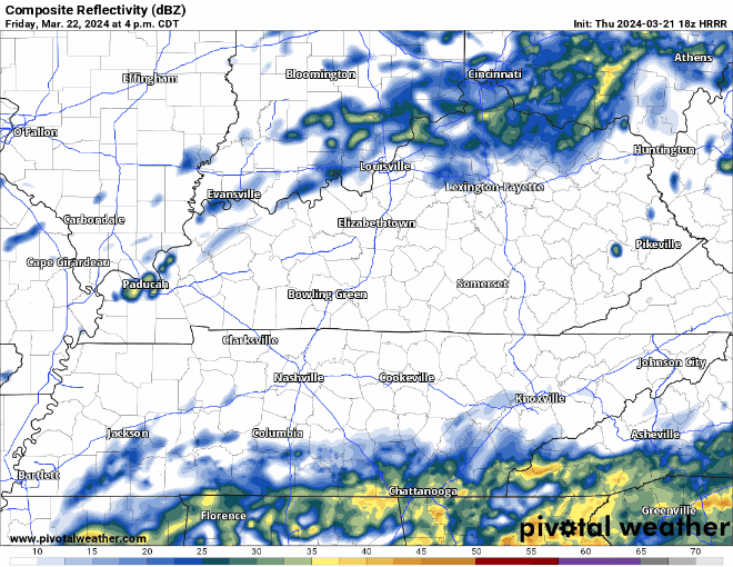
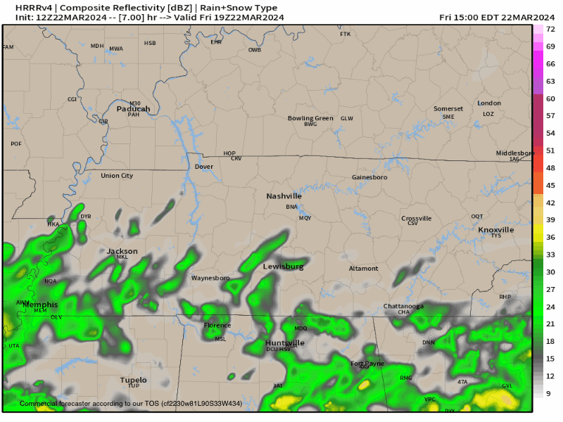
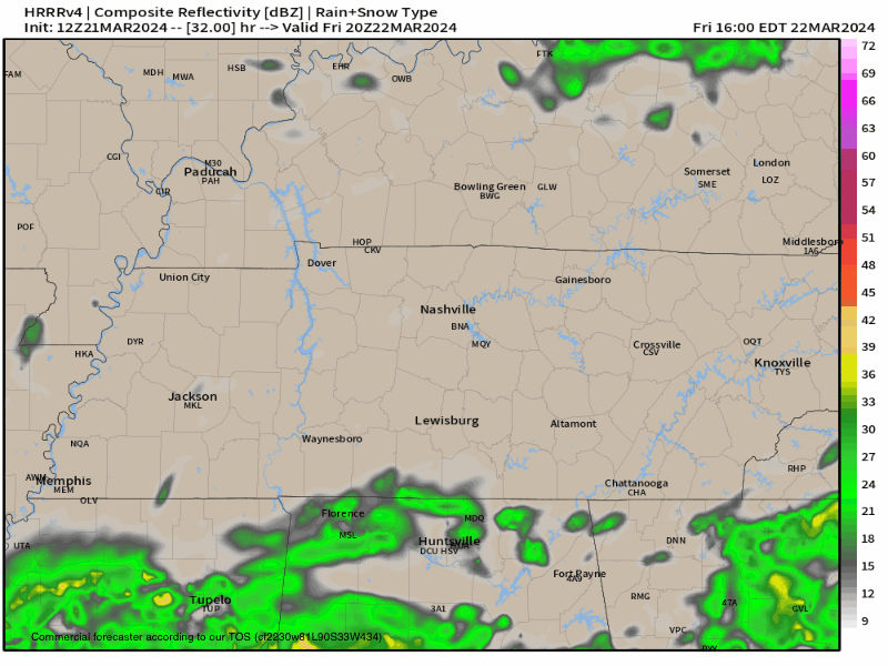
HRRR model (above) gives its best guess at what the radar will look like tomorrow (could be wrong!). Rain should start around ~ 5 or 6pm, +/- a couple hours, and last thru about midnight. Majority of it looks to stay to our SW, but we should get a couple hours of rain. Rainfall totals up to 0.5″, no thunderstorms expected. read more

HRRR model has light rain tomorrow night. Most of it misses to our SE. Model may be wrong. Will update.

Rainy Friday, Dry + Warm Saturday and Sunday, Another System Mon/Tues.

Another cold night ahead, we’ll wake up (depending on your sleep schedule) with temps in the mid to upper 30s.

Temperatures will quickly rebound, getting up into the mid 60s by Thursday afternoon. Pretty nice day. read more

Rain likely Friday. Lightning unlikely. Hi Res data in range tonight w/ deets. After a quiet weekend, another system late Mon-Tue. Strong winds likely but severe (at least for now) appears unlikely (bc no CAPE). This will be watched. read more

Spending this blue sky Weds emotionally preparing for a summertime of questions about cicadas and inaccuracies in the coming Twister movie reboot.

Thankfully, no more sub-freezing temperatures expected in the next 7 days after dipping down into the low to mid 20s last night.

High temps back near 70 degrees tomorrow, with high staying in the 60s for the remainder of the week. read more

Hard freeze expected tonight with low dipping down into the mid 20s. We’ll wake up with temps in the upper 20s.

“We’re still about 2 weeks from our last average freeze date, so this isn’t abnormal, but it’ll be painful for anyone who jumped the gun on planting.” – NWS Nashville read more

Hard Freeze Expected Monday Night, Fire Danger Highest Mon + Tues.

Main headlines this week will be a hard freeze and fire danger.

Official low tonight is 33°, but your backyard may make it below freezing. High temps Monday only expected to make it in the mid 40s.

Hard freeze expected overnight Monday. read more