
HEAT
Summer officially began early this morning.
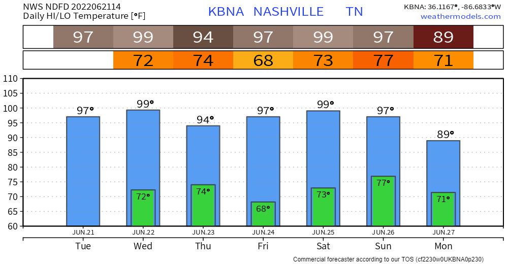
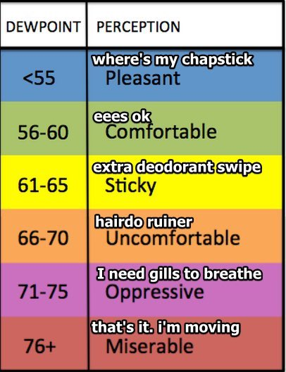
This streak of near 100° temps will be a dry heat — not Vegas dry, Nashville dry — except for Wednesday when the dewpoint jumps up from the Comfortable to a Bit Sticky into the Uncomfortable area. That’ll send the heat index to 102°. Rest of the week the temp and heat index will be close together.
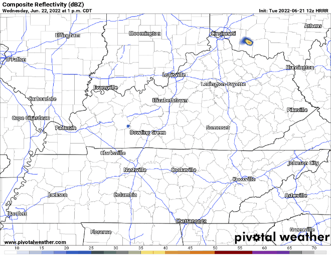
WEDNESDAY RAIN MEH
Rain is possible late Weds afternoon into early evening. Here’s the HRRR model, notice only a few are chosen for rain and we may not see anything at all.
LATE WEEKEND RELIEF?
It takes a lot to break a heat wave. Models show a weak cool front maybe late Sunday into Monday. It would bring rain and take the edge off the heat for a day or so. But I don’t trust the models just yet. This is a weak front and these “death ridges” that make heat waves are tough to shake.
Quick References:
Weather changes constantly.
Follow @NashSevereWx on Twitter for any changes to this forecast.
Live coverage during tornado and severe thunderstorm warnings.

Look good.
Support the mission.

We are 100% community supported. No ads. No subscription fees. Keep it free for everyone.


Categories: Forecast Blogs (Legacy)
You must be logged in to post a comment.