
In all seriousness:
I agree!
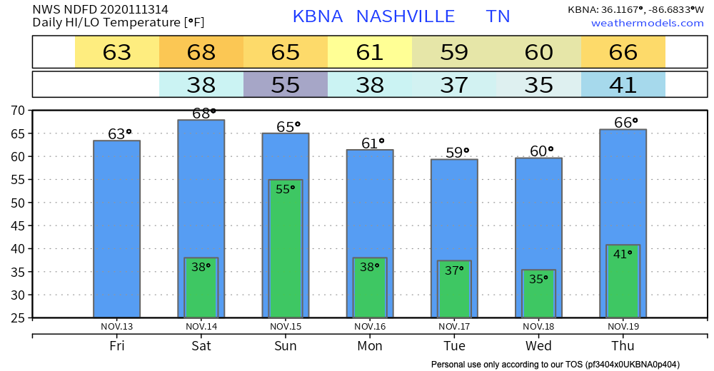
Sun will be plentiful today. Temperatures will peak around 64º this afternoon. Expect a slight breeze from the north, which may make temperatures feel a few degrees cooler.
Our Next Chance of Rain Arrives This Weekend
Saturday things are looking clear and mostly sunny! Temperatures will reach the upper 60’s.
Saturday night/early Sunday, a cold front will move across Middle Tennessee. A significant dose of showers will follow overnight into the morning hours on Sunday.
Parameters are also such that an isolated storm or two across the north are not out of the question either.
-NWS Area Forecast Discussion
We aren’t expecting a severe event, but we can’t rule out a rumble of thunder or strong winds.
The tornado probabilities are far off to our west and very low:
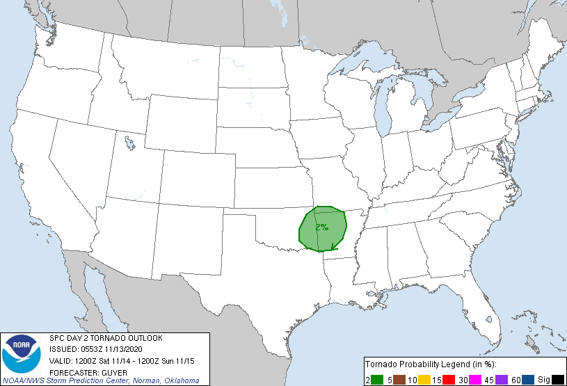
More details on timing and locations of storms to come, once models rein (no pun intended) in their forecasts a bit.
Aka, tomorrow.
Rain should clear by mid-morning Sunday. Your afternoon outdoor plans are safe!

After the rain event on Sunday, a surface high pressure system will prevail. Think of it as a shield that’s keeping rain away from us. So, next week will be clear with temperatures hovering around seasonal values.
Sounds pretty good to me…
Until then, enjoy the day!
Categories: Forecast Blogs (Legacy)
You must be logged in to post a comment.