
More cool air has arrived
Today we should reach into the low 60°s with clearing skies as last night’s rain moves out of the area.
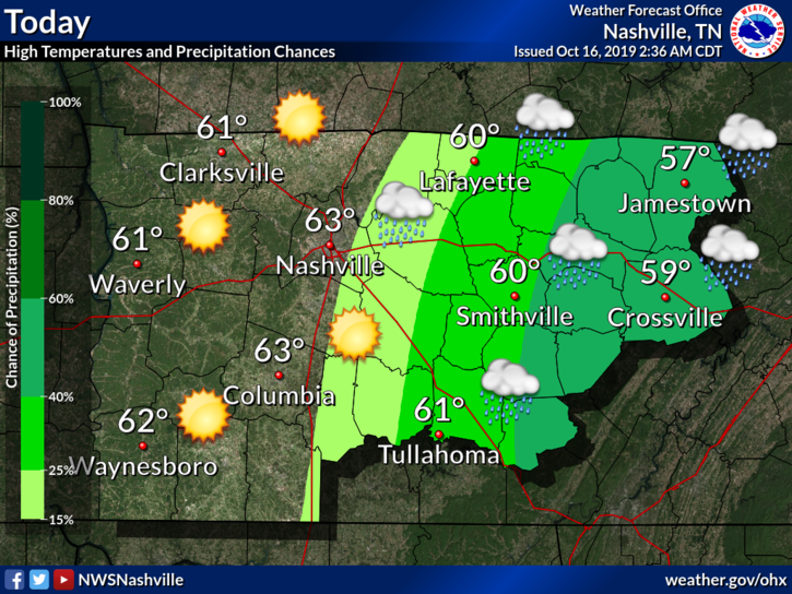
This is thanks to a cold front. The wind is pretty cold, though.
Our low overnight into Thursday morning is brisk:
Temperatures tonight will dip into the 30’s most areas, with patchy frost likely in the cooler locations. We won’t see any appreciable warming until Friday.
NWS-Nashville AM Forecast Discussion, 10/16/19
More of the same really. High should reach low 60°s and the overnight low for Thursday will be somewhere in the low 40°s or upper 30°s.
Below is a model run of the NAM3, showing the dewpoints behind that cold front that moved through. You can see the extent of the dry air (in blue) replace the warm, humid air (in orange), sweeping across the country.
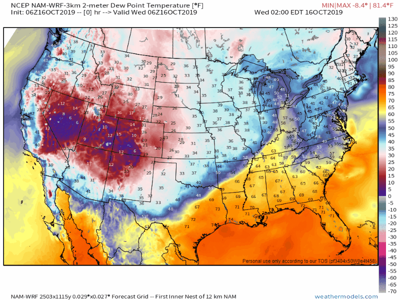
This is a prime example of nature turning on the AC, keeping that pesky summer heat at bay.
Friday we warm up a few degrees back into the 70s.
Saturday also looks good. The second half of the weekend, not so much.
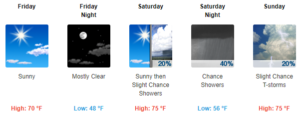
Sunday/Monday Rain Event
The next rain event will be either Sunday or Monday, maybe both. Models are back and forth on timing and extent of rain. It may rain during the Titans/Chargers game and we can’t completely rule out a storm or two (but that seems unlikely). During this time, the best chance of rain is Monday night, ahead of yet another cold front. A few storms can’t be ruled out Monday night, but this isn’t (so far) looking like a strong storm setup.
Check back for updates to the forecast and be sure to follow us on Twitter @NashSevereWx for more information!

Categories: Forecast Blogs (Legacy)
You must be logged in to post a comment.