
Wednesday
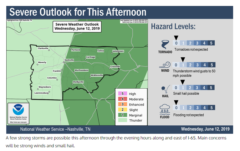
A chance for showers and a few isolated storms exists as an upper level system swings through the region. It seems like the best chances will be just to our east but we can’t rule out a few stray showers that could pop up mainly between 2 and 8 PM. The National Weather Service echoes this:
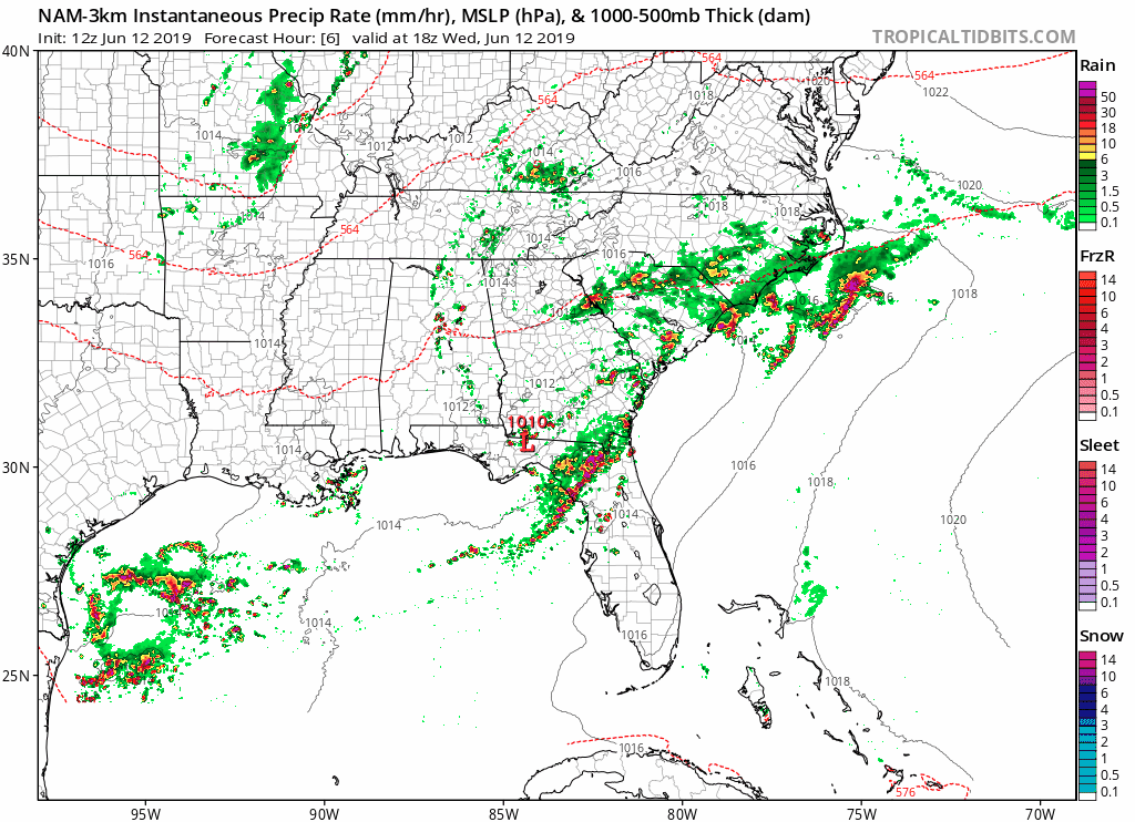
Models all indicate scattered to numerous showers and thunderstorms will break out east of I-65 this afternoon.
No severe weather is expected at this time, but a few of the storms could be locally strong
Here is the latest NAM3 model:
(Editor’s Note: Don’t cancel your afternoon/evening outdoor plans. But, have a plan if you need to run inside for a few minutes while a shower or brief storm passes.)
Thursday & Friday
Mostly sunny and pleasant!
High on Thursday of 75 and a little warmer on Friday with a high of 80. Dew points in the low to mid 50s will make it feel quite comfortable.
The Weekend
Saturday will remain dry but warmer and more humid with dew points surging into the mid 60s.
Showers and thunderstorms are possible Sunday as another upper level disturbance moves through the area. No precise ETAs as of now as the models have some timing issues, but we will keep you updated through the week.
Keep checking back for more updates!

Categories: Forecast Blogs (Legacy)
You must be logged in to post a comment.