
Frost Advisory Until 9AM, Fall Pattern Continues Into Next Weekend
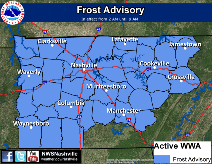
* TEMPERATURES…Lows will be in the mid to upper 30s across Middle
Tennessee.
* IMPACTS…Sensitive outdoor plants may be killed or damaged by
frost if not protected.
PRECAUTIONARY/PREPAREDNESS ACTIONS…
A Frost Advisory means that widespread frost is expected.
Sensitive outdoor plants may be killed if left uncovered.
– – –
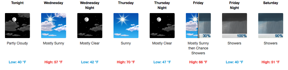
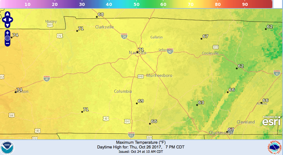
Wednesday will be another cool day, but a surge of warmer air out of the south returns for the day on Thursday. Highs on Thursday will generally top out in the upper 60s to around 70ºF.
NWS High Temperatures Thursday
On Friday, a noticeable increase in cloud cover will begin with rain developing and moving in from the west late Friday night. Friday Night Lights should be just fine as we see it now, so head out and enjoy some high school football.
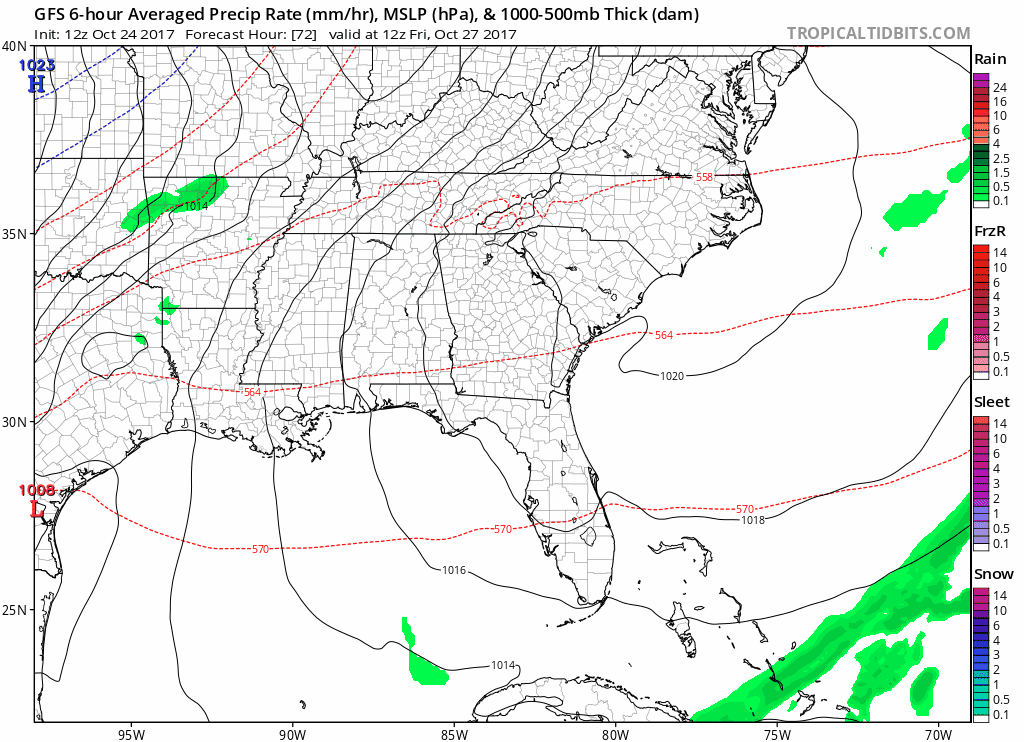
Light to moderate, steady rainfall continues through Saturday, ending around dinnertime or so Saturday evening.
GFS Modeled Precipitation Friday-Saturday PM
The main headline is the cold air behind Saturday’s rain.
GFS Model Low Temperatures Saturday/Sunday/Monday Night
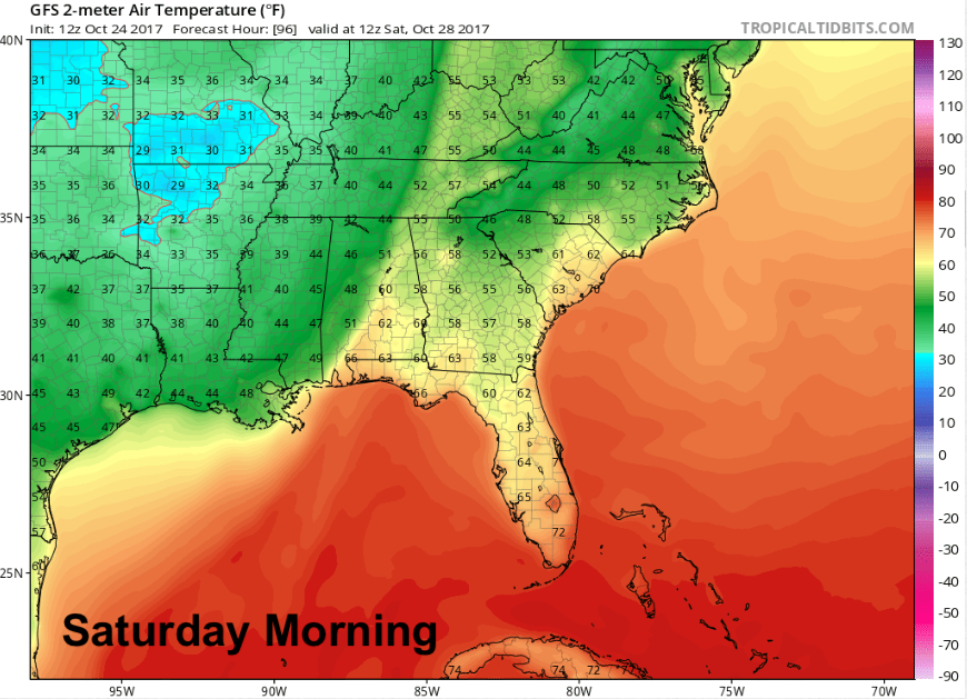
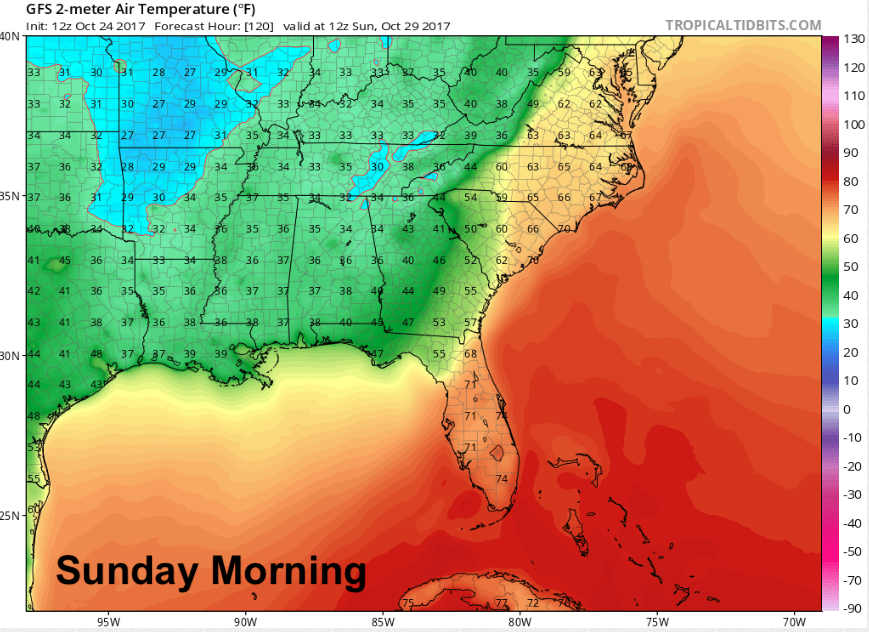
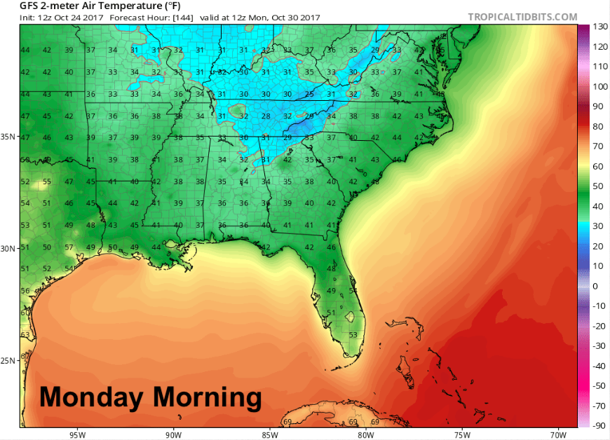
Frost will be possible, although there are some factors providing uncertainty to widespread frost developing for now. One thing is certain…the fall/winter wardrobe season is definitely upon us. Prepare to bundle up for trick-or-treating, too.


Categories: Forecast Blogs (Legacy)
You must be logged in to post a comment.