
Sunshine Hanging on for a Few More Days
The end of these warm temps is in sight, but these temps want to hold on for just a little bit longer over the next couple of days.
https://giphy.com/gifs/cheezburger-cat-black-and-white-14kybDP9JZvmnu
Temps look to stay in the low 80s tomorrow with enough sunshine for everyone.
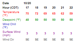
Friday Night Lights –
Overall, pretty nice conditions are in store for any outdoor activities tonight. Temps will cool off rapidly after sunset, so you’ll want a light jacket after halftime.
Hourly Forecast Tonight from 5 PM (18) Until 10 PM (22)
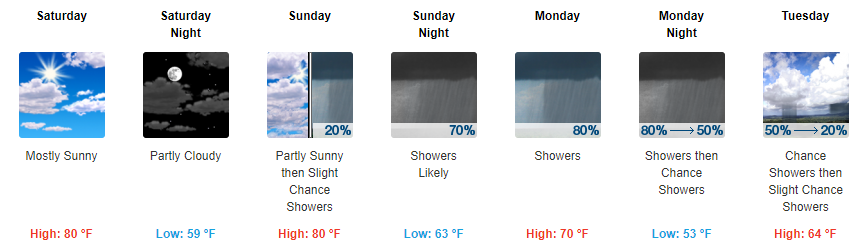
Showers to Start Next Week & a Cool Down in Sight
Starting Sunday, our chance of showers begins to increase. There is some differences from model to model, but the majority of our models show the best chance of showers coming Sunday evening and throughout the day on Monday. Showers should begin to fizzle out late Monday evening, leaving us with a small chance early on Tuesday.
GFS Loop Sunday AM Through Tuesday Afternoon
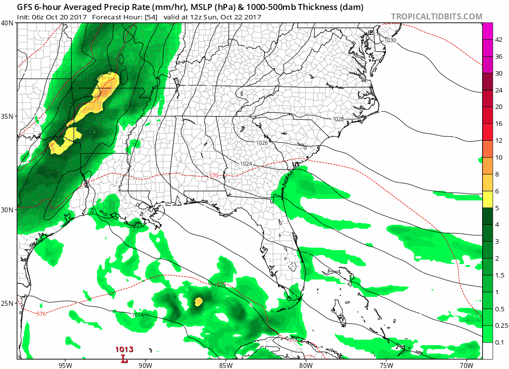
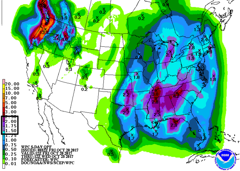
There will likely be periods of light scattered rain with a few periods of heavier showers in the mix over the course of Sunday and Monday. Expecting to see anywhere between an inch to two inches of rain when all is said and done.
In terms of field conditions on Monday, they will probably be pretty soggy.
By Tuesday, our high temps will fall back into the 60s and look to stay that way for the remainder of the week.

Categories: Forecast Blogs (Legacy)
You must be logged in to post a comment.