
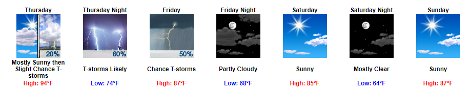
Sunny Start Tomorrow, Things Begin to Change Late Tomorrow Night
Thursday daytime appears to be pretty similar to the past few days with highs in the 90s and dew point temps in the 70s. Heat index values will once again be in the 100° to 105° range, so it will be another hot day. The majority of the day will consist of sunny skies.
As we move into the afternoon to evening hours, we are expecting to see some showers and storms develop. In addition, a cold front is expected to push down into Tennessee sometime between late Thursday night and Friday. Depending on the timing of the front will greatly influence our weather pattern on Friday.
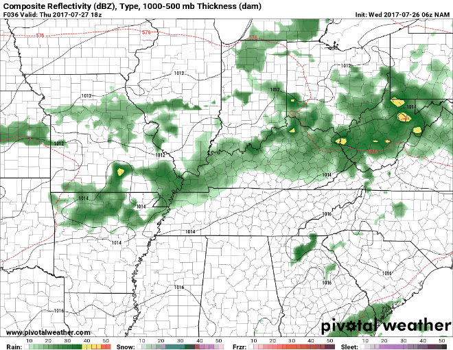
As for the timing, NAM still seems to like the late Thursday night arrival of showers and storms, but does now show showers/storms possibly sticking around into Friday.
NAM Loop 1 PM Thursday Through 7 PM Friday
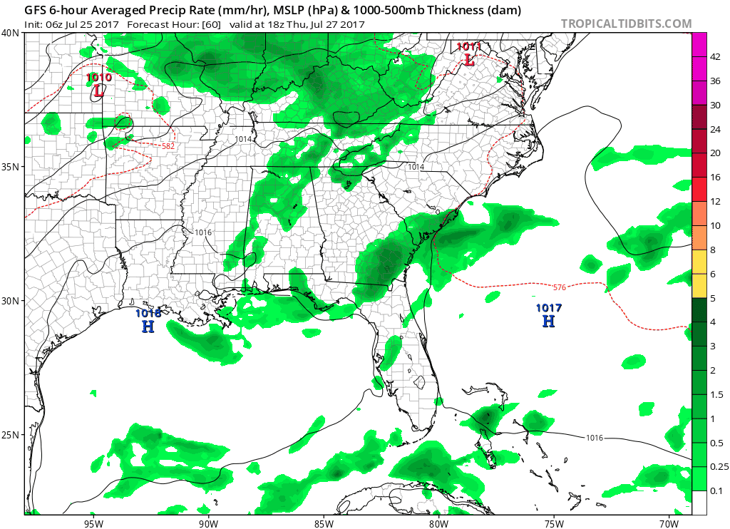
On the other hand, the GFS and Euro still like the daytime Friday arrival of showers and storms and doesn’t have us seeing a whole lot Thursday night.
GFS Loop 1 PM Thursday Through 1 AM Saturday
Either way, we could see a few strong to severe thunderstorms develop along this line of showers and thunderstorms.
In terms of timing, it will all depend on the evolution of this cold front. If storms ride down I-24 and stay together, we could very well see some storms Thursday night. In addition, we could get some redevelopment on Friday. It will also depend on how quickly the cold front reaches us. Once it moves through, the severe weather aspect will be over.
As for the severe weather aspect:
SPC has issued a Day 2 (tomorrow) Marginal Risk outlook for our area, which translates to there being a 5% probability of severe weather occurring within 25 miles of your location.
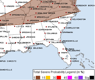
Additionally, the SPC has issued a Day 3 (Friday) Marginal Risk outlook for our area, which translates to there being a 5% probability of severe weather occurring within 25 miles of your location.
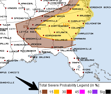
The main concerns would be damaging winds and maybe some heavy rainfall issues.
There are still a lot of variables at play and timing aspects to iron out. We will continue to keep an eye on everything and update you with the latest information as it becomes available.
Sunshine and Cooler Temps Rule the Weekend
Temps will begin to cool off on Friday behind the cold front discussed above. By Saturday, our dew point temps will also fall down into the low 60s. It’s been a while since we have experience dew point temps this low.
https://giphy.com/gifs/demi-s-Fj2717AZkXluw
Highs will also be in the mid-80s, so much more comfortable considering it is the last weekend of July.
Whether you are shopping for tax-free weekend, or just want to go out on the lake, it looks like the perfect weekend for any plans you may have.
https://giphy.com/gifs/full-house-michelle-tanner-gif-YJ5OlVLZ2QNl6

Categories: Forecast Blogs (Legacy)
You must be logged in to post a comment.