
Heat Advisory Until 7 PM
It’s been another scorcher.
BNA reporting 93°F, dewpoint 75°. Heat index 105°. pic.twitter.com/gwhKBXakV7
— NashSevereWx (@NashSevereWx) July 23, 2017
As I write, BNA briefly touched 95°, but settled back down to 93°. Today’s high is 96°.
Rain & Thunderstorms Tonight?
We saw a few weak impulses of energy set off a few showers this morning in south Williamson Co.
After 6 PM, a stronger impulse is expected to arrive from Kentucky and create widespread rain and thunderstorms across Middle Tennessee (but maybe not here, keep reading). This impulse will feed off plenty of storm fuel, however, with no real shear, organized storms are not expected.
These pokey storms will make moderate to heavy rainfall with a small chance of gusty winds. Storms should fade by 10 PM or 11 PM due to loss of daytime heating.
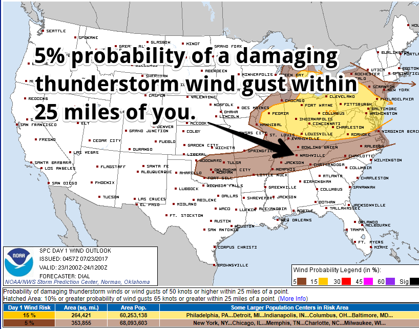
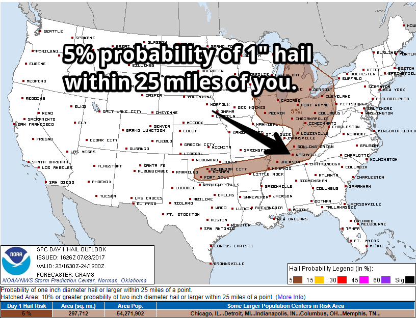
The Storm Prediction Center includes us in a 5% probability of damaging thunderstorm winds and large hail.
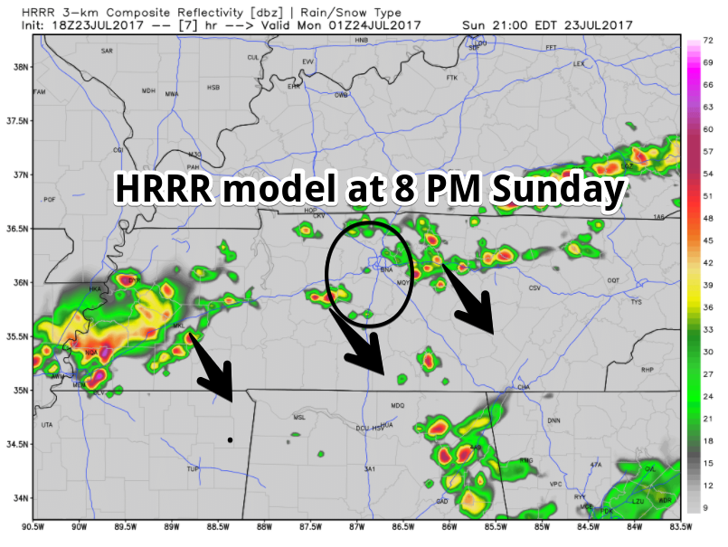
There’s a question as to whether this storm activity will arrive in, or go around, Nashville or Williamson County.
The HRRR model thinks the storms coming from the south will be broken, leaving some of us out of the rain/storm activity.
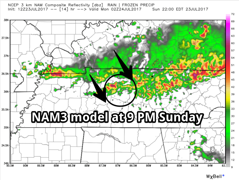
The NAM3 model predicts are more solid storm line and rain for everyone, arriving between 8 PM and 9 PM tonight:
Expect heavy rain and frequent lightning in any storms we see.
We will frequently update the forecast on Twitter @NashSevereWx, which you can also follow on this web page.
Not So Hot Week Ahead
Expect typical mid/late afternoon pop-up shower and thunderstorm chances, but nothing big is expected Monday through Wednesday. Rain is more likely Thursday and especially Friday (with a chance of strong storms) as a cold front approaches.
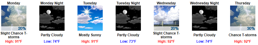
If that Friday front delivers, we should see below average temps next weekend.


Categories: Forecast Blogs (Legacy)
You must be logged in to post a comment.