
Afternoon Storm Chances Through Next Week
UPDATE: There are a few thunderstorms sagging southward towards Davidson County. Will these make it here? Time will tell. They are taking their sweet time. We’ll be following their progression, and post-sunset dissipation on Twitter @NashSevereWx.
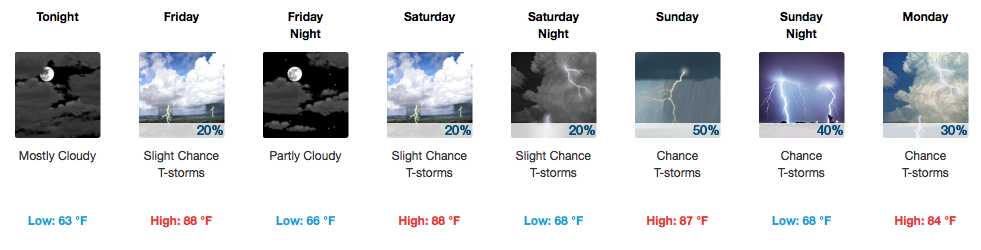
Small rain chances will exist each day into the weekend, particularly increasing in coverage on Sunday. These are afternoon thunderstorms that, by the heating of the day spark up, and then fall apart after dark.

By the time a frontal boundary sweeps through the area on Sunday, here’s how much the Weather Prediction Center thinks we’ll see in rainfall totals:
WPC Rainfall Totals Through Next Tuesday AM
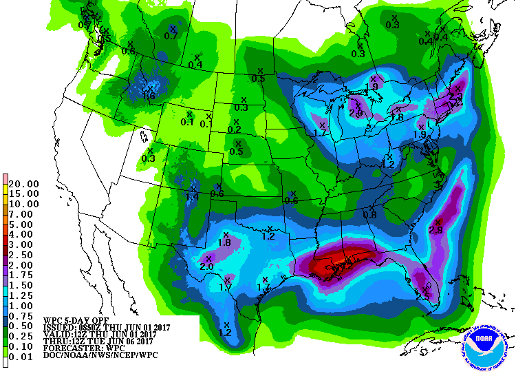
Not a whole lot of measurable rainfall!

After Sunday/Monday’s cold front finally clears the area, Tuesday into late next week look absolutely spectacular with highs in the 70s/low 80s…that’s an incredibly comfortable range for this time of year!
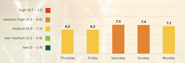
5-Day Pollen.com Forecast

Categories: Forecast Blogs (Legacy)
You must be logged in to post a comment.