
Current Radar
Rain, Maybe Storms, Tonight
A few hailers in W Tennessee were ongoing late this afternoon, streaking NNE into Kentucky, where a Severe Thunderstorm Watch is currently in effect.
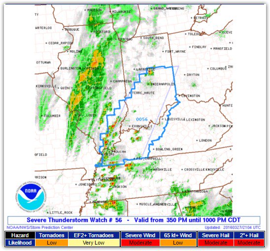
Although we are excluded from the Watch, some discrete storm cells were sitting to our SW, and should move into our area tonight in advance of an approaching cold front.
Hail and damaging winds are the main concerns inside any thunderstorm.
Here is how the HRRR model takes us through the night:

We aren’t really worried about it, but it’s possible that despite declining instability, we could get a few significant or severe storms. We are closely watching and will be live-tweeting @NashSevereWx tonight.
Cooler Monday & Tuesday
Wednesday – Friday: Wet, Stormy
Rain is expected sometime Wednesday. The GFS and Euro models are about 12 hours apart on the ETA, but both agree on a heavy rainfall event. Strong/Severe weather is difficult to determine considering the variance in models for Thursday. Through Friday, we may have seen as much as 2″ of rain, terrible news for outdoorsy stuff. Rain should end in time for Saturday, but the ground looks to be pretty wet.

This website supplements @NashSevereWx on Twitter, which you can find here.
Categories: Forecast Blogs (Legacy)