
Current Observations and Radar (trying something new, be sure to refresh yo’ browsa)


Monday 83° Rainy Start, Maybe Clearing
The rain showed up this morning, right on time.
When will it end? The HRRR model thinks the rain blob will expand west, before finally pulling east and shutting off the spigot around dark:

I’m not convinced the rain will expand that far west such that it’ll be raining until dark, but rain continuing into the afternoon is a good bet.
Thunderstorms are possible in the afternoon, but those are unlikely to be strong.
Tuesday 84° Rain Likely
With surface high pressure spinning clockwise to our east, warm and humid air will continue to stream into Middle Tennessee.
Meanwhile, a series of rain-making, but weak, upper level disturbances will arrive over top of this humid airmass, making and off and on rain likely all day Tuesday.
Wednesday 82° More Rain, With Strong/Severe Thunderstorms Possible
The same weather pattern will remain Wednesday.
The upper level energy responsible for Tuesday’s showers is expected to be even stronger, raising the possibility of strong, and maybe severe, thunderstorms.
The Storm Prediction Center reduced our probability of a severe weather event from 15% (yesterday) to 5%:
This is a low-end severe weather concern, with damaging winds the main threat.
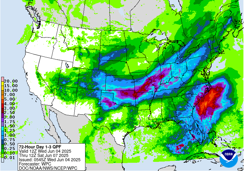
Rainfall totals through Thursday morning should be well over 1″, maybe even 2″:
Rainouts are pretty likely. The rest of the week looks pretty rainy as well.
This website supplements @NashSevereWx on Twitter, which you can find here.
Categories: Forecast Blogs (Legacy)