Tonight
Expect sunshine and scattered thunderstorms, which we will be watching for you on Twitter @NashSevereWx. One or two storm lines is expected tonight and during the overnight hours. Some storms could be strong.
The Storm Prediction Center issued a Severe Thunderstorm Watch for West Tennessee:

We are excluded from the Watch area.
Our NWS says a line of storms coming out of the Watch Box will be affecting western middle Tennessee between 8 PM – 2 AM. When will they arrive here? We’ve asked the models.
The models give us guidance on what to expect. Remember, models provide guidance, not gospel, about what may actually happen.
The best short range model we have is the HRRR. It likes storms to arrive into CMA Fest by 8 p.m. and stay for an hour or two. Hopefully, Vandy will have already beaten Louisville by then:

Overnight Tonight / Wee Hours of Monday Morning
The Hi-Res NAM model Sunday 5 PM – Monday 2 AM (one frame an hour) shows early Monday morning arriving storms (during the wee hours), long after the festivities at LP Field have ended. This model also suggests these storms will lose some punch as they approach our area.

The Canadian model (Sunday 1 PM – Monday 7 AM) agrees with the NWS — the main line of storms will form around 7 pm along the Mississippi River, move slowly east, and weaken along the way.

These storms may wake you up tonight as they push on through. Heavy rain, small hail, gusty winds, and lightning are all possible. We are not expecting tornadoes or any widespread severe weather.
Monday – High 86; Slight Risk of Severe Weather
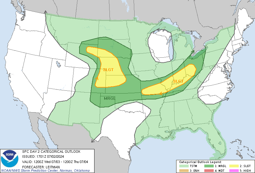
The Storm Prediction Center has included us in a “Slight Risk” of severe weather for tomorrow. “Slight Risk” is often misunderstood. “Elevated” is probably a better word.

Tornadoes are NOT expected tomorrow. The main threat will be damaging winds and hail. Timing of the storms tomorrow is uncertain, but the afternoon and early evening hours is the most likely time. It appears any severe storms will be individual cells instead of a classic line.
Tuesday – High 90
The rain departs. Sunshine returns, and so does the heat! Even the overnight hours won’t cool off much, with lows only in the 70s.
Categories: Forecast Blogs (Legacy)
