Tonight – 72 at 10 p.m.
No chance of rain.
Sunday – High 84
Our National Weather Service wrote the following (in blue) to emergency management personnel and other CMA Music Festival organizers:
Morning & Afternoon


The WRF model agrees with an on/after midnight Sunday ETA:

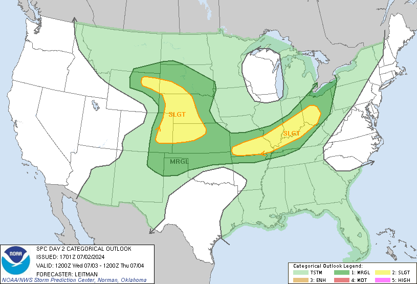
The Storm Prediction Center updated their Day 2 Slight Risk area to include parts of Middle Tennessee, but not metro Nashville, due to this potential. The updated SPC graphic is attached.

We will update this in the morning when the SPC updates its outlook and we get in range of the short term models (such as the beloved HRRR).
Monday – High 85
Rain is likely Monday morning, and may continue off & on the rest of the day.
Tuesday – High 91
Rain departs, but the heat will build into the 90s. Wednesday’s high is 93. Thursday we’ll hit 90, and again confront the chance of storms (some may be strong).
In-storm updates can be found on Twitter @NashSevereWx.
Categories: Forecast Blogs (Legacy)
