A quick shower will be possible over the next hour or two, but the majority of the day should end up dry.
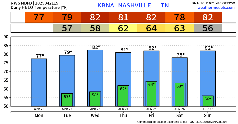
Tuesday should be dry, along with the majority of Wednesday – but a shower or two isn’t totally out of the question.

A quick shower will be possible over the next hour or two, but the majority of the day should end up dry.
Tuesday should be dry, along with the majority of Wednesday – but a shower or two isn’t totally out of the question.
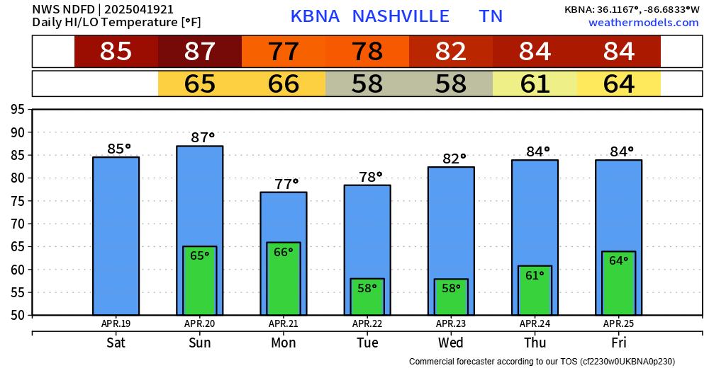
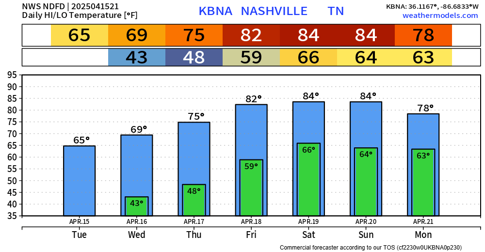
Great weather on this Easter Sunday. High temps will creep up into the mid 80s over the next few hours. Chocolate may melt a bit in eggs if not found quickly.

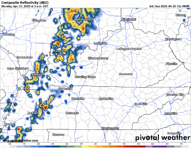
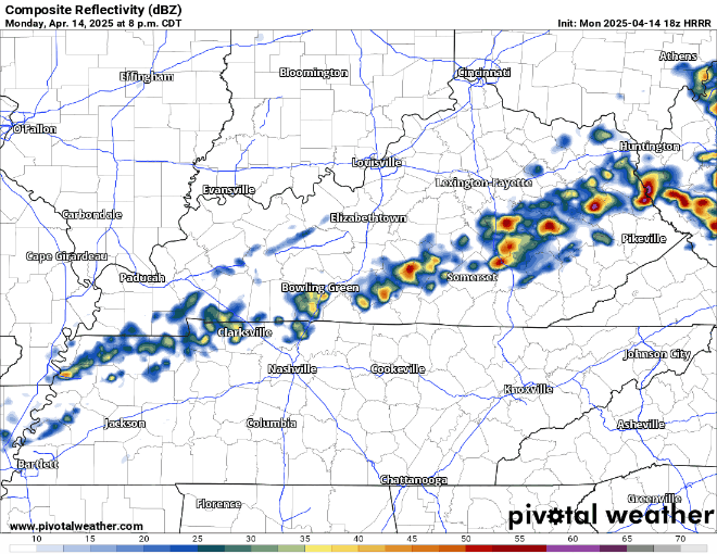
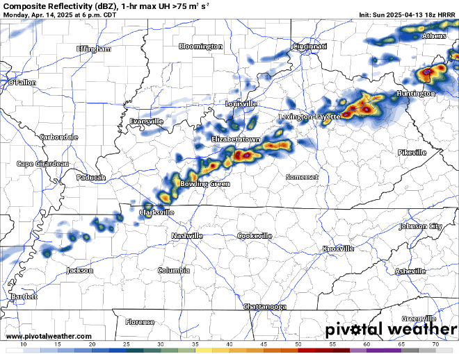
Rain chances return to the forecast starting Monday morning. No severe weather – maybe a rumble of thunder or two. Rain should exit by Monday afternoon, HRRR guesses below:
High temps only made it to the low 80s today due to some high-level clouds.
Tomorrow on Easter we’ll have another chance to make it up into the mid 80s. Our record high for April 20th is 87° – so at least a tie of the daily record high seems like a good bet.

Winds have died down a bit, but some additional gusty winds are possible thru this evening.
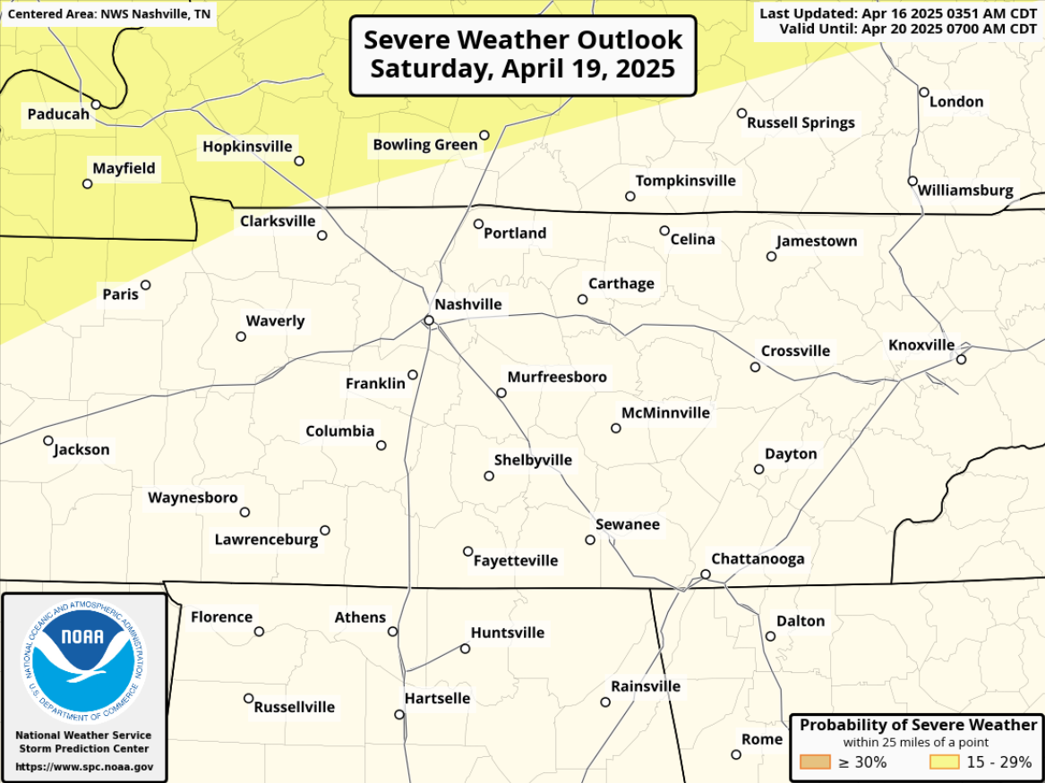
Saturday weather looks great. Dry with highs in the mid 80s – about 10° above average for this time of year.

Models have finally come to a general consensus that we will see some nice weather this weekend.
Those possible showers this afternoon? Not expected to happen anymore.
Dry Friday – although winds could gust up to 30mph from the south during the afternoon.
This is all the latest thinking – but weather changes. Stay connected for any updates to the forecast!
Thursday and Friday both warm and mostly dry. The only exception could be a few quick showers Thursday afternoon/evening, but these would be NBD. I don’t see these affecting any outdoor plans.
Now thru Friday, we j chillin.
We could see a few light showers Thursday, but those look to be few and far between.
Temps slowly increasing throughout the week, getting to borderline hot by Friday and staying there for the weekend.
ETA of our expected showers continues to get pushed back little by little.
Still not expecting any severe storms but still can’t totally rule out a strong storm or two. Gusty winds, lightning, pea size hail the possibility in the strongest of storms – most of us won’t see that though.
Winds could be a little gusty Monday afternoon, up to 25 mph.
Also, some showers and storms look possible Monday PM, probably closer towards the evening/night. Ball practices may be OK.
Currently not expecting any severe weather, but some rumbles of thunder not out of the question.
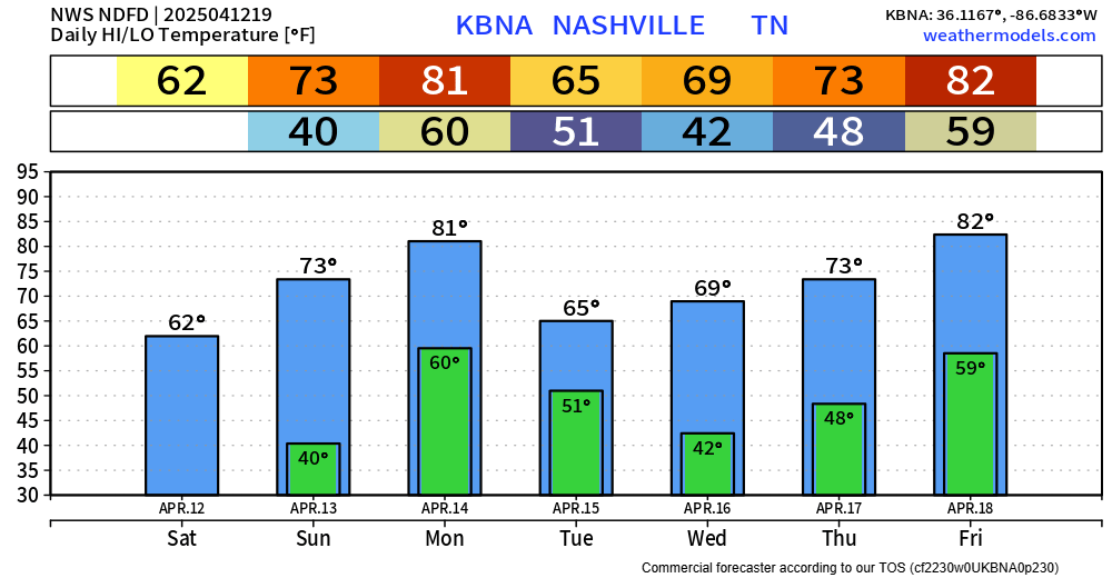
A few may see frost early Sunday morning.
Winds a bit gusty Sunday and Monday afternoons. Gusts mid 20 MPHs.
Rain possible late Monday night into Tuesday. Hi res models are out of range. Overall setup looks weak. “I’d be surprised to see a quarter of an inch of precipitation out of it,” said NWS Nashville.
You must be logged in to post a comment.