
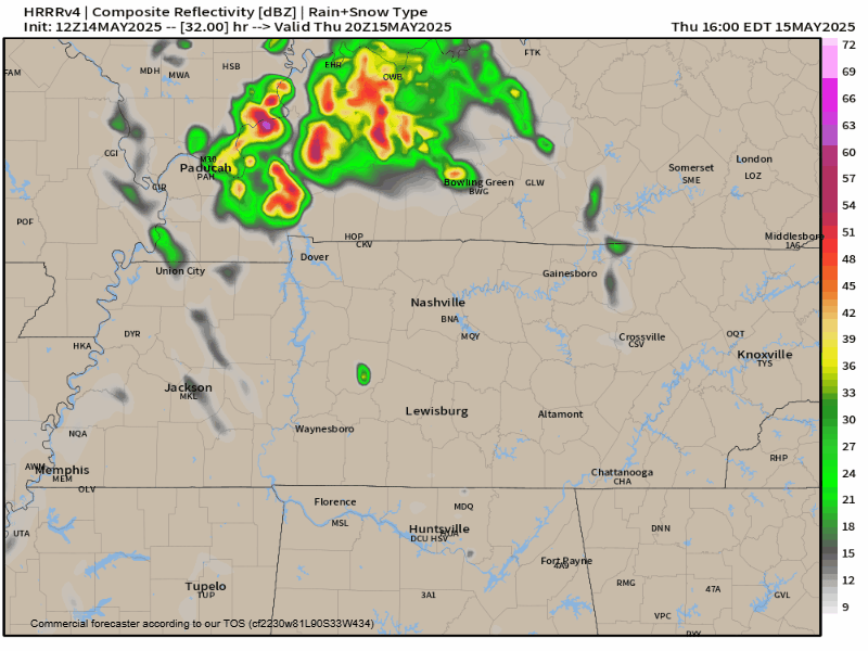
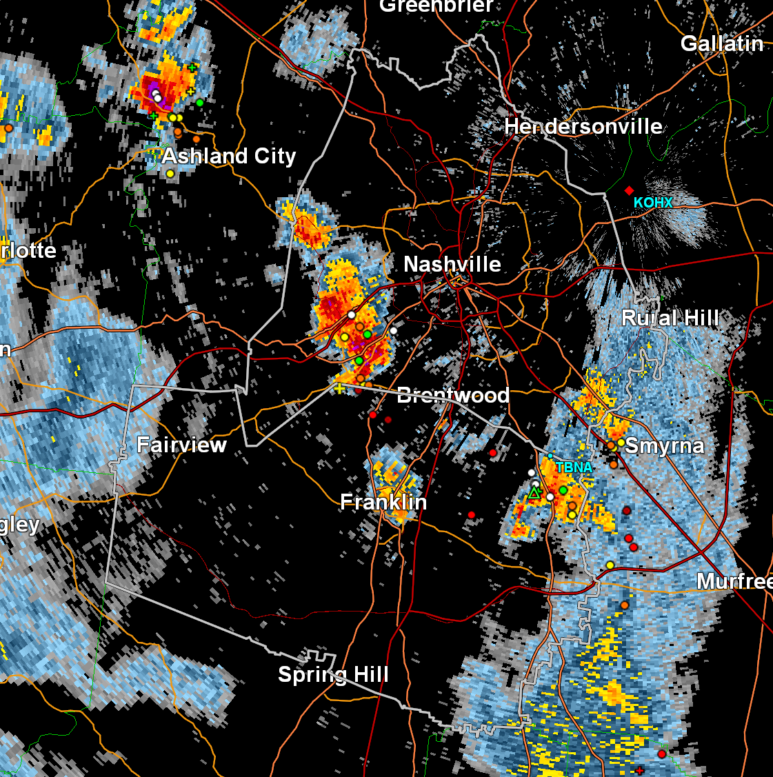
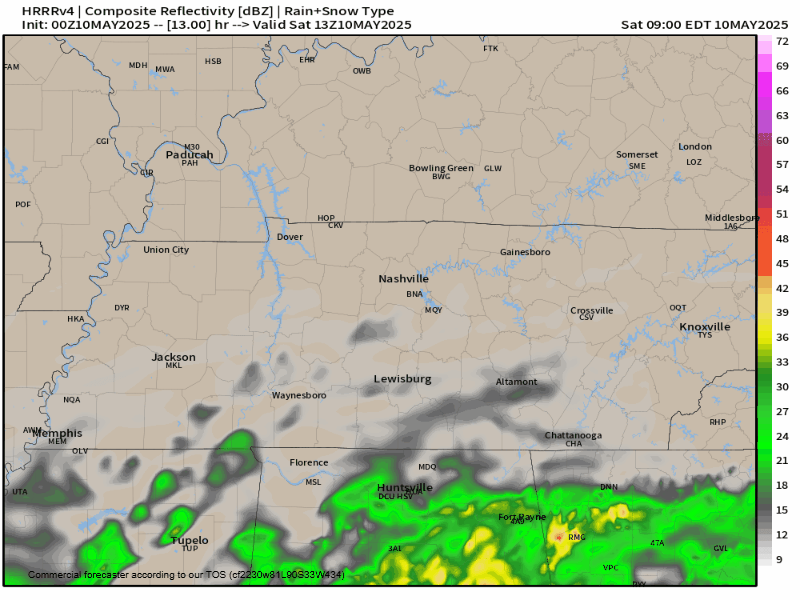
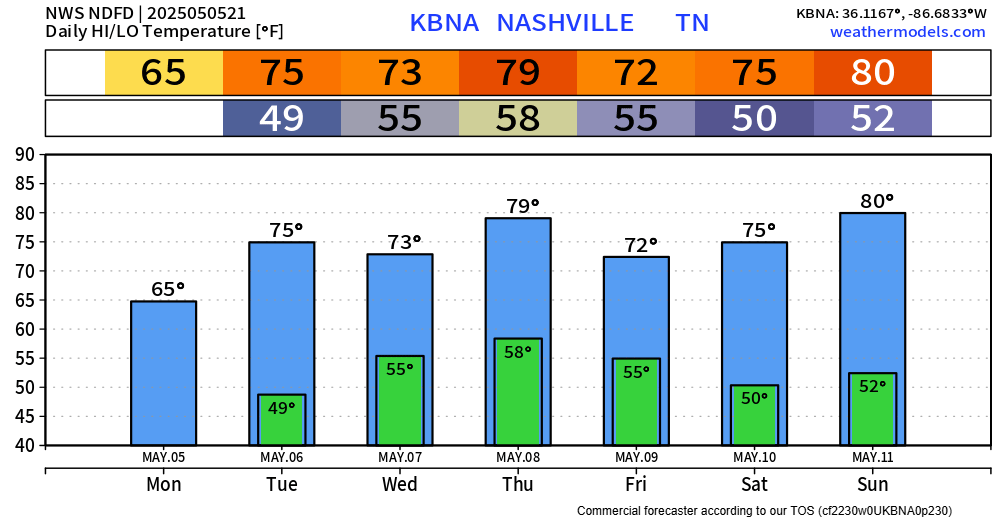
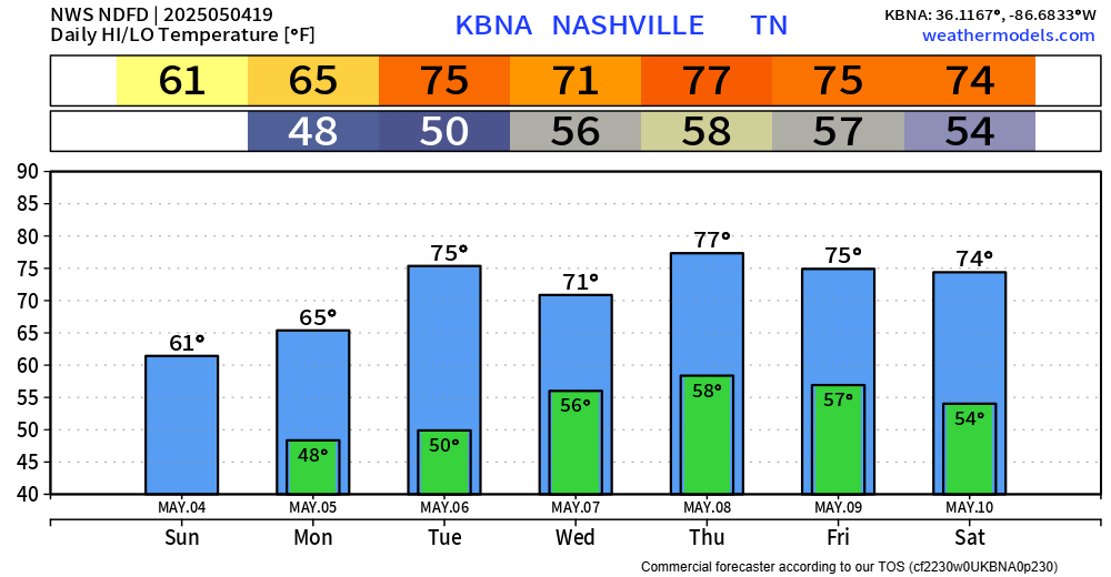
A storm may pop this afternoon but the HRRR is clear. Storms more likely east of us. Small hail and gusty winds the potential hazards. We are not severe outlooked.
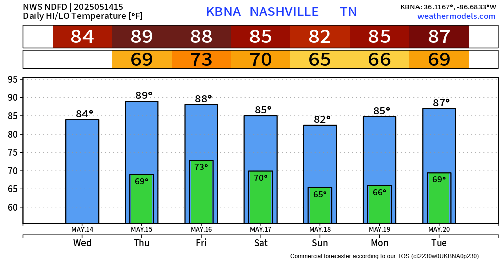
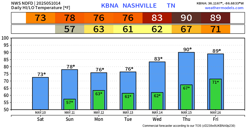
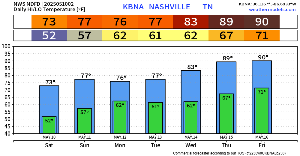
- Heat and Humidity Thu-Fri. Temps near 90 with dewpoints mid to upper 60s. Summer peeking out of the gopher hole.
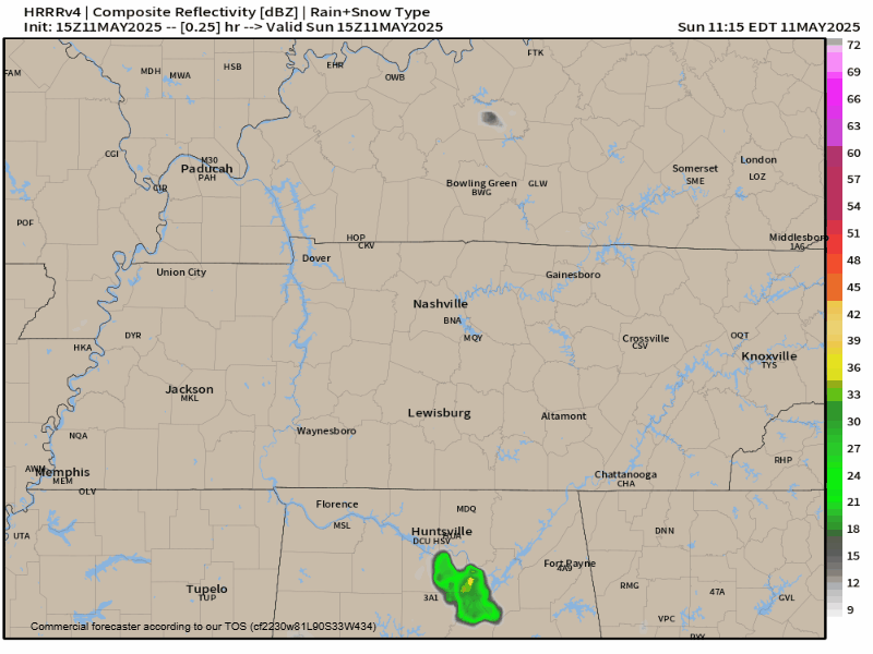
2. HRRR has storms Thu PM rush hour. May go north, maybe not. We’ll watch this. No severe expected here. Lightning, heavy rain instead.
You must be logged in to post a comment.