
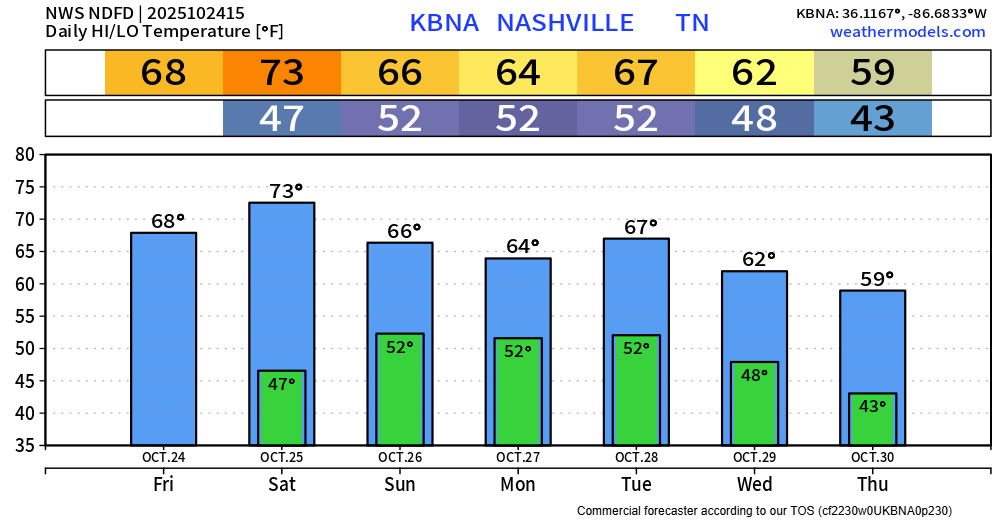
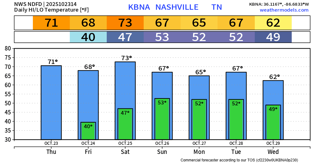
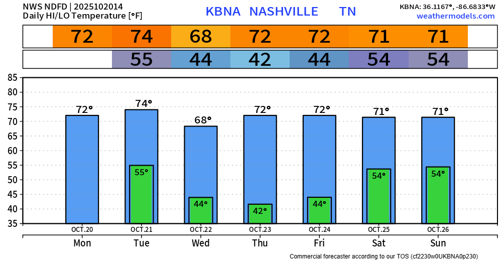
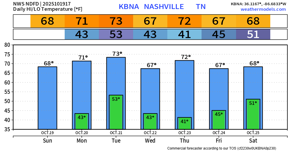
Can’t rule out some occasional drizzle during the day today, but most of the day should be dry. It’ll stay pretty gloomy with cloud cover hanging on throughout the day.
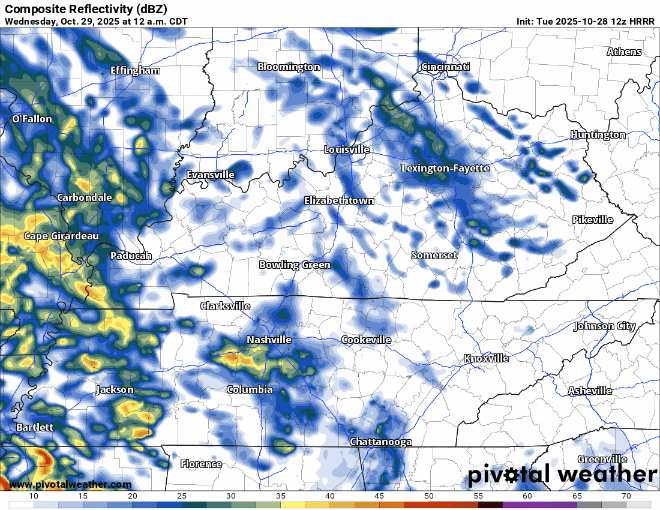
Rain returns late tonight. Light to moderate showers will be on/off throughout the entirety of Wednesday, mostly on. HRRR model gives a guess on what the radar could look like below.


You must be logged in to post a comment.