
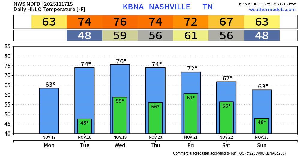
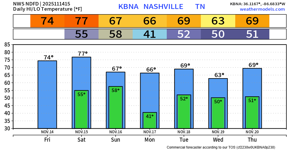
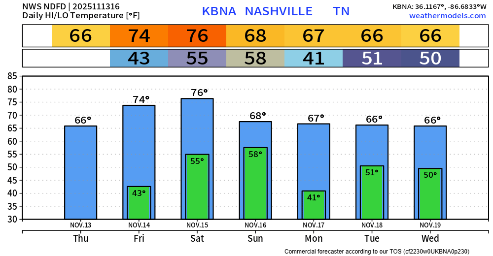
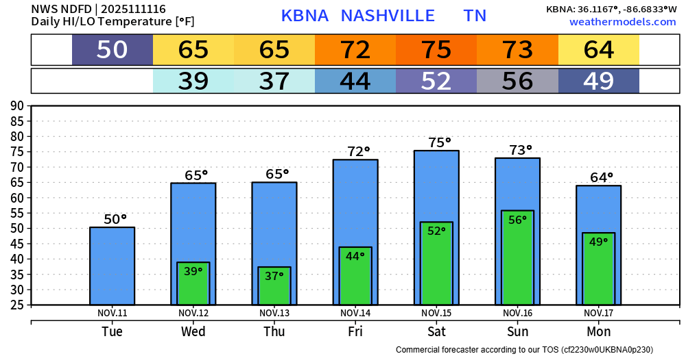
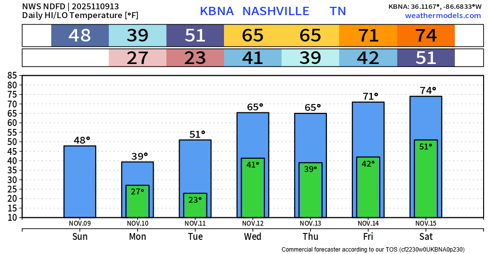
Our rain/storm chances are returning today, although we aren’t guaranteed rain.
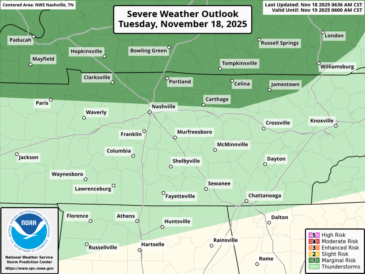
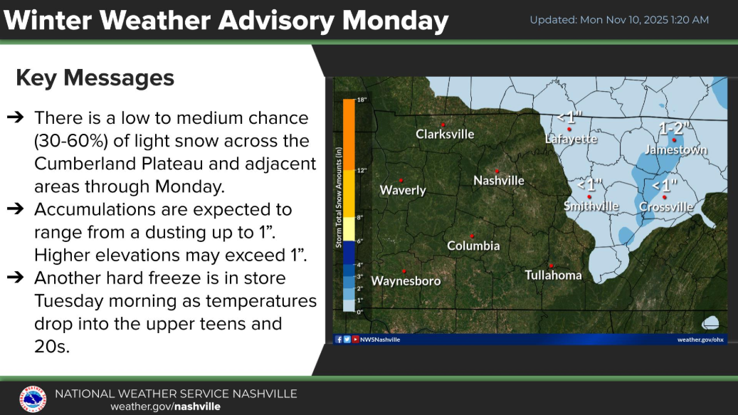
To address the elephant in the room first, the Storm Prediction Center has outlooked most of Davidson Co. and far NW WillCo. with a 5% chance of damaging straight-line and hail, as well as a 2% chance of a tornado – all within 25 miles.

You must be logged in to post a comment.