
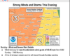
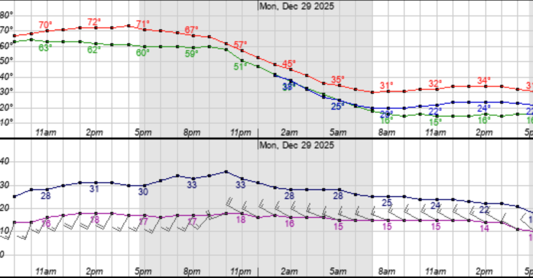
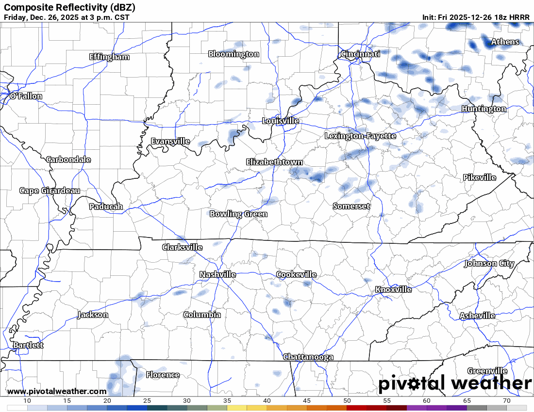
A strong storm system moving across the Plains today will push a cold front through middle Tennessee tonight, bringing the risk of severe weather to Davidson and Williamson counties. The Storm Prediction Center has placed much of the area in an Enhanced Risk, which means scattered severe storms are expected and a few could be intense. The main story tonight is damaging winds and a secondary risk for tornadoes. We’re watching for CAPE to build as the line approaches which could make storms more intense. We’re also watching for dry air near the surface to pull stonger elevated winds down to the surface. Today is a day to stay weather aware and make sure your family has a plan to shelter in the even of a tornado warning. Let’s dive into the details.
You must be logged in to post a comment.