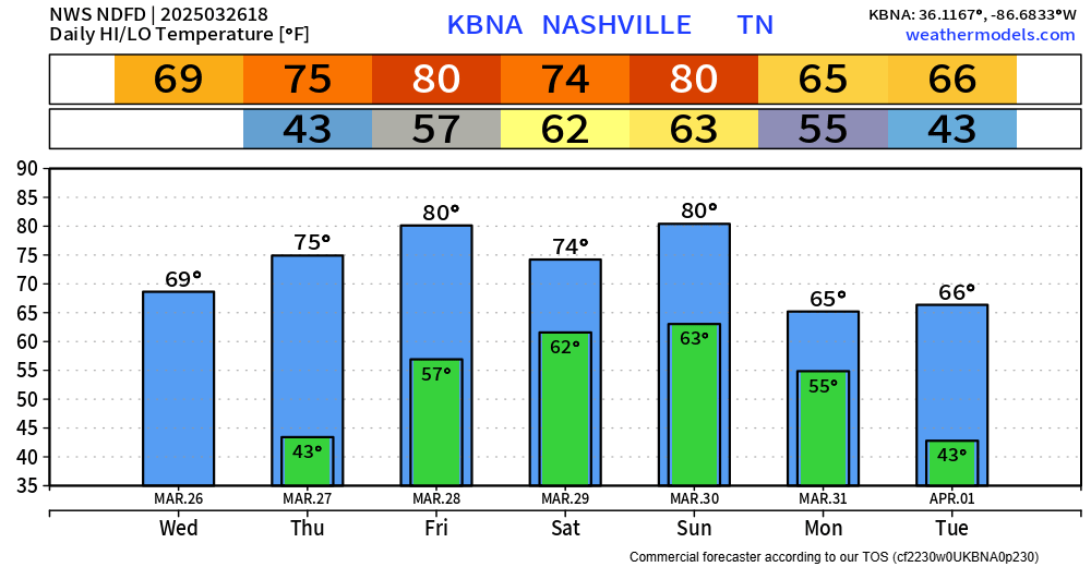
Friday gives us one last day of nice weather until our relatively active weekend. Some of us may reach 80°.
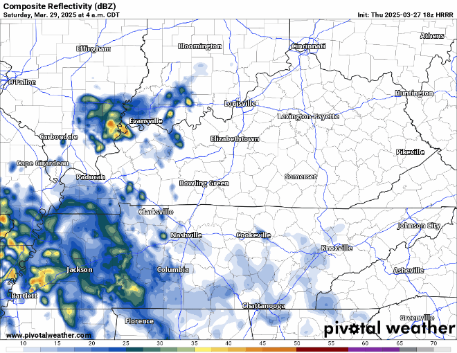
Saturday looks rainy at times, especially the second half of the day. No severe weather expected.

Friday gives us one last day of nice weather until our relatively active weekend. Some of us may reach 80°.
Saturday looks rainy at times, especially the second half of the day. No severe weather expected.
Besides the low chance (~10-15%) of a quick shower Thursday and/or Friday afternoon, we have a dry + warm remainder of the work week.
Turning our attention to the weekend – not to be mistaken for The Weeknd.
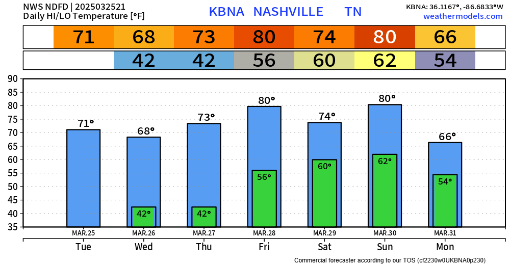
Besides maybe a quick shower Thursday afternoon (although these chances are low, ~15%), the rest of the work week does indeed look dry. Warm temps as well.
And like clockwork, our rain chances go up as soon as the weekend comes.
Work week looks great weather-wise.
Temps near norm to slightly above norm, no rain chances.

Saturday currently has some low (~30%) rain chances but not expecting severe storms. Too far out to know if your outdoor plans will be affected.
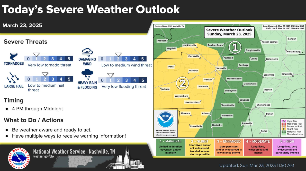

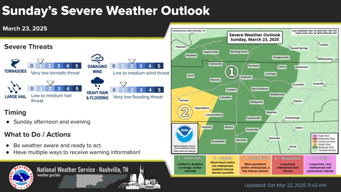
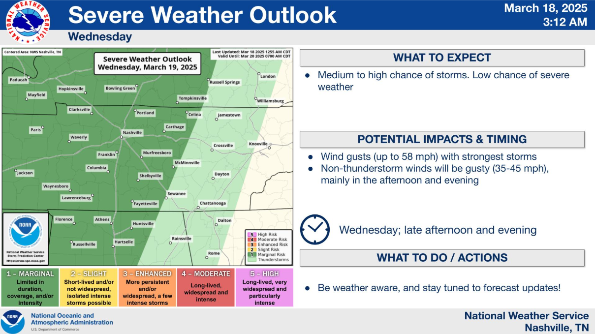
We are still outlooked by the Storm Prediction Center with the following probabilities within 25 miles:
Rainfall totals only around 1″, so no flooding issues expected.
Timing:
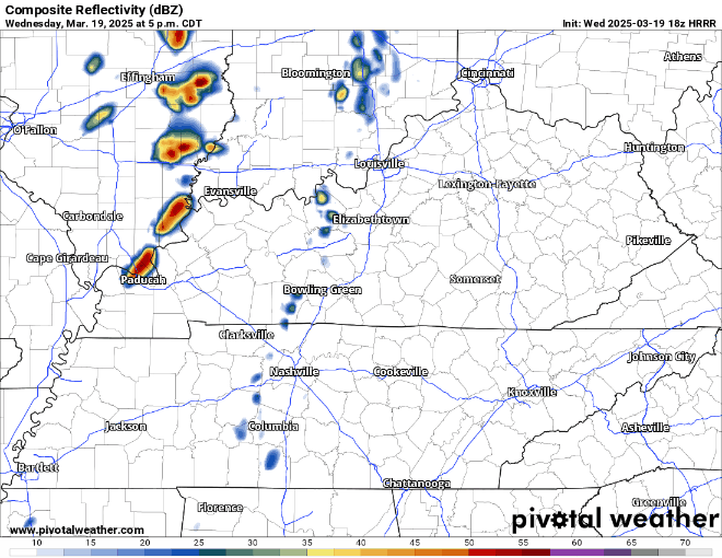
Latest HRRR model thinks majority of the activity will be during the 6-8p timeframe. This could be off by an hour or so.
Any outdoor plans now thru midday Sunday look great. Warm temps + dry.
While storms are likely Sunday evening, most of them are expected to stay behaved. But a few may be worth keeping an eye on.

The Storm Prediction Center has our counties outlooked with a:

Very nice Saturday ahead. Dry + highs in the mid 60s.
While storms are likely Sunday, the severity of said storms are in question.
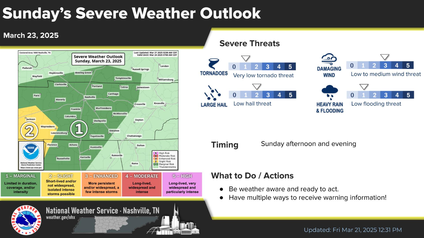
Timing wise, our main focus is Sunday afternoon and evening.
The main concern would be damaging straight-line winds and hail, but even this threat looks quite low at the moment. The tornado threat looks non-zero, but very, very low.
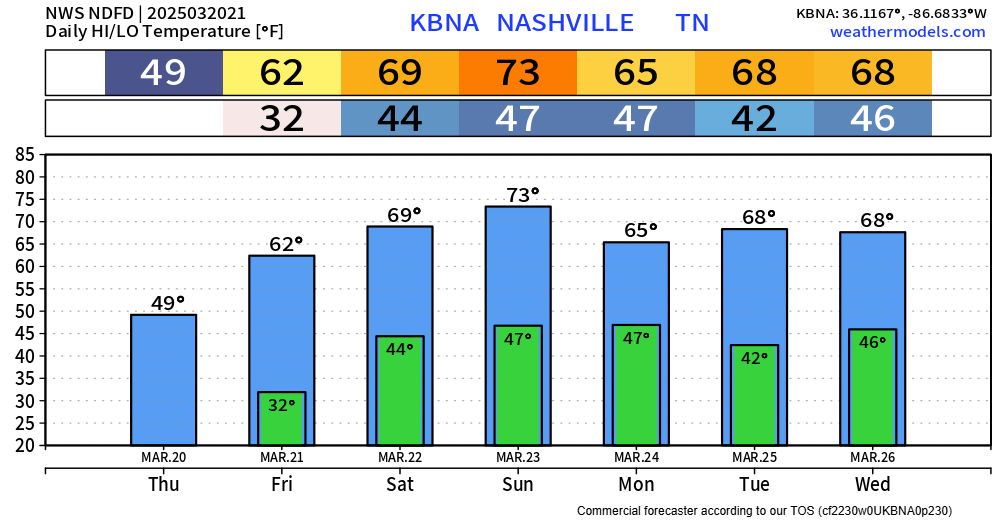
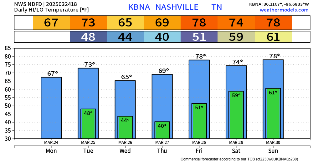
It’s quite fitting for the first ‘official’ day of Spring to be cold, cloudy, and some of us even saw some sleet/graupel.
Most, if not all, of us will get down to freezing tonight – cover up any loved plants!
Until 10p tonight we will have a Wind Advisory for wind gusts up to 45 mph possible. With winds coming out of the south, travel on W-E roads (like I-40 and 840) may be difficult, especially for high-profile vehicles. Winds should relax tonight.
Another seasonally warm day is on tap for Wednesday – highs getting all the way up into the mid 70s – roughly 15° above average.
Part of the reason for the warm temps will be strong southerly winds, gusting up to 45 mph. This is the reason for our Wind Advisory valid tomorrow (Wednesday) from 10a to 10p. With the winds coming out of the south, travel on W-E oriented roads (such as I-40, 840) may be difficult for high-profile vehicles. Secure any outdoor furniture and bring in trash cans.
You must be logged in to post a comment.