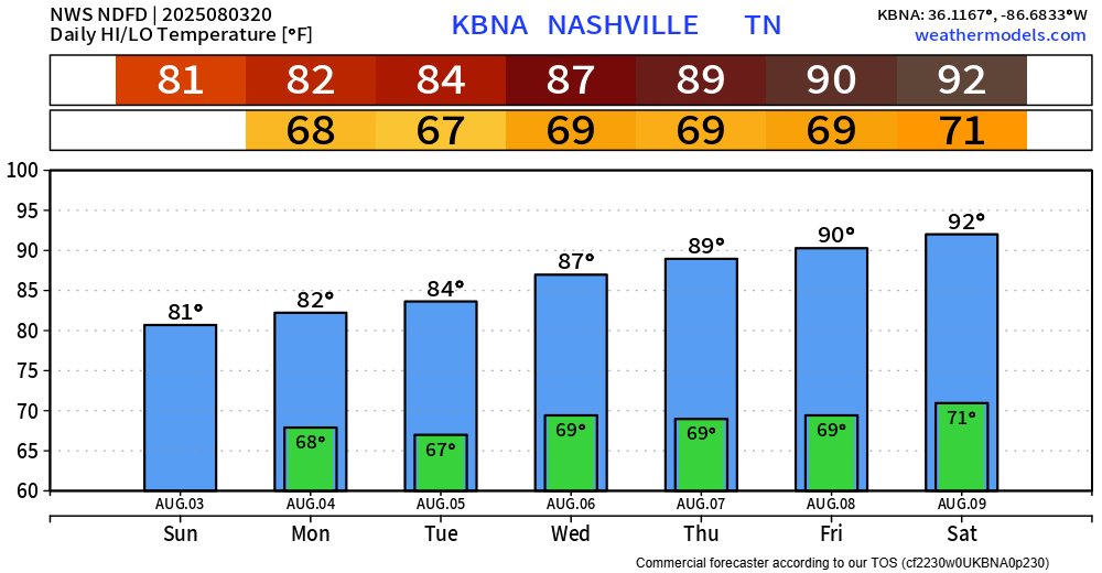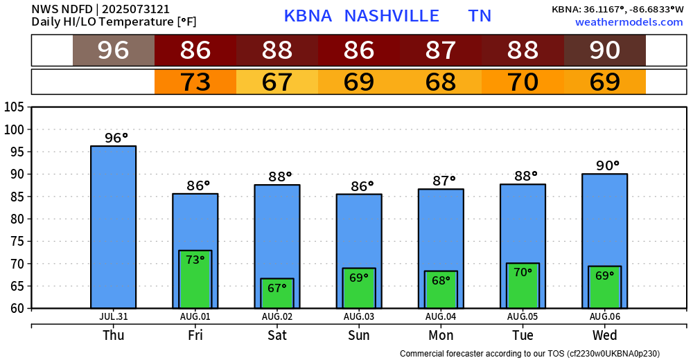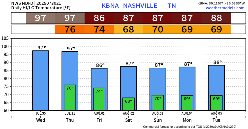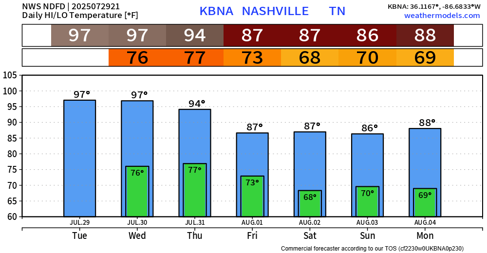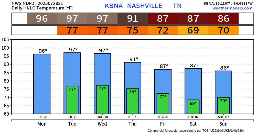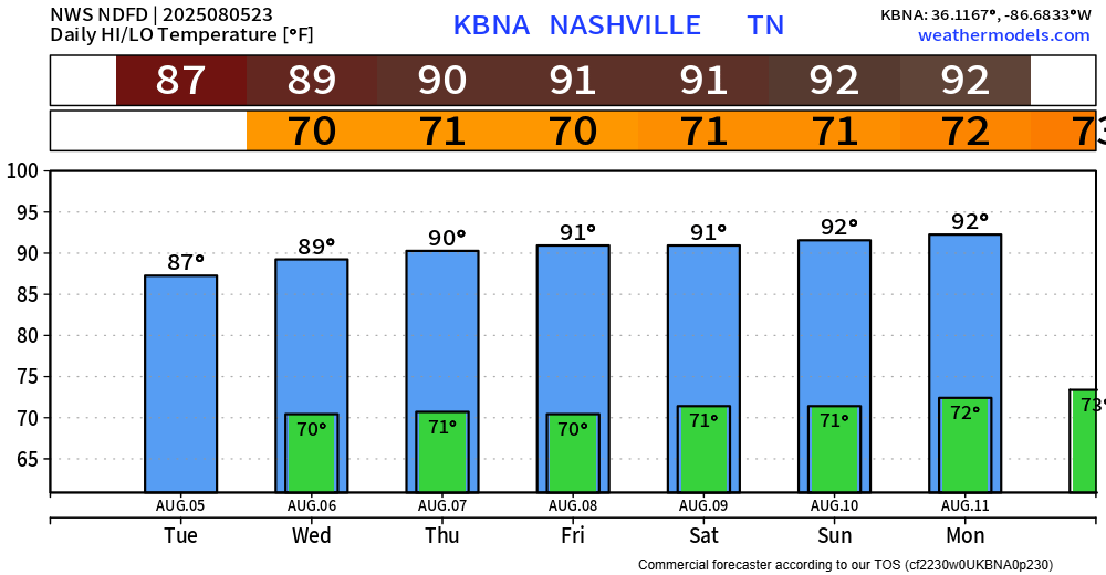
BNA reached 89° today – exactly on average for August 5th.
Temperatures won’t stray too far away from that number this week, but they’ll slowlyyy climb up into the low 90s.
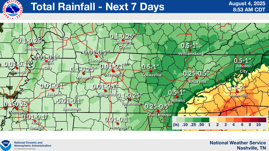
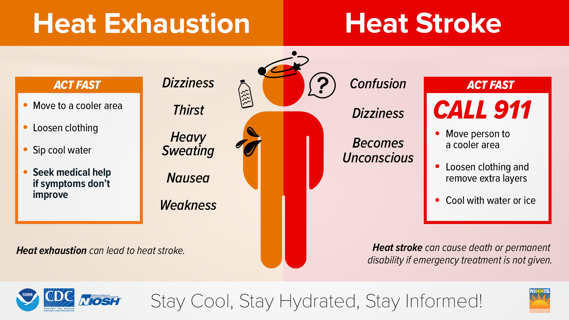
Dewpoints will also climb up a tad throughout the week, reaching the upper 60s (compared to the low 60s we had today). All of these things will cause heat index values to creep up near 100° by this weekend. Thankfully, nothing like we saw last week – but hot regardless.