
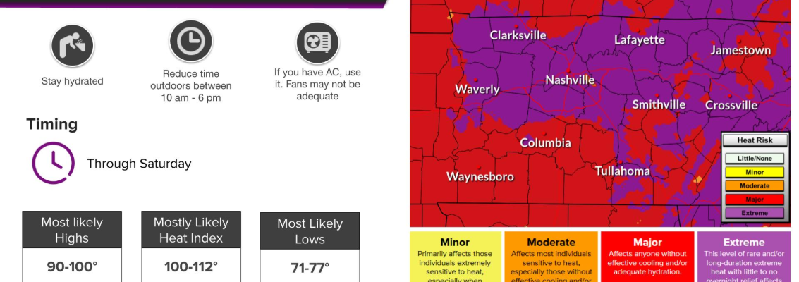
We have one more day of our Extreme Heat Warning, that expires at 8p today. Although the heat doesn’t just totally disappear after today.
Heat index values will climb to near 110° this afternoon, as actual air temperatures make another run for the triple digits. We did hit 100° yesterday, marking the first time since August 19th, 2025.
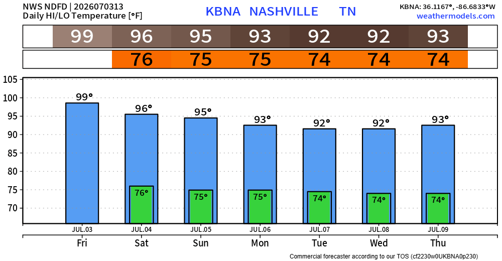
Temperatures will back off ever so slightly, with temperatures in the mid 90s and heat index values closer to 105° for Saturday and Sunday.
What’s the difference between feeling like 105° v. 110°? Not much. Continue to take precautions as you are outdoors, including plans on the 4th. Take frequent breaks, stay hydrated, and check in on those who are without adequate A/C.
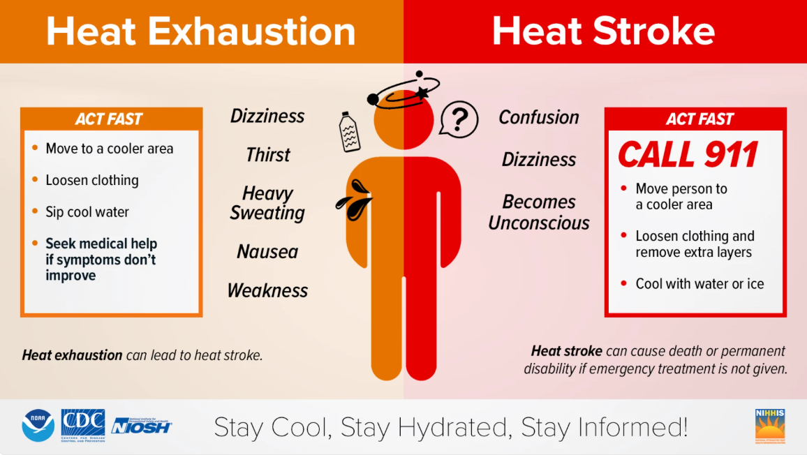
Know the signs of heat illness and what actions to take. And always look before you lock, never leave pets or children in a vehicle.
We have our continued chances of afternoon/early evening popup showers and storms (the Wattery) today into at least early next week.
Today (Friday) we have a 5% chance of damaging straight-line winds within 25 miles.
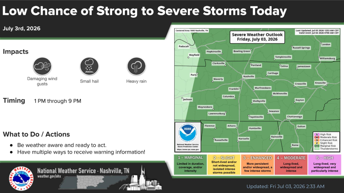
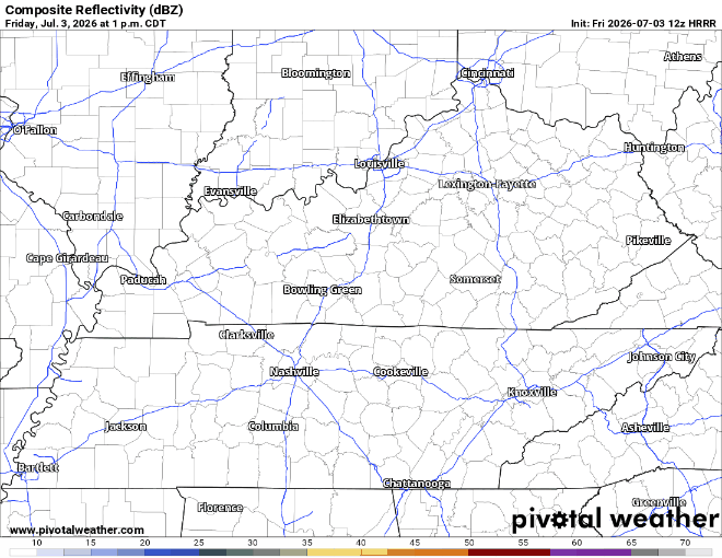
The latest HRRR model shows decent storm coverage across the area later today, although models are guidance, not gospel.
With any storm, heavy rain and lightning will also be a possibility on top of the gusty winds. Those with outdoor plans should keep an eye on the radar and know where to head indoors to let it pass. We have a radar on our website you can use anytime: Radar – Nashville Severe Weather
Looking specifically at the 4th, a similar set up exists. Isolated to scattered storms begin in the afternoon and begin to die down by the evening. Models think it will be a pretty close call of whether or not we are completely dry by firework time. My gut tells me we’ll be good – because America.

The good news is that nothing looks like a complete washout. If you do happen to get a storm, it’ll blow over eventually. Remain flexible with outdoor plans (including those getting out on the water) and know where to go indoors if thunder roars. We’ll keep an eye on things.
Categories: Featured Blog