
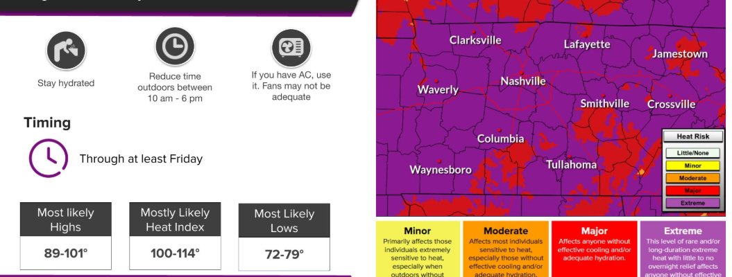
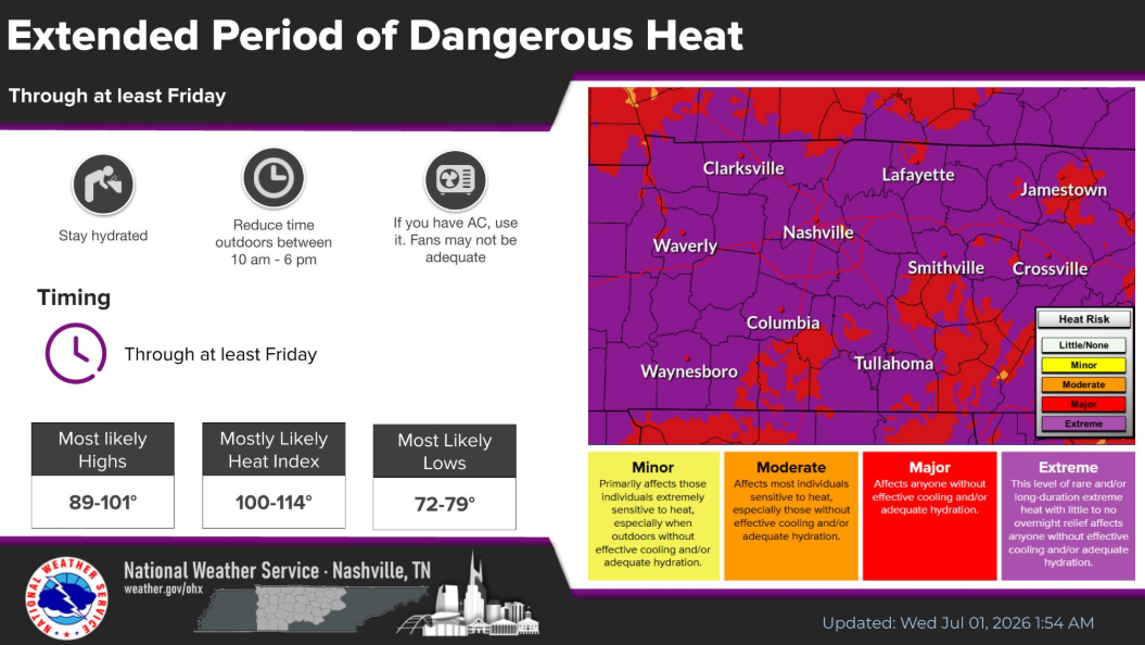
Another day still under our Extreme Heat Warning, which continues thru 8p Friday.
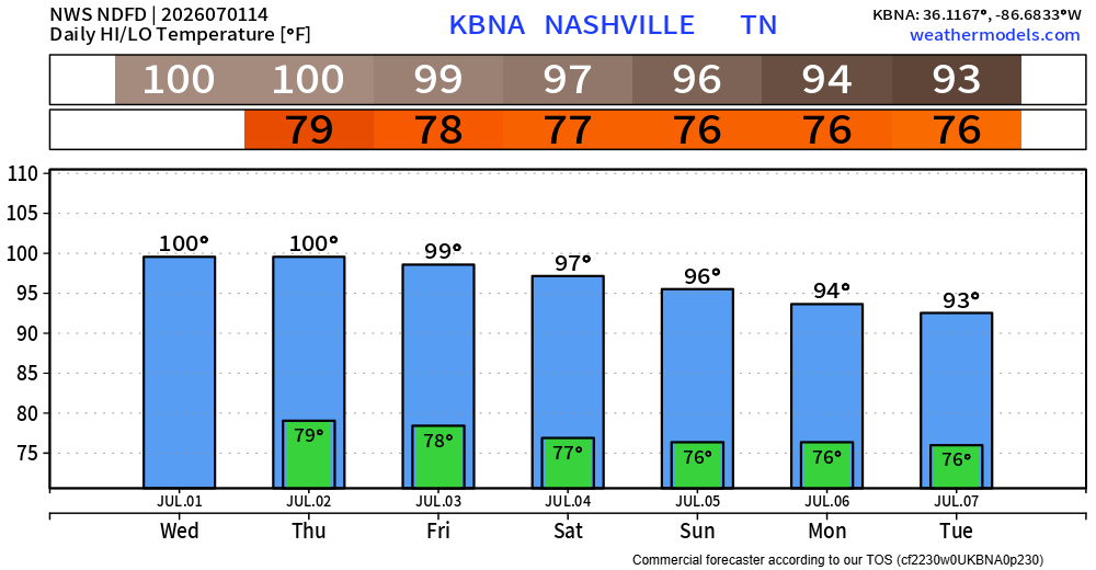
Actual air temperatures will peak in the upper 90s, nearing 100°. Dewpoints will be in the low to mid 70s, causing heat index values to be in the 105-110°+ range.
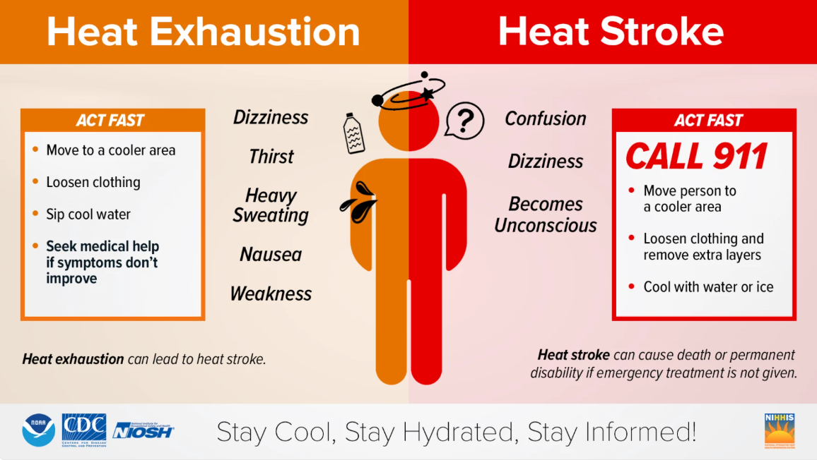
Heat-related illnesses can set in quickly under conditions like this, no matter who you are. If you have to be outdoors for long periods of time, please stay hydrated and take frequent breaks. Check in on those who may not have adequate A/C.
Know the signs of heat-related illnesses and what to do if you or someone else is experiencing them.
And always, look before you lock. Never leave kids or pets inside a vehicle, no matter how quick you are “just running inside.”
Instead of the upper 90s, we ease into the mid 90s by Saturday and onwards into early next week. Heat index values will still easily reach into the 100s. Don’t forget about H20 while you are celebrating the 250th. Being near a body of water or being able to duck into some A/C will be crucial.
Wattery (water + lottery chances) return in some fashion today. The majority of us will likely stay dry, with only a few storms being able to form this afternoon/early evening. With any storm, heavy rain, lightning and gusty winds will be possible.
Essentially a copy + paste for Thursday onwards. Scattered showers/storms possible in the afternoon/early evening. Can’t totally rule out a strong storm or two with damaging straight-line winds. No complete washouts are expected.
And yes, this does include Saturday. Unfortunately, it’s impossible to know exactly when, where or if a storm forms over your activities. Those with outdoor plans should remain flexible and also know where to go indoors if a storm does come by. Coverage should decrease around dinner, leaving firework plans dry (fingers crossed).
As always, we’ll keep an eye on things and keep y’all posted with any updates.
Categories: Featured Blog