
Our Extreme Heat Warning continues until 8p on Thursday. I could see it getting extended thru Friday.
Today thru Thursday (and probably Friday) will be the hottest days we’ve seen in some time.
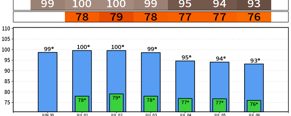
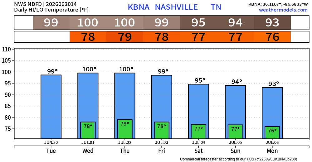
Actual air temperatures near 100°, with dewpoints in the low 70s will get heat index values near 110°. Overnight lows will only be in the upper 70s, which will give us very little relief. BTW, if we do hit 100° – it will be the first time since August 19th, 2025.
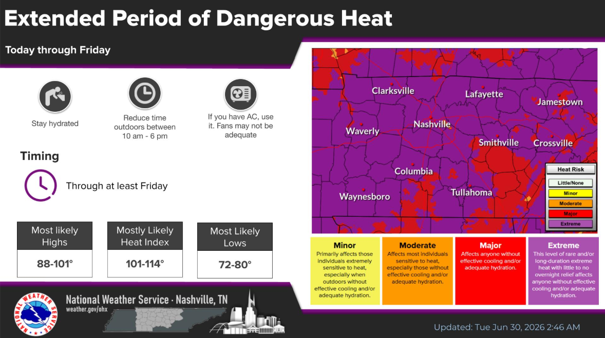
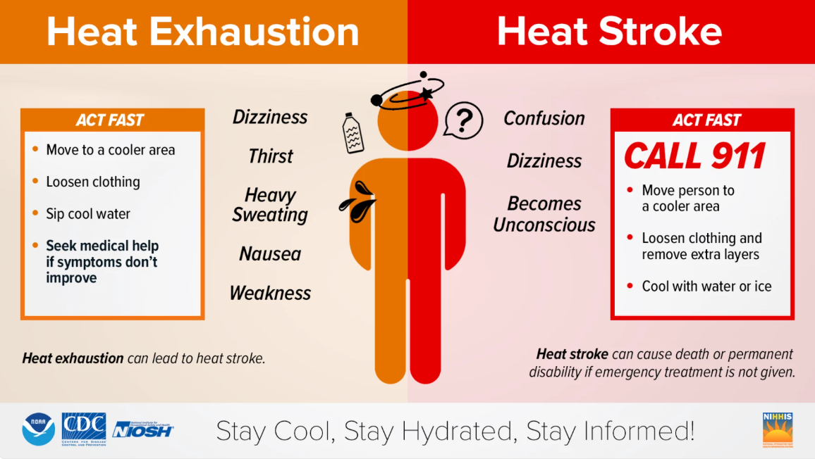
If you have to be outdoors for long periods of time, be sure to stay hydrated and take frequent breaks. This kind of heat can creep up on anyone quickly, no matter how in shape you think you are. Know the signs of heat exhaustion and heat stroke – and know what to do.
And always, look before you lock. Never leave kids or pets inside a vehicle, no matter how quick you are “just running inside.”
Temperatures will turn down a half notch by the 4th. It will still feel like you are wearing the air though. Good time to be near a body of water.
Our classic Wattery (water + lottery) chances return by Thursday and continue into early next week. This will be the typical, popup storms possible in the afternoon and early evening. Coverage will be fairly isolated, so some will stay dry while some might get a decent storm.
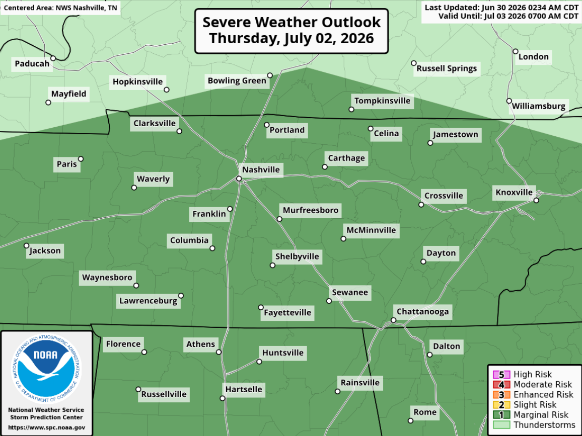
While most storms will likely stay below severe limits, it’s not impossible for a storm to reach severe criteria. Specifically looking at Thursday, we are outlooked with a 5% chance of severe weather within 25 miles. The Storm Prediction Center notes this is for the possibility of damaging straight-line winds with a strong storm.
With any storm, including on the 4th, lightning will be a possibility. Regardless of where you are, know where to go indoors to ride out a storm.
No single day looks like a total washout, including Saturday. Any popups look to diminish closer to dinner. As of right now, your firework plans appear to be dry. We’ll keep an eye on this.

Categories: Featured Blog