
A little more uncertainty than usual regarding today’s forecast – which is never fun.

Yesterday, multiple high-res models agreed that we would see multiple waves of storms throughout the day, even starting as early as this morning. This is no longer the case.
Models have trended things to our north and east. Does this mean that it’s correct? Definitely not. They were dead wrong yesterday.
Current thoughts:
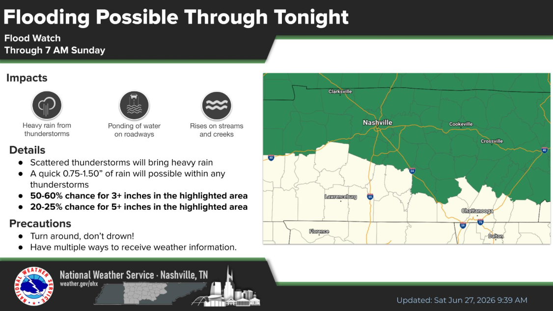
1) We still have a Flood Watch thru 7a Sunday. Models have trended the heaviest rain towards the Plateau, but no reason to let our guard down – especially if you live in a low-lying/flood prone area.
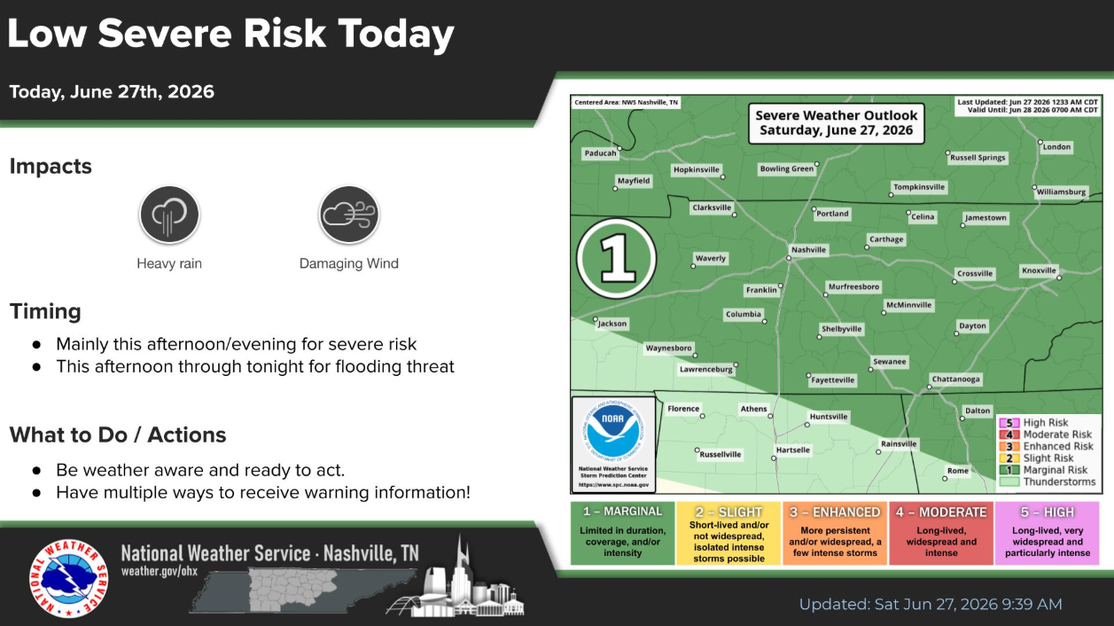
2) Storm Prediction Center still has us outlooked with a 5% chance of damaging straight-line winds and a 2% chance of a tornado – within 25 miles. This is a very low concern at this point, with the flash flood potential being the main threat.
3) If we were to see showers/storms today, it is more likely this evening/overnight. While some popups cannot be ruled out this afternoon, it appears that our highest chances exist later.
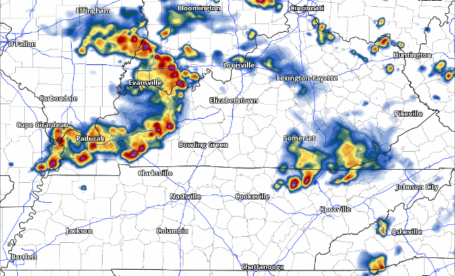
Here’s the latest HRRR model, take it with a grain of salt:
Models usually struggle, but they especially struggle with these summertime set ups. Today will be one of those days where we lean on observations and trends.
Those with outdoor plans today should stay connected and remain flexible. Have a place to go indoors if a storm is headed your way. Those going to AJ’s should mentally prepare for the possibility of a lightning delay. As always, we’ll be posting updates on all of our socials all day as needed.
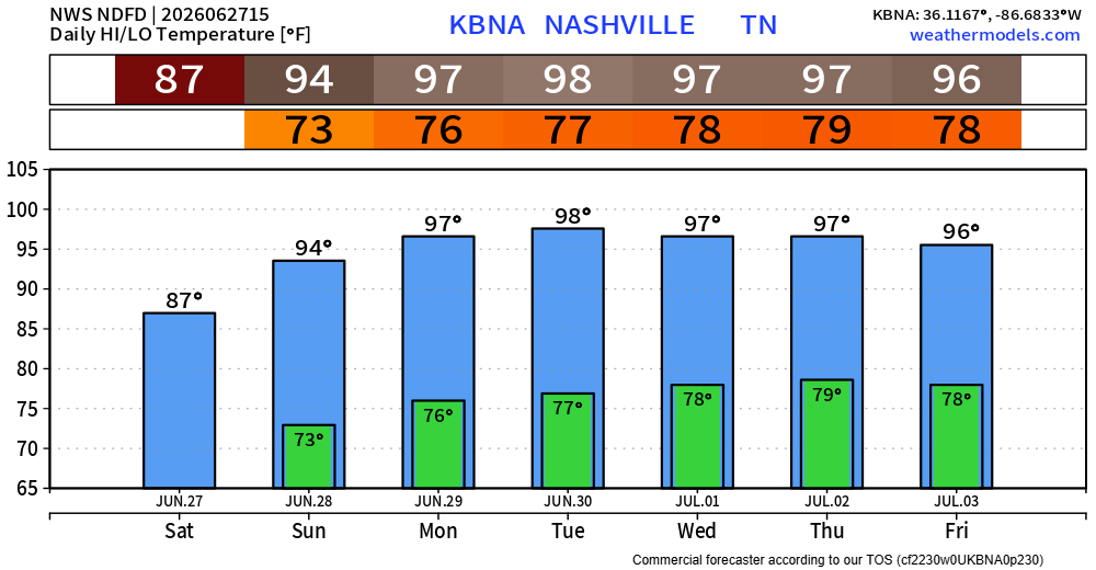
Besides a few possible lingering showers in the morning, Sunday will be dry. No additional rain chances thru the middle of next week.
Sunday also begins our stretch of very hot weather. High temps in the mid to upper 90s, with heat index values nearing 105° each afternoon. Not very enjoyable outdoors. Take it easy if you have to be outdoors for long periods of time.
Categories: Featured Blog