
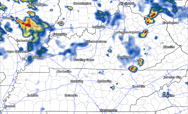
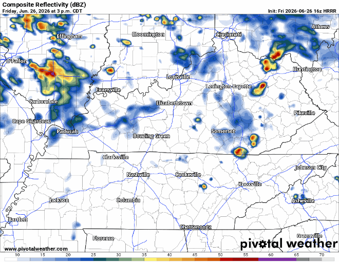
Recent model runs have backed off on our storm chances this afternoon and evening, although chances certainly are not zero, especially with this clearing we are seeing.
With any popup storm this afternoon, we can’t totally rule out a strong storm or two with some damaging straight-line winds. The Storm Prediction Center continues to have us outlooked with a 5% chance of damaging straight-line winds within 25 miles.
The latest HRRR model thinks we do a good job of dodging any storms for the remainder of the day. It could also be wrong. We’ll keep an eye on the radar.
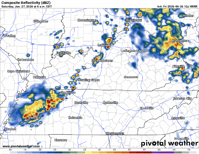
Tomorrow (Saturday) appears to be a more active day.
Things are likely to kick off in the morning, as a line of storms (probably weakening?) moves in. Waves of showers and storms are expected to continue most of the day into the evening, as they ride a boundary.
Two things we’ll be watching:
1) Potential for training of slow-moving storms, which could lead to localized flash flooding issues
Regarding the flooding potential, there are several different models that show some impressive (in a negative context) rainfall totals somewhere in Middle TN. Where exactly, we just don’t have the accuracy to know that right now. However, if these models are correct, a swath of 3-5″+ of rain will be possible tomorrow, leading to potential flooding issues. We will absolutely be watching trends today and early tomorrow. As a result of this potential, we have a Flood Watch that will go into effect starting at 7a Saturday.
2) Low-end severe threat, with damaging straight-line winds, hail and a tornado being possible
Current thinking is that we see several waves of storms tomorrow. Our initial wave in the morning will be limited to a potential gusty wind threat, with later rounds in the afternoon/evening have the potential for all severe hazards. There is some uncertainty to how much we can destabilize, which will be something we can only truly realize until tomorrow with observations.
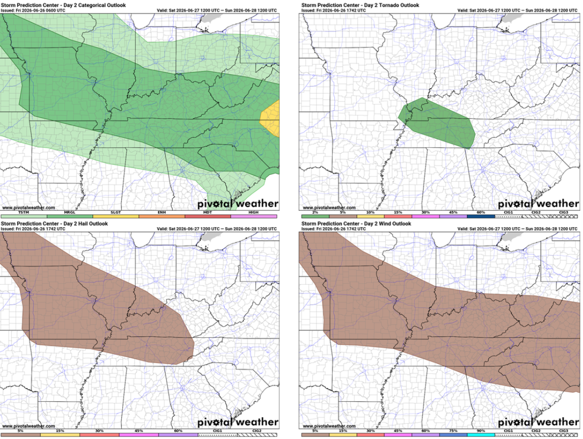
The Storm Prediction Center has us outlooked with a 5% chance of damaging straight-line winds and hail, along with a 2% chance of a tornado – all within 25 miles.
A low-end threat, but not zero. Those with plans tomorrow should stay connected and have ways to receive warnings in case one is issued for you. Remain flexible with outdoor plans and have an indoor place to go in case of a storm.
We’ll be following this the whole way through and will post updates as needed on all of our socials as needed. If there is a warning issued, we will go live on our YouTube channel: Nashville Severe Weather @NashSevereWx – YouTube
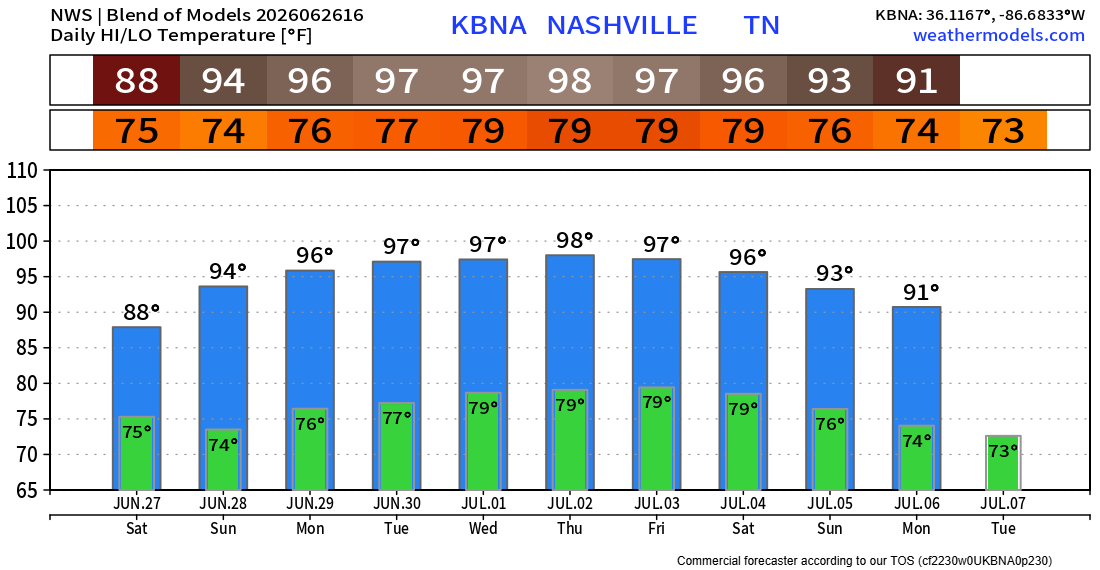
Sunday starts the beginning of our mostly dry and very hot week. Temperatures will be as hot as they’ve been since last summer with highs in the mid to upper 90s. Heat index values will be in the 105-110° range essentially all of next week.
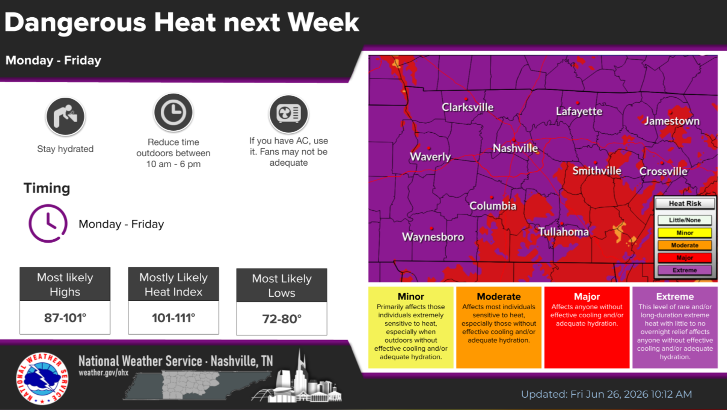
Be prepared to take breaks if you have to be outdoors for long periods of time and stay hydrated. Know the signs of heat exhaustion v. heat stroke.
Very little relief overnight as we struggle to get below 80°.
Long-range models suggest this continues into the 4th of July weekend.
Categories: Featured Blog