
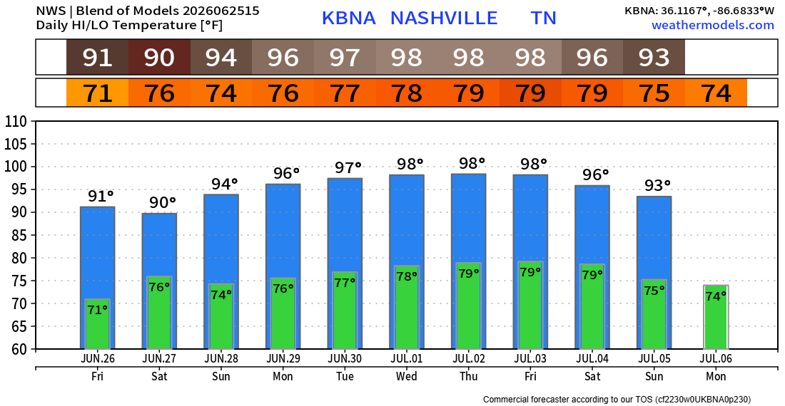
Models have backed off on our rain chances for today and now think we stay dry. Typical, hot summer day with highs near 90°.
We get two days of more active weather on Friday and Saturday.
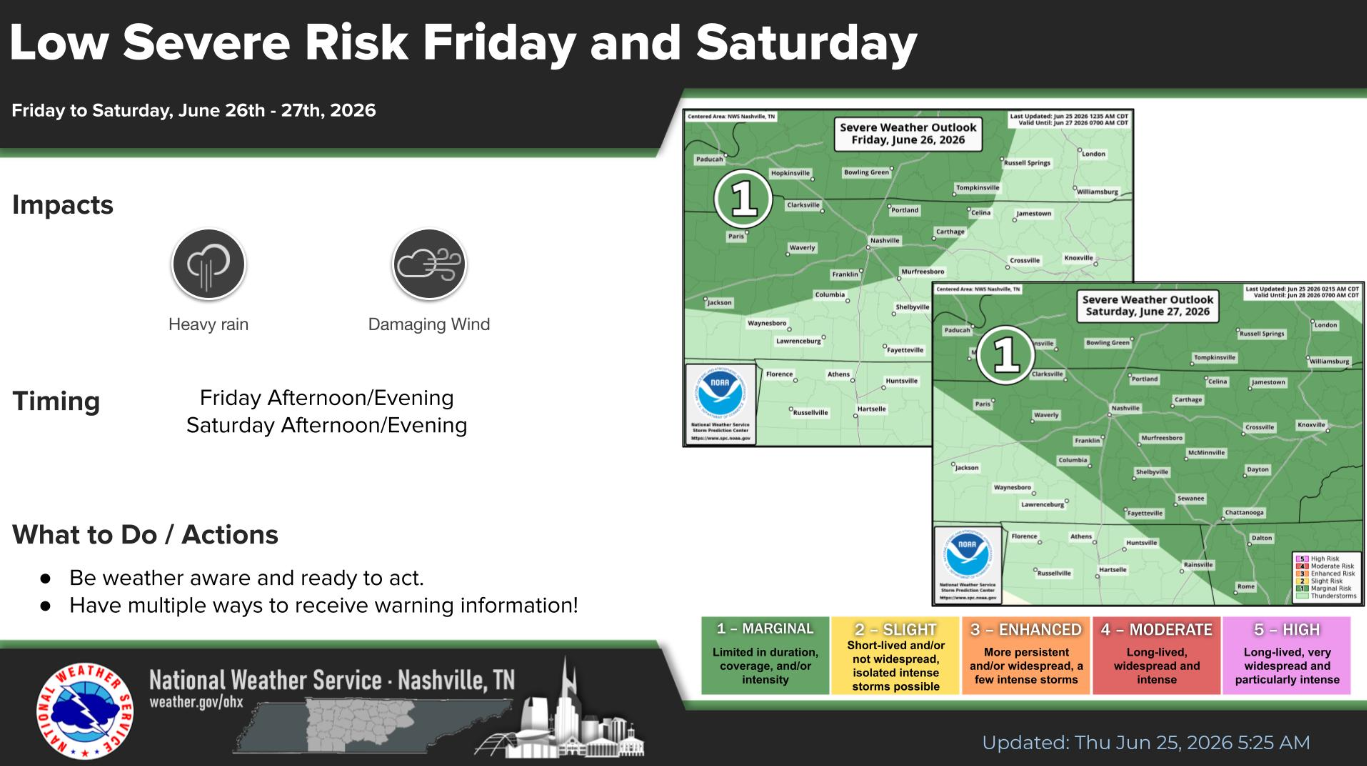
The Storm Prediction Center has outlooked us with a 5% chance of damaging straight-line winds within 25 miles for Friday. Similar probabilities for Saturday as well.
Friday timing looks to generally be afternoon and evening. Saturday more of late morning thru the evening. Unfortunately, can’t really get any more specific than that right now. Once the high-res models come into range, we can get into more specifics. Current guidance shows more-than-usual disagreement, especially at this range – leaving confidence a little lower than usual.
“Damaging winds are the main hazard here, and while there is a tornado threat further to our north, our risk of tornadoes is very low.” – NWS Nashville
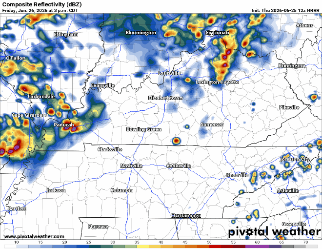
For what it’s worth, here’s the HRRR’s take on Friday afternoon/evening:
We’ll keep an eye on things and keep y’all updated. If you do have outdoor plans either day, be sure to stay connected and have an indoor spot to head to in case a storm rolls over. No day looks like a total washout.
Sunday we begin to dry out and really heat up. All of next week, highs will likely be as hot as they’ve been all year.
With high temperatures in the mid to upper 90s, and dewpoints in the low 70s, heat index values will easily be 100°+. Yes, this is not unusual in late June here, but it will be the hottest we’ve been since last year. Be sure to take it easy if you have to be outside for long periods of time.
Categories: Featured Blog