
Another nice day ongoing. Not too hot and dewpoints only in the mid 50s. Good day to take your lunch break outside.
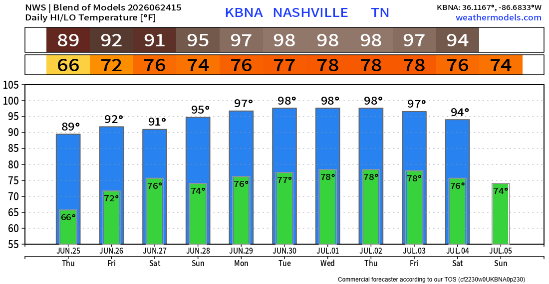
Thursday our temperatures will slowly start to climb. Could be the start of a prolonged stretch of 90°+ days.
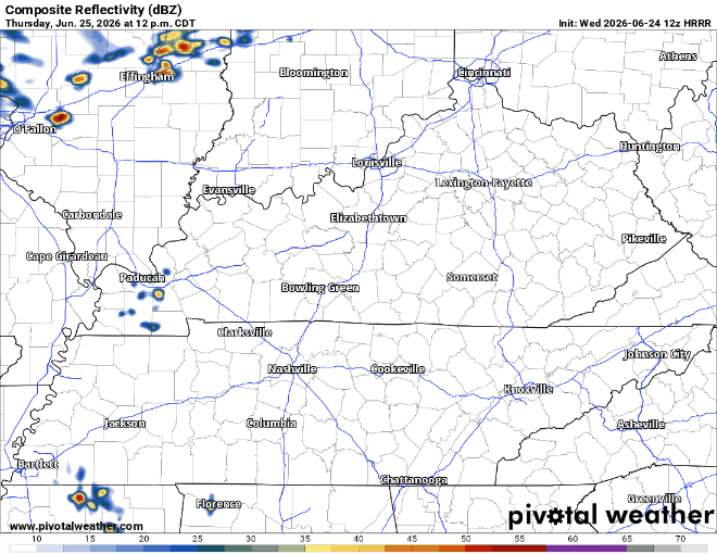
Increasing moisture will lead to a return of Wattery chances. Coverage looks fairly isolated, with the majority of us likely staying dry. HRRR gives a guess on how isolated these showers/storms will be. No severe weather is expected, but heavy rain, lightning and gusty winds will be possible with any storm.
Rain/storm chances continue on Friday and Saturday. Coverage will be a bit more widespread, with chances in the 40-60% range. Mostly confined from midday thru early evening. No severe weather expected, but the usual hazards will be possible with any storm.
No day looks like a washout. For those that do have outdoor plans this weekend, keep an eye on the radar – when thunder roars, go indoors.
The headline over the next week will become the brutal heat that will settle in. Long-range models are in good agreement that we deal with highs in the mid to upper 90s next week, with heat index values approaching 105°. We could very well see some Heat Advisories next week if this comes to fruition.
“Heat risk looks to be in the major category to possibly extreme towards the end of the period, meaning heat illness will occur in a shorter amount of time outdoors than usual. Make sure to keep this in mind if you have any outdoor activities in the coming days.” – NWS Nashville
Categories: Featured Blog