
Although our Flood Watch has been canceled early, we still do run the risk of some localized flash flooding today – along with a low shot at a strong to severe storm this afternoon and evening.
The Storm Prediction Center has outlooked the majority of our two counties in a 5-15% chance of damaging straight-line winds and a 2% chance of a tornado, both within 25 miles.
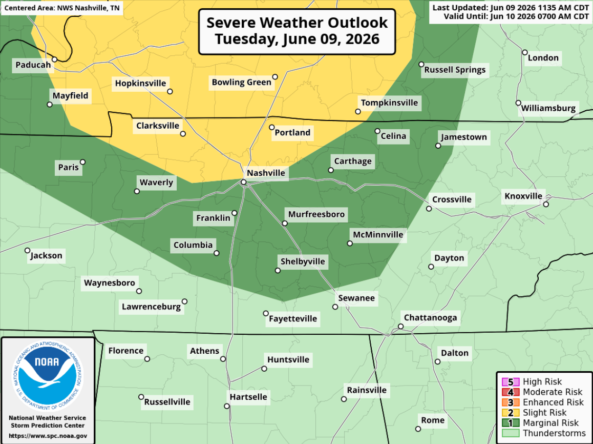
Again, very low-end threat, but not one to ignore. Instability levels (storm fuel) and moisture values will be quite high, but shear looks fairly lackluster (although that’s pretty typical during the summer).
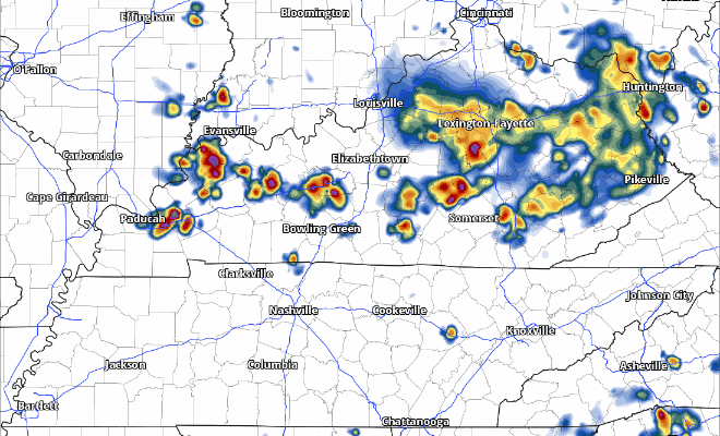
The latest HRRR model shows storms firing in southern Kentucky, converging into a line or semi-discrete line and slowly pushing SE.
Of course, this is just one run of one model, but this puts the line of storms close enough where we’ll definitely be keeping an eye on things. We’ll be posting updates on all of our socials all day as needed. Be sure to have a way to receive warnings in case one is issued for you.
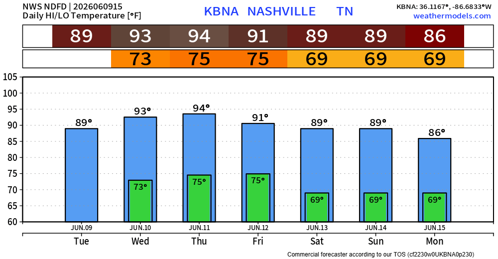
Although we’ll be drying out Wednesday and Thursday, the heat will be turning up.
Highs will be approaching the mid 90s, paired with dewpoints in the upper 60s/low 70s = heat index values near 100°. It is June in Middle TN, so this isn’t anything unheard of. However, it is the hottest weather we’ve experienced so far this year, so be sure to take frequent breaks if you have to be outdoors for long periods of time.
Our dry spell will be short-lived as rain/storm chances return Friday.
“…showers and thunderstorms will be more numerous Friday afternoon with the front moving into Middle Tennessee most likely during peak diurnal heating [afternoon].” – NWS Nashville
Thankfully, no severe weather is currently in the forecast.
Low rain chances on Saturday before rising towards a little more into the medium range on Sunday/Monday.
Those going to Bonnaroo should plan for hot weather with some rain certainly possible, especially on Friday. Nothing looks like a total washout right now, fingers crossed that holds true.
Categories: Featured Blog