
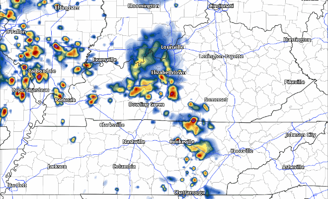
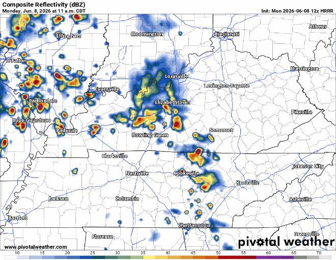
We have a Flood Watch in effect today thru 8p.
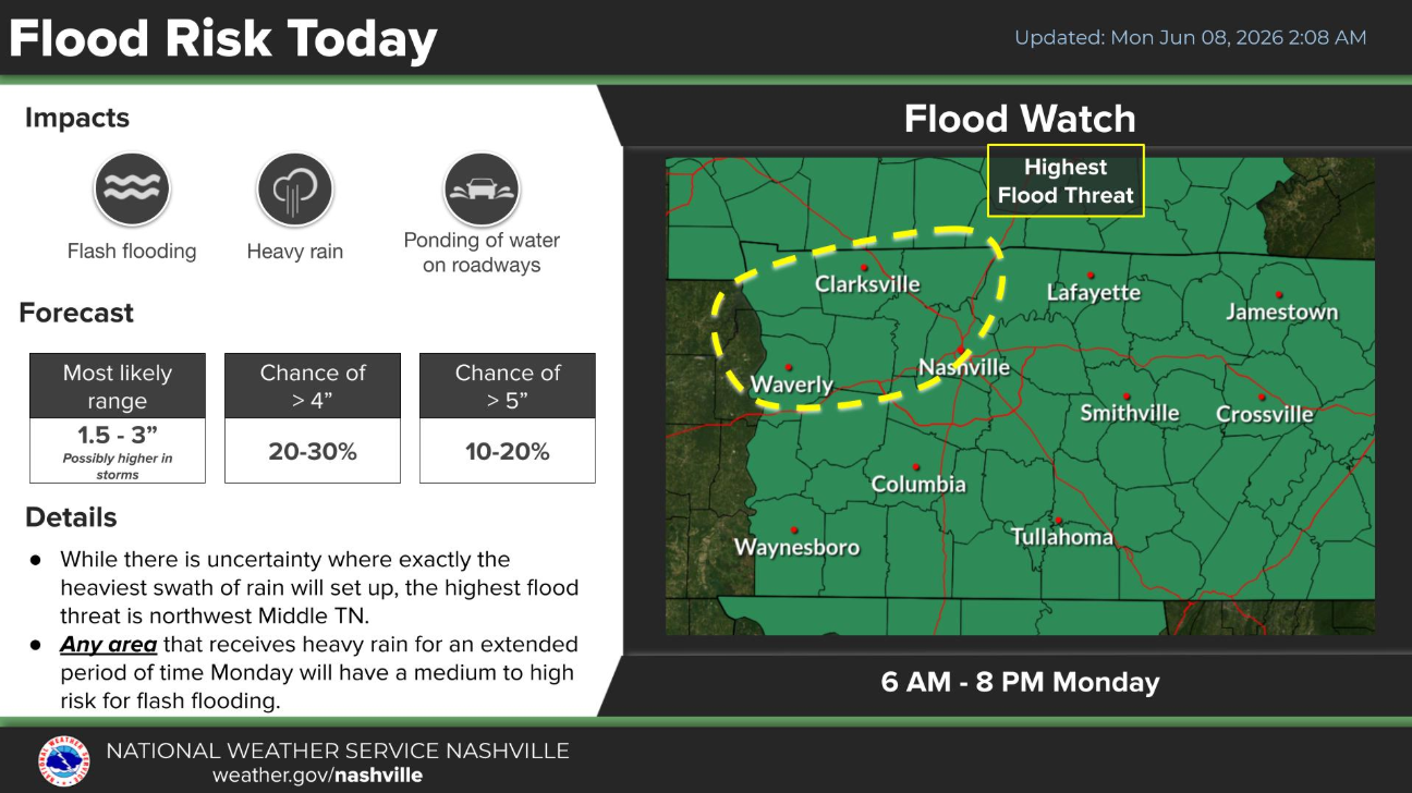
1.5 – 3″ of rain will be possible today from showers/storms, which could cause flooding – especially in low-lying areas.
The latest HRRR model keeps coverage fairly scattered – but models are guidance, not gospel. We’ll be monitoring things all day, stay weather aware today, especially if you live in a flood-prone areas.
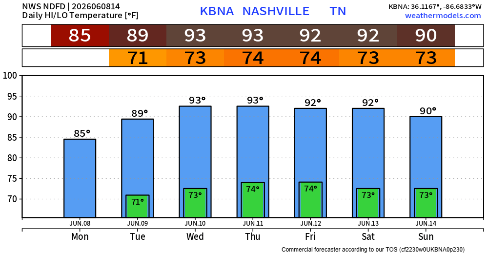
Additional showers/storms will be possible Tuesday afternoon/early evening. No severe weather is expected. Although of course, lightning will be possible with any storm. When thunder roars, go indoors.
I think we’ll be able to squeeze in a dry Wednesday and Thursday before rain chances return Friday, lingering into the weekend. Specifics are still fuzzy; we’ll keep an eye on things.
Starting Tuesday, we’ll really start to feel the summertime heat. Highs in the low 90s paired with dewpoints in the upper 60s/low 70s will cause heat index values to reach over 100°. Certainly not anything we don’t experience during the summers, but do take it easy if you have to be outside for long periods of time.
Categories: Featured Blog