
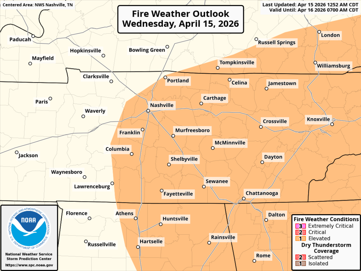
Elevated fire danger today thanks to low relative humidity values, gusty winds and our recent lack of rain. Outdoor burning is highly discouraged.
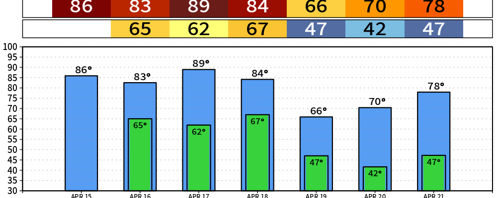
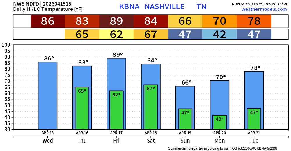
Our well above average temperatures will continue thru Saturday. Today and Friday will both have a run at the daily record high temperatures – 87° set in 1936 for today, 90° set in 1955 for Friday.
We finally have some rain chances return to the forecast on Thursday.
During the morning hours, it’s possible we have some showers move into the area. These should be fairly scattered and bring some light rain to some; an umbrella or rain jacket will do the trick for the walk into work/school.
Something we’ll be watching is the possibility of additional storms to form in West TN during the afternoon/evening hours and slowly move into our neck of the woods. This remains to be seen, and for what it’s worth, the latest HRRR model has some serious doubts. However, if storms are able to get going, can’t totally rule out a strong storm or two with strong winds and perhaps some small hail – although the chance of that is very, very low.
To account for this very, very low risk, the Storm Prediction Center has added a 5% chance of damaging straight-line winds and/or hail within 25 miles.
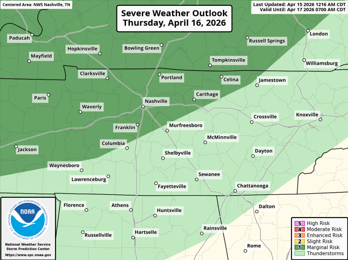
As always, we’ll keep an eye on things and will keep y’all updated. Rainfall totals look unimpressive, mostly 0.25″ or less.
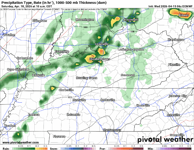
A cold front will move thru on Saturday (most likely during the afternoon/evening), bringing some rain chances along with bringing our temperatures down back closer to average.
No hazardous weather is currently expected, just some rain. Unfortunately, it doesn’t look like much rain with totals only near 0.5″.
The latest Euro model likes a late afternoon arrival for the rain, although this is certainly subject to change.
An early look at next week suggests a gradual warming trend with no rain chances until at least the back half of the week.
Categories: Featured Blog