
BNA reported a total of 0.02″ of rain yesterday, which was nice to keep the temperatures down a little, but won’t do much at all in terms of helping us with our worsening drought.
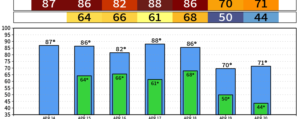
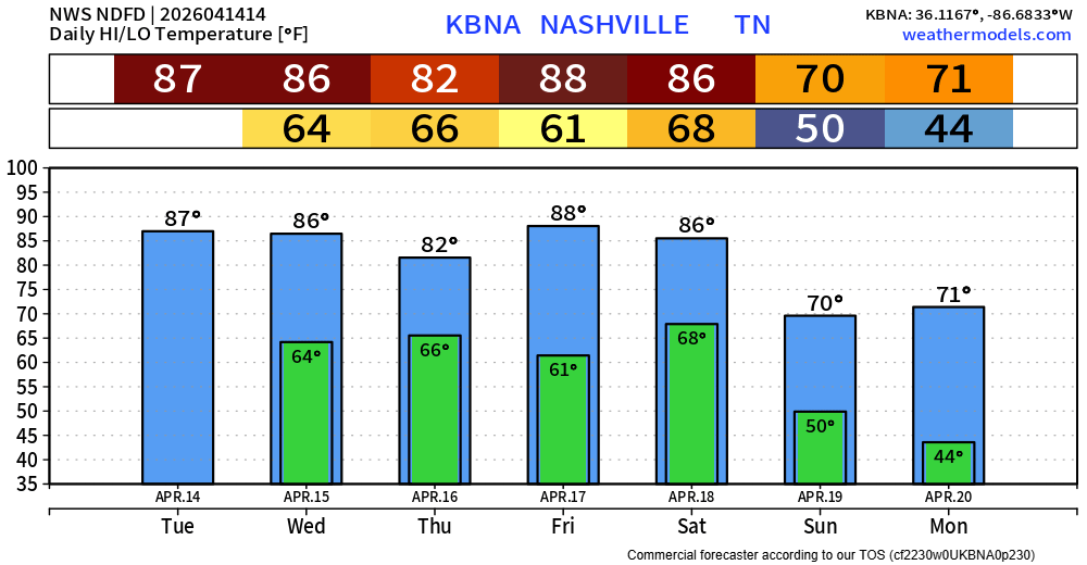
Today we’ll have plenty of sun to help our high temperatures surge into the mid to upper 80s. Our daily record high is 89° (set in 2017), so we’ll see if we can make a run at it.
In fact, every day thru Saturday (with the exception of Thursday), we’ll have at least a shot at tying or breaking each day’s daily record high.
Thanks to our dry fuels paired with gusty winds and low relative humidity, our fire danger will remain a tad elevated over the next several days – especially Wednesday. Continue to be extra cautious with any outdoor burning.
The reason that Thursday is the exception will be thanks to some showers and storm possible that afternoon and evening. The good news, no severe weather is currently expected. The bad news, rainfall totals (if any) look to be fairly light at around 0.25″ – so not much in the way of relief.
Our next decent chance at some rain will come along an overdue cold front passage Saturday PM, again bringing some decent chances for some showers and storm area wide. Again, no severe weather is currently expected. Timing is still a bit iffy but generally looks to be sometime Saturday afternoon/evening – but this could certainly change. Rainfall totals again look fairly unimpressive, but at least something to help put a dent in our rainfall deficit.
The cold front will help cool us down to closer to average temperatures for this time of year, toward the low 70s.
Categories: Featured Blog