
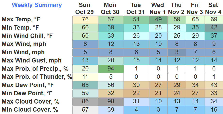
Thankfully the rain held off for the Oilers dub, not a half bad Sunday. Temps are in the 70s for the last time for at least the next six days.
Overnight the cold front will bring rain and open the door for colder temps.
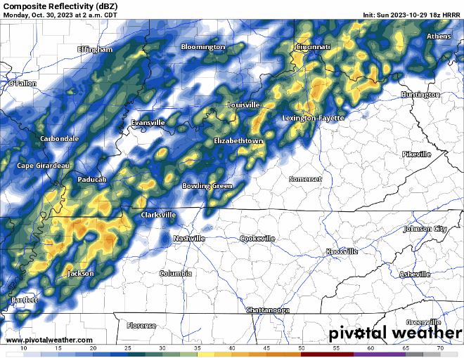
The HRRR model (above) shows on/off showers nearly all day Monday. Rolly ball sports may be in danger of rain outs, although rainfall totals will not be much, generally around 0.25″.
Temperatures will not move much at all throughout the day and will drop to around freezing Monday night into Tuesday morning.
We’ll be dealing with morning temps near or below freezing for a majority of the week.
Trick or treating looks dry, but temps will be in the low 40s/upper 30s. Time to trick or treat efficiently.
High temperatures slowly warm throughout the week, getting up into the upper 60s by the end of the week, mornings stay chilly.
After Monday, there’s no rain in the forecast.
Quick References:
Weather changes constantly.
Follow @NashSevereWx on Twitter for any changes to this forecast.
Live coverage during tornado and severe thunderstorm warnings:

Look good.
Support the mission.

We are 100% community supported. No ads. No subscription fees. Keep it free for everyone.


Categories: Forecast Blogs (Legacy)
You must be logged in to post a comment.