
Besides a few stray showers, not a half-bad Saturday lies ahead of us. Temps already in the upper 70s as of 10am.
Sunday will have temperatures in the 70s for the last time for a while, rain chances also pick up.
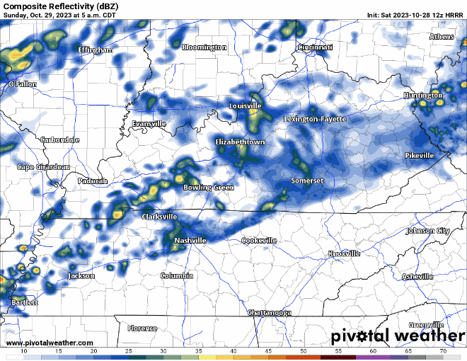
As shown above by the HRRR model, a majority of the rain will hold off to the NW of us, but some of us, especially Davidson Co. will (finally) see some rainfall. Hopefully it can hold off until after the Titans game, but ponchos for tailgates, the game, and the after party look necessary. Lightning delays look unlikely.
The Cool Down
Monday still looks like the day where we get our first real taste of winter. The cold front will have some showers along it as it pushes thru Monday AM, and will slowly drop temperatures throughout the day.
Frost looks possible Tuesday AM, with temps not warming up much throughout the day.

Quick References:
Weather changes constantly.
Follow @NashSevereWx on Twitter for any changes to this forecast.
Live coverage during tornado and severe thunderstorm warnings:

Look good.
Support the mission.

We are 100% community supported. No ads. No subscription fees. Keep it free for everyone.


Categories: Forecast Blogs (Legacy)
You must be logged in to post a comment.