
Another pleasant day and tomorrow will be more of the same. Still a lot warmer that what we are used to this time of year.
Rain chances finally come back around Friday.
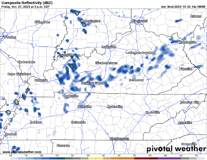
The HRRR model (above) shows showers creepin’ in Friday AM and staying on/off throughout the day. Any rain we see would be light, so not thinking any rainouts.
Rain chances stick around for the rest of the weekend, mostly confined to the NW of us, rainfall totals here look to be around 0.25″. Not drought-busting, but it won’t hurt.
The cold front that fall fans have been waiting on is in our sights. Current ETA guess is at some point Monday. This will have some showers with it, but it’ll also bring in some legit fall weather.
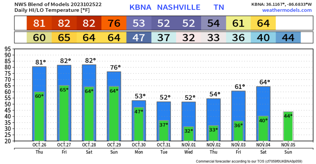
This front will knock our high temps down about 30°, along with giving us our first shot at some frost + seeing the freezing mark.
Trick-or-treating still looks dry and cold. Time to start thinking about some warm costumes.
Quick References:
Weather changes constantly.
Follow @NashSevereWx on Twitter for any changes to this forecast.
Live coverage during tornado and severe thunderstorm warnings:

Look good.
Support the mission.

We are 100% community supported. No ads. No subscription fees. Keep it free for everyone.


Categories: Forecast Blogs (Legacy)
You must be logged in to post a comment.