

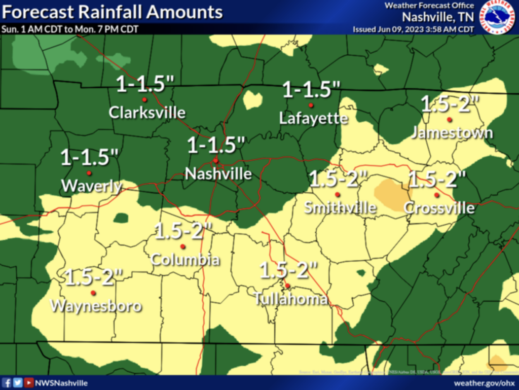
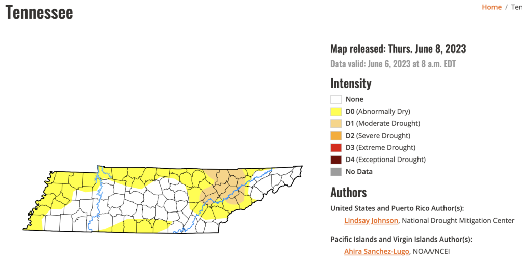
Rain will be a welcome sight to many this weekend…unless you have outdoor plans. Latest U.S. Drought Monitor has us as “abnormally dry.” Sounds right.
Hi-Res Models, which are just coming into view, generally agree that scattered showers and storms will arrive Sunday morning. That’s about all we can get from those models right now….because that’s as far out as they go. The lower-res models pick up from there and keep rain off/on all day Sunday into Sunday night.
Lightning and scattered heavy downpours are a good possibility…the kind that send everyone inside for a while. Unfortunately, we don’t know exactly when yet.
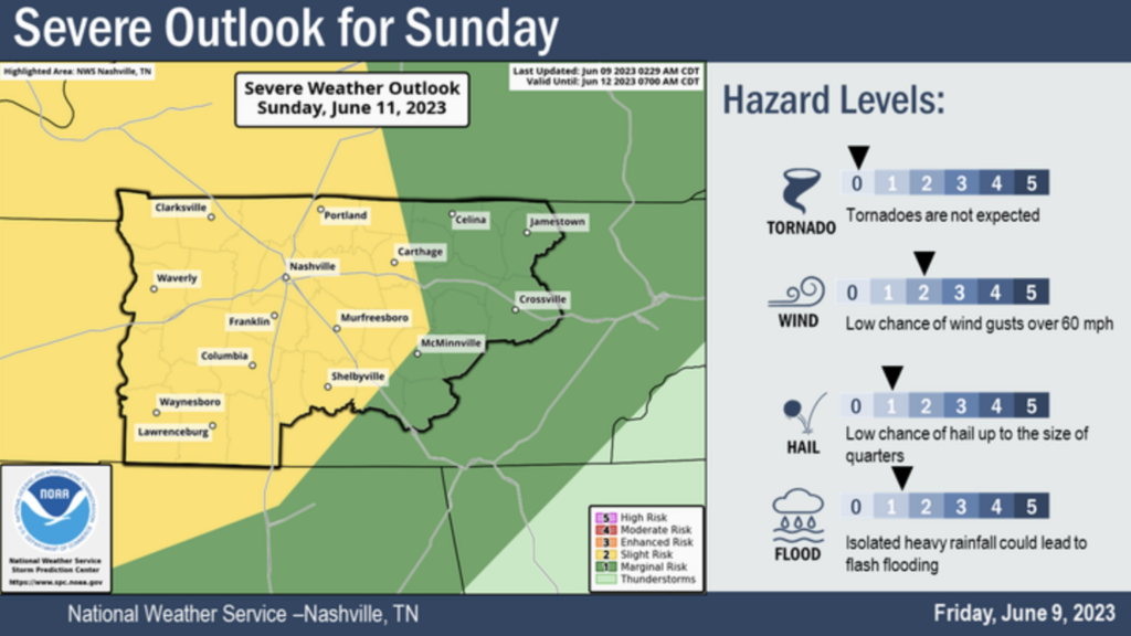
Severe Weather Threat
This system has some organization with it, which could yield some damaging straight-line wind gusts. SPC believes there is a 15% chance of this occurring within 25 miles of you. Our local NWS office gives some specifics here:
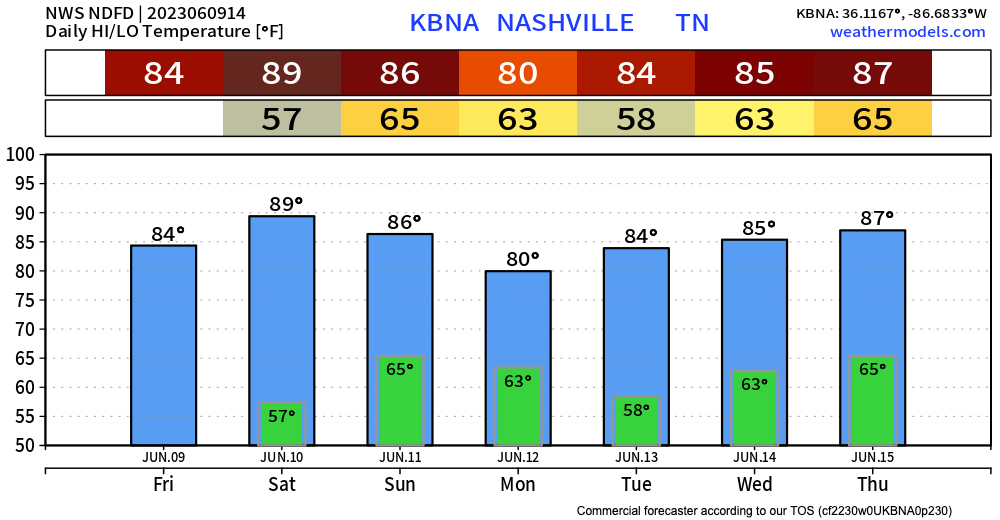
Temps
Overall, nothing crazy temp-wise. Expect highs in the 80s, lows in the upper 50s, low 60s. Pretty typical.
Quick References:
Weather changes constantly.
Follow @NashSevereWx on Twitter for any changes to this forecast.
Live coverage during tornado and severe thunderstorm warnings:

Look good.
Support the mission.

We are 100% community supported. No ads. No subscription fees. Keep it free for everyone.


Categories: Forecast Blogs (Legacy)
You must be logged in to post a comment.